Tareqh PPK
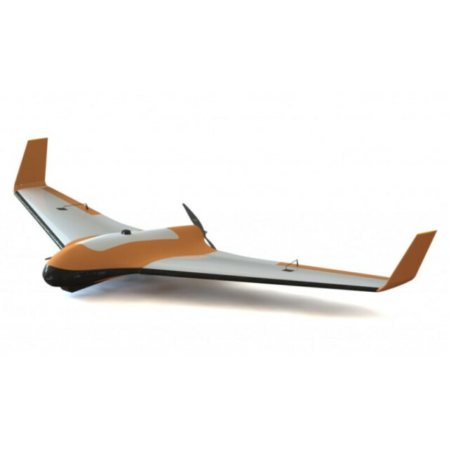
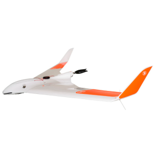
Professional Fixedwing UAV for Mapping
TareqhUAV
Tehran, IR
Description
Tareqh mapping drone is a professional drone for photogrammetry and remote sensing applications in vast areas.In PPK version of the UAV with the high-resolution camera, low-impact lens and PPK system (Post Processing Kinematic) Absolute accuracy of mapping is 3 cm in X / Y and 4 cm in Z without ground control point..
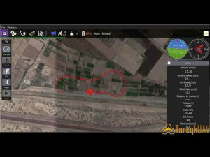
Tareqh package include GCS(Flight management software) And a tailless drone (Blended wing Body) Tareqh support a variety of sensors and include a rugged small transportation case.Tareqh UAV with 1 hour endurance can be used in remote out of reach areas and fly as high as 900 metres from ground level and in wind of up to 40 kilometers per hour for imaging.
Specifications
-
Environment
-
Min. operation temperature [°C]
-10
Max. operation temperature [°C]
40
Max. wind speed [m/sec]
12
Max. humidity [%]
90
-
Imaging/scanning devices
-
Type of Camera
sony a6300 24 mp
Additional Sensors and additional information
Canon EOS M3Maicasense Rededge Multi spectralFLIR Thermal camera
Build-in Stablilsation
N
Exchangeable
Y
Sensor tilting to allow oblique views
N
Onboard imaging/scanning devices
RGB Camera, Additional sensors, NIR Camera
-
Platform
-
Brand
TareqhUAV
Max. payload [kg]
0.5
Max. stay in the air [min]
60
Max. speed [km/h]
100
Max. height above sea level [m]
900
Propulsion
Electric
Platform
Aircraft
-
Accessories
-
Transportation accessories
rugged aluminium case 100*45*30 cm transportation case
Included batteries and charger
additional battert pack and charger
More included products and spare parts
long range telemetry link (40 km) , remote controller , manual
-
Operation Characteristics and Safety
-
Min. ø of launch/landing site [m]
5
Launching method
hand launch
Automatic launch and landing
Y
Training provided
Y
Collision avoidance systems (CAS)
Y
Autonomous emergency landing
Y
-
Dimensions
-
ø / wingspan [cm]
212
Height [cm]
20
Weight [kg]
3.2
Weight of battery [kg]
0.6
Number of rotors
1
Transport on human back
N
-
Base Station
-
Ground computer included
N
Type of Ground computer
laptop or tablet
Sensor control
N
-
Navigation Sensors
-
Type of GNSS receiver and captured signals
Supports GPS,GLONASS ,GALILEO, SBAS,QZSS,L1
Type of IMU
3 axis Gyroscope, Accelerometer
Other sensors and additional information
pitot tube (airspeed sensor) , barometer , sonar
Correction services [PPK, RTK]
PPK
-
General
-
Year of last update
2018
Typical applications
survey,aerial mapping,3d mode,agriculture
-
Included software and automatically generated
-
Flight planning software
Qgroundcontrol software
Photogrammetric software
Pix4D , Agisoft photoscan
Point cloud processing software
Pix4D , Agisoft photoscan
Type of software included
Flight planning, Photogrammetric software, Point cloud processing software
Automatically Generated Products
3D City Models, Point Clouds, 3D Landscape Models, DEMs, DTMs, Orthomosaics, NDVI maps
Additional information on software or automatically generated products
3D City model , Point cloud , DEM , DTM , Orthomosaic


