
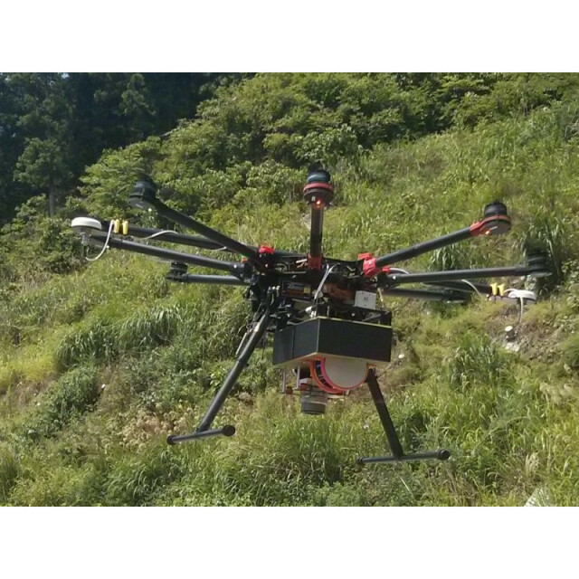
Sky-Scanner
This high performance airborne data collection system fills the gap between the low-cost low-altitude photogrammetry approach of current UAV systems, and the more complex and expensive LiDAR systems typically deployed on manned fixed and rotary wing aircraft.
Siteco Informatica
Bologna, IT
Description
This high performance airborne data collection system fills the gap between the low-cost low-altitude photogrammetry approach of current UAV systems, and the more complex and expensive LiDAR systems typically deployed on manned fixed and rotary wing aircraft.
Specifications
-
Environment
-
Min. operation temperature [°C]
-40
Max. operation temperature [°C]
50
Max. wind speed [m/sec]
100
Max. humidity [%]
99
-
Imaging/scanning devices
-
Onboard imaging/scanning devices
RGB Camera, Lidar
Type of Camera
Changeable
Type of Lidar
Velodyne VLP-16
Build-in Stablilsation
Y
Sensor tilting to allow oblique views
N
-
Platform
-
Platform
Copter
Max. payload [kg]
2.5
Max. stay in the air [min]
60
Max. speed [km/h]
30
Max. height above sea level [m]
100
Propulsion
Electric
-
Operation Characteristics and Safety
-
Min. ø of launch/landing site [m]
1
Launching method
Vertical Take off
Automatic launch and landing
Y
Training provided
Y
Collision avoidance systems (CAS)
N
Autonomous emergency landing
Y
-
Dimensions
-
ø / wingspan [cm]
25
Height [cm]
18
Weight [kg]
2.5
Weight of battery [kg]
0.7
Weight of filled fuel tank [kg]
0
Number of rotors
8
Transport on human back
Y
-
Base Station
-
Ground computer included
Y
Sensor control
Y
Real time image and video download link
N
-
Navigation Sensors
-
Type of GNSS receiver and captured signals
BD982
Type of IMU
Applanix Type 68 (AP15)
-
General
-
Year of last update
2016
Typical applications
Inspection, Mapping, Surveying, Photogrammetry
-
Included software and automatically generated
-
Type of software included
Flight planning, Point cloud processing software
Flight planning software
Ground Station
Point cloud processing software
Siteco RS-SyncVelodyne
Automatically Generated Products
3D City Models, 3D Landscape Models, DEMs, Orthomosaics


