
mdLiDAR1000
Fully integrated system for producing 3D point clouds optimized for land surveying, construction, oil & gas, and mining applications.
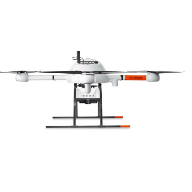
mdLiDAR1000 is a fully integrated system for producing 3D point clouds optimized for land surveying, construction, oil & gas, and mining applications.
microdrones
Siegen, DE
Description
mdLiDAR1000 consistently provides an accuracy of 6 cm (0.2 ft) when flown at 40 m (130 ft) at a speed of 3 m/s.
Microdrones has developed an end-to-end LiDAR solution combining a drone, a LiDAR payload, a fully integrated software workflow, and world class support to consistently provide quality deliverables.
Specifications
-
Imaging/scanning devices
-
Onboard imaging/scanning devices
-
Included software and automatically generated
-
Type of software included
Automatically Generated Products


