Innomar standard-rov SBP
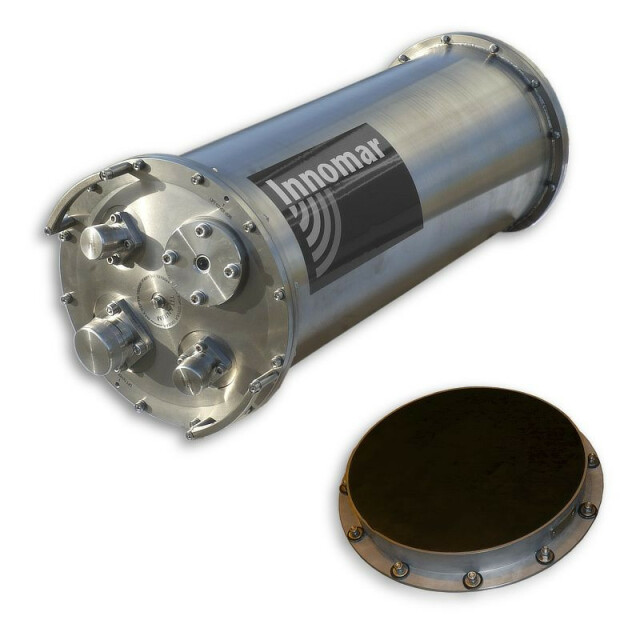
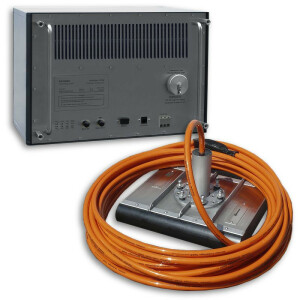
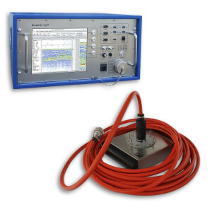
The Innomar standard-rov sub-bottom profiler acquires full-waveform data in water depths up to 2,000 meters. Transducer altitude above seafloor is from less than two meters up to 400 metres. The layer resolution is better than 10cm and seabed penetration is up to 50 meters, depending on sediment type and noise level. The built-in active beam stabilisation significantly improves data quality while the vehicle is following the seabed contour.

INNOMAR Technologie
Rostock, DE
Description
The Innomar standard-rov sub-bottom profiler acquires full-waveform data in water depths up to 2,000 meters. Transducer altitude above seafloor is from less than two meters up to 400 metres. The layer resolution is better than 10cm and seabed penetration is up to 50 meters, depending on sediment type and noise level. The built-in active beam stabilisation significantly improves data quality while the vehicle is following the seabed contour.
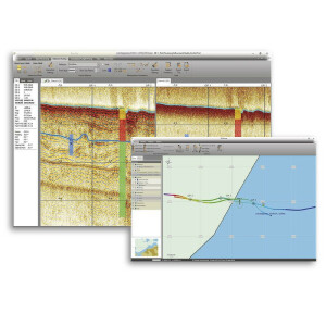
The Innomar standard-rov data can be processed with any seismic software (SEG-Y format), but Innomar also provides the ISE post-processing software specialized on the Innomar SBP data.
Latest product generation 2017.
Do you have questions about this product?
- Questions about price, availability, and/or retailers
- Questions about technical specifications and usage
- Questions about suitability for your project or application
Specifications
-
Mode of operation
-
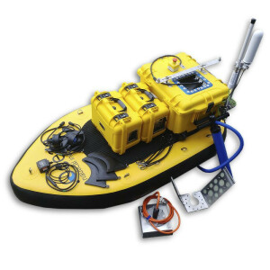
Platform type
ROV, Towed, AUV
Operating System
Windows
Min. depth of operation [m]
1
Max. depth of operation [m]
2000
Min. frequency [Hz]
5000
Max. frequency [Hz]
100000
Signal composition
Broadband, Dual Frequency
Max. resolution [m]
0.05
Max. penetration [m]
40
Max. pulse rate [Hz]
40
Max. pulse length [s]
0.0015
Dynamic range [dB]
180
Pitch corrected
Y
Roll corrected
N
Heave corrected
Y
Frequency
Power output [W]
3000
Source Level
> 240 dB
-
General
-
Product type
Parametric Sub-Bottom Profiler
Year of initial development
2003
Application
Deep sea
Max power consumption [W]
250
Power type
AC, DC
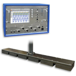
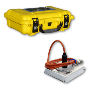
Transducer weight [kg]
32
Transducer length [m]
0.47
Transducer width [m]
0.47
Transducer height [m]
0.06
Weight of logging unit [kg]
58
Length of logging unit [m]
0.75
Width of logging unit [m]
0.28
Height of logging unit [m]
0.28
Portability of logger
Size (Deck unit)
Any PC
-
Integration in work process
-
Remote operation
Y
External heave input
Y
External roll input
Y
External pitch input
Y
External positioning input
Y
Marking of events
Y
Real time coupling to survey software
Y
Coupling to post-processing software
Y
-
Data Processing
-
Data displayed
depth, echo plot
Main use
route surveys, geological surveys for dredging and building site surveys
Data output
depth, SBP raw data
Formats
NMEA, ASCII, SEG-Y
Data output for seafloor classification
N
Connections
LAN
Internal logging
Hard drive
Post-processing
Innomar ISE Software or any SEG-Y software
Related products
