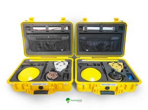
UNI-Complete
UNI-Complete is the most complete GPS surveying set to start with.
If you can use a smartphone, you can work with the UNI-GR2. Survey digitally and stakeout with the complete surveying set. Work faster and above all more efficient. Determine the exact and centimeter location of cables, pipes, trees, fields and more with GPS. Calculate the size of a piece of land, whether small or big, or see how much material you need for the project.
marXact
Hilversum, NL
Description
Survey anything you want with centimetre accuracy
Survey trees, pipes, roads, markings, cables and much more. In layers with names you like and store points, lines, polygons or arcs with or without attributes. Everything with centimetre accuracy.
Easy stakeouts
Just tick the point you want to stake out on the map and follow the directions. Getting close? Aim one circle in to another and mark the spot. It's as easy as a game!
Your data in local coordinates
Import and export your data in your desired format. From complete 3D drawing AutoCAD files to all details in a CSV export. In local or global coordinates, directly to the office with the UNI-Cloud.
Everything you need at a fair price
UNI-Complete is the all-in package containing all required products to perform all examples mentioned on this page - and much more! At a fair price, you get all you need for just € 5645,- ex. VAT.
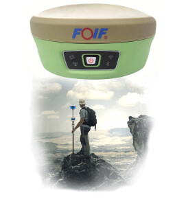
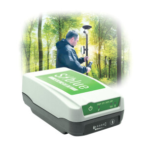
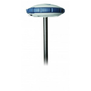
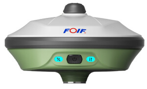
UNI-GR2
A universal GNSS receiver. Receiving GPS, Glonass, Beidou, Galileo, QZNSS and SBAS to get your position fixed with ease.
UNI-CONNECT
The easiest surveying software available. It works on any device with a browser and WiFi and lets you survey and stake out like a game.
UNI-CLOUD
Gets your data from and to the field in no time. Connects to the UNI-Cloud API and gives you remote and phone support.
UNI-RTK PREMIUM
With hundreds of base stations worldwide, UNI-RTK Premium gets you all your CM-accurate correction data. Also known as a Real-Time Kinematic Network.
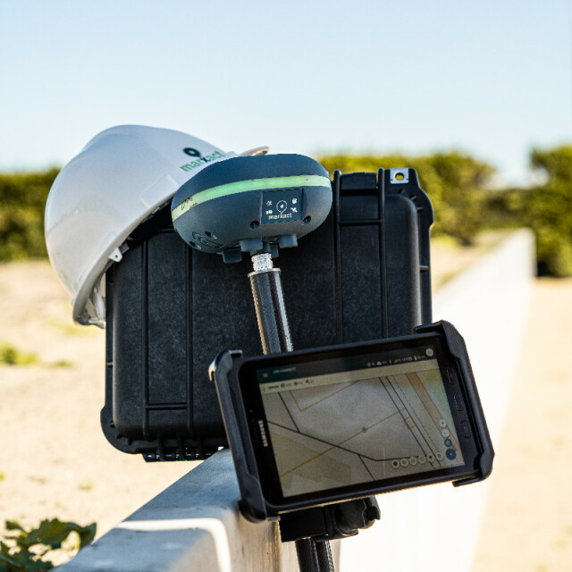
POLE, TABLET & MOUNT
The basics to get you going: a weatherproof Android tablet, two-meter carbon fibre survey pole and a mount for the tablet.
Specifications
-
More information
-
Distinguishable features
9 Degrees of Freedom powered level LED - Ring, WiFi, UNI-Cloud, compatible with most other devices.
-
Power
-
Internal power supply
Liion battery: 2 × 5200 mAh
External power supply
18V / 1.33A DC Adapter or 5V / 0.5A Mini-USB Cable
Operating time with internal power supply [hr]
12
Certifications
CE
Rechargeable with (auto)battery
Yes
Direct car connection cable available
Yes, available upon request
-
Performance
-
No. channels
432
Max. simultaneous tracked channels
432
Tracked satellite signals
GPS (L1/L2/L5), Glonass(L1/L2), Galileo (E1 / E5a / E5b), Beidou (B1/B2/B3)
SBAS differential signals
WAAS / EGNOS / GAGAN / MSAS
RTK Network Compatibility
Yes
-
General
-
Type
Aerial, Land, Marine
Year of initial introduction
2018
Height [m]
0.09
Depth [m]
0.14
Width [m]
0.14
Total Weight [kg]
0.8
-
Horizontal uncertainty
-
code: DGNSS/RTC (constant part) [m]
0.4
phase: RTK kinematic (constant part) [m]
0.01
phase: RTK kinematic (variable part) [ppm]
1
phase: static post processing (constant part) [m]
0.003
phase: static post processing (variable part) [ppm]
1
-
Communication: Protocols
-
RTCM standards for differential data
RTCM 2.x / RTCM 3.x
Other formats for differential data
UNI Binary / UNI-Cloud
NMEA output format
NMEA-0183 / NMEA-2000
other output formats
RINEX
L-Band Compatible
L1 / L2 / L5
-
Recording
-
Memory medium
MicroSD
Data capacity [MB]
32GB
-
Communication: general
-
Communication ports
RS232, USB, Micro-USB, CAN,
Simultaneous links
Y
PPS Out
Y
Bluetooth
Y
-
Environment
-
Operating temperature: min. [°C]
-20
Operating temperature: max. [°C]
65
Humidity resistance
99%
Water sand and dust proof
IP67
Shock and vibration proof
2 meter pole drop
ROHS compliance
Y
WEEE compliance
Y
-
Communication: links
-
Radio modems
868MHz / 915 MHz
GSM; UMTS phone modems
3G Multi-band; UMTPS/HSDPA/HSUPA/GSM/GPRS/EDGE


