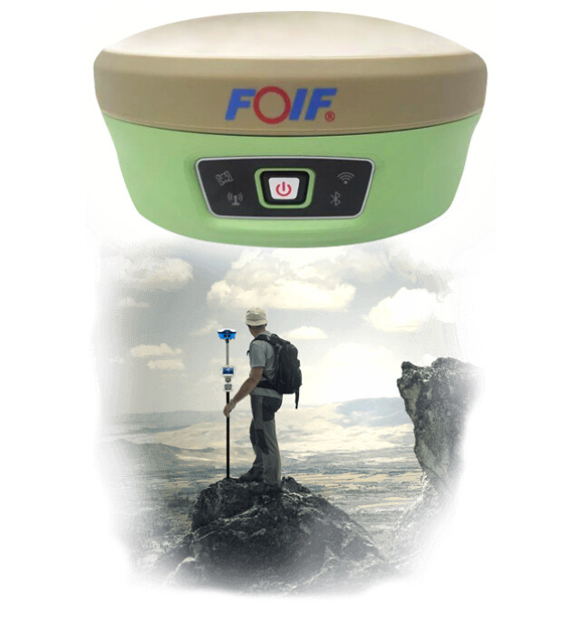
A90 Smart Antenna
Features GNSS Smart Antenna With Built-in Connectivity Components and UI Web-Based Management
The GNSS-RTK Rover A90 offers incredible performance in all conditions. Its compatibility of connectivity to RTK or satellite corrections allows you to work without geographical restrictions. Multi-frequency with L-Band (RTX) and SBAS, 336 channels for all GNSS constellation tracking 4G cellular connectivity or RX/TX long-range.

SXblue
Montreal, CA
Description
A90 tracks GPS, GLONASS, Galileo, BeiDou and can maximize the tracking to observe all visible GNSS satellite signals, thereby providing maximum performance for accuracy and real-time measurements.
A90 also supports L-Band function and can get cm accuracy just with one receiver.
Performance
A90 can quickly search available satellites and soon get a fixed solution. A90 with its advanced technology ensures it works well even in harsh environments such as under heavy foliage.
Highly integrated internal components
The innovative technology made A90 has an excellent combination of GNSS, 4G, Bluetooth and Wi-Fi antenna. A90 is also inserted with highly integrated Bluetooth, Wi-Fi and 4G network modules, which reduces the internal signal crosstalk. The powerful 360-degree omnidirectional signal receiving in A90 enables full omnidirectional communications.
Third-generation tilt surveying technology
Inserted with a high-sensitive E-bubble and brand-new tilt survey algorithm, A90 is calibration-free. Immune to magnetic disturbance and free from the limitation of tilt angles. A90 can measure points where a vertical placement of the pole is not possible such as house corners.
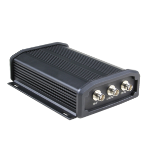
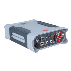
All protocol compatible internal radio
Initially adopting our independent R & D TRM series internal radio, A90 enables frequency band change ranges from 410-470MHZ. Enables communication with protocols like SATEL, PCC-GMSK, TrimTalk 450s, South, TrimMark III (19200) and GeoTalk, GeoMark. A90 is able to work a distance of 5 km with only 1 Watt radio.
4G Network
A90 with its advanced 4G module, guarantees 4G network can transmit world-widely. This results in more convenient and stable network communication.
Multi-Connectivity and WEB UI Control
Distinguished from the former GNSS, A90 provides two connecting methods for the receiver and controller—Bluetooth connection and Wi-Fi connection. Data transmission proves to be more stable with these new connecting ways.
The second generation WEB UI on A90 is fully compatible with all devices and all browsers. It’s more convenient with WEB UI control.
Long Life Battery
Inserted with 2 smart hot swappable Lithium batteries, A90 can work a maximum of 10 hours without stopping. Battery level can be viewed at the press of one button. With the new excellent design, more than 20% of power consumption can be reduced.
Weight & Dimension
Without affecting accuracy and efficiency, this innovative GNSS Receiver—A90 is made extremely light and small. Even though it’s equipped with a magnesium alloy fuselage, A90 weighs only 1 kg and measures only 140mm x 157mm x 76mm.
Port protection
Port covers protect the ports from water and dust. Inserted port manufactured lower than outer shell to avoid damage when dropping. Marks that clearly demonstrate different port uses make sure they are plugged correctly.
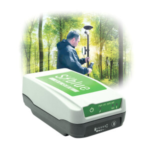
Cloud Service
Cloud service in SurPad software enables simultaneous work in the field and office and enables data to promptly upload and backup, which greatly improves surveying efficiency.
Alarm system
In UHF model, when the base is moved or with low power or no satellites, the rover will alarm immediately.AAA
Do you have questions about this product?
- Questions about price, availability, and/or retailers
- Questions about technical specifications and usage
- Questions about suitability for your project or application
Specifications
-
General
-
Year of initial introduction
2018
Height [m]
76
Width [m]
157
Total Weight [kg]
1.2
Type
Land
-
Performance
-
Tracked satellite signals
GPS: L1 C/A, L2C, L2E, L5. GLONASS: L1 C/A, L2C, L3. BeiDou: B1, B2, B3. Galileo: E1, E5A, E5B, E5 AltBOC, E6. IRNSS: L5. QZSS: L1CA, L1C, L2C, L5. SBAS: L1, L5
SBAS differential signals
WAAS, EGNOS, GAGNAN, MSAS
Type of measurements
full wavelength carrier phase
Reacqisition time [s]
1
RTK Network Compatibility
Y
No. channels
336
Max. simultaneous tracked channels
336
-
Environment
-
Operating temperature: min. [°C]
-30
Operating temperature: max. [°C]
65
Humidity resistance
100%
Water sand and dust proof
IP67
Shock and vibration proof
1,2
ROHS compliance
Y
-
Communication: general
-
Communication ports
5 pin, 7 pin
Simultaneous links
Y
PPS Out
Y
Bluetooth
Y
-
Communication: Protocols
-
RTCM standards for differential data
RTCM 104
CMR standards for differential data
CMR, CMR+
NMEA output format
0183
other output formats
Rinex, binary
L-Band Compatible
no
Configuration method
Web UI, software
-
Communication: links
-
Radio modems
internal
GSM; UMTS phone modems
internal
CDMA phone modems
no
Landline modems
no
-
Horizontal uncertainty
-
code: DGNSS/RTC (constant part) [m]
0.3
code: DGNSS/RTC (variable part) [ppm]
1
phase: RTK rapid static (constant part) [m]
0.008
phase: RTK rapid static (variable part) [ppm]
1
phase: RTK kinematic (constant part) [m]
0.01
phase: RTK kinematic (variable part) [ppm]
1
phase: static post processing (constant part) [m]
0.005
phase: static post processing (variable part) [ppm]
0.5
phase: kinematic post processing (constant part) [m]
0.01
phase: kinematic post processing (variable part) [ppm]
1
Initialization time on the fly [s]
10
Range on the fly [km]
50
RTK network solution methods
vrs, fkp, imax
-
Power
-
External power supply
yes
Operating time with internal power supply [hr]
10
Rechargeable with (auto)battery
yes
Direct car connection cable available
yes
-
Recording
-
Memory medium
SD
Data capacity [MB]
4
-
More information
-
Distinguishable features
Pole can be tilted up to 30°Trimble BD970 MotherBoardWi-FI Wireless ConnectionCreates a hotspot for smartphone, tablet and laptop
Documents
Brochure
brochure-f90-geneq-en.pdf
130.41 KB

