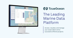
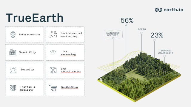
TrueEarth
Take your terrestrial data to new heights of understanding.
TrueEarth gives you the power to view your terrestrial geodata with unprecedented speed, ease and clarity, so you can zoom in, find what you are looking for and go from there.
north.io
Description
Security and Efficiency without compromises
Experience the new paradigm of cloud geodata infrastructures combining scalable cloud performance, highest security standards and intelligent data analysis enabling streamlined workflows.
Improving interoperability
The support of norms, standards and various geodata formats provides users with a shared portal for data collection, analysis and visualization.
Enabling cooperation
The Gaia-X aligned cloud creates a common BigData platform for users to share and collaborate on. Data and WebServices can be created and shared directly.
Intuitive geodata analytics
TrueEarth offers a constantly growing spectrum of tools such as spatial analysis, statistical evaluation, calculations and visualization creating a growing data ecosystem.
Security as a principle
The public cloud of our partner IONOS with BSI-certified protection generates automated mirrored systems and S3 backups. This ensures maximum protection for vital data.
Raising efficiency
With our cloud-native software, we focus on maximum scalability and performance. Instead of maintaining expensive servers on premise, you scale the performance as needed.

Forged to perform.
TrueEarth uses latest technology and standards of the geospatial industry (OGC) making sure to always provide our partners with a dependable high performance platform.
Scalable geodata infrastructure
Lifting your geodata in the cloud offers unlimited scalability for data storage and processing. Based on latest technologies (Kubernetes, Apache Spark and Parquet), we built a performant geodata infrastructure with seemless sharing capabilities (RSYNC, SFTP, web-based).
Modular architecture
With TrueEarth’s modular infrastructure you can integrate your existing geodata solutions and generate new value by combining different services and data. We are constantly exploring geodata services through API integration (e.g. spire Weather Forecast).
Geospatial search
Our novel and intuitive geosearch empowers everyone to find and utilize their geodata to unlock hidden value. Stop looking, start finding.

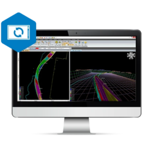
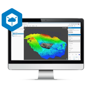
Intuitive visualization
By using scalable cloud power we enable high performance vizualisations with an intuitive user interface. This allows for browser-based rendering of even complex 3D-datasets such as pointclouds.
Contact us today to learn more about TrueEarth
Related products
