
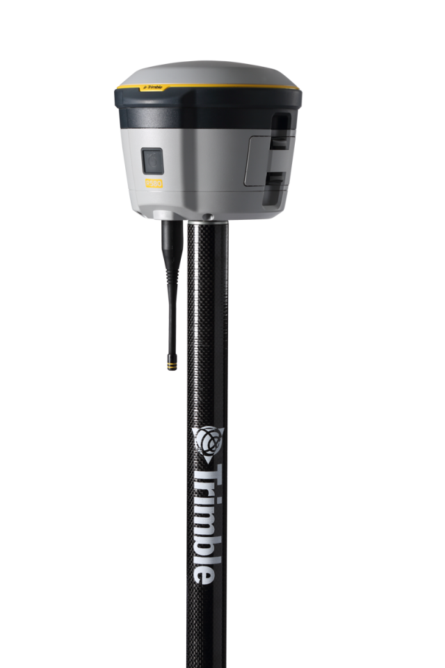


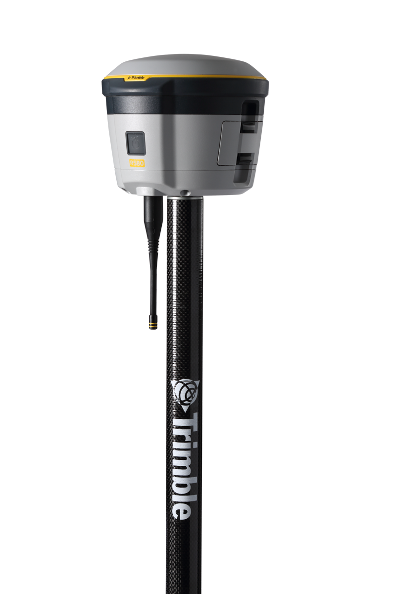


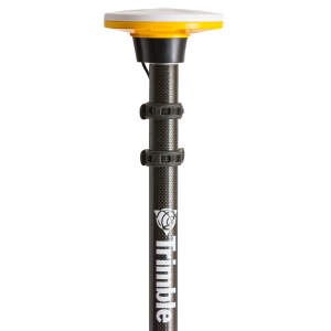
Trimble R580
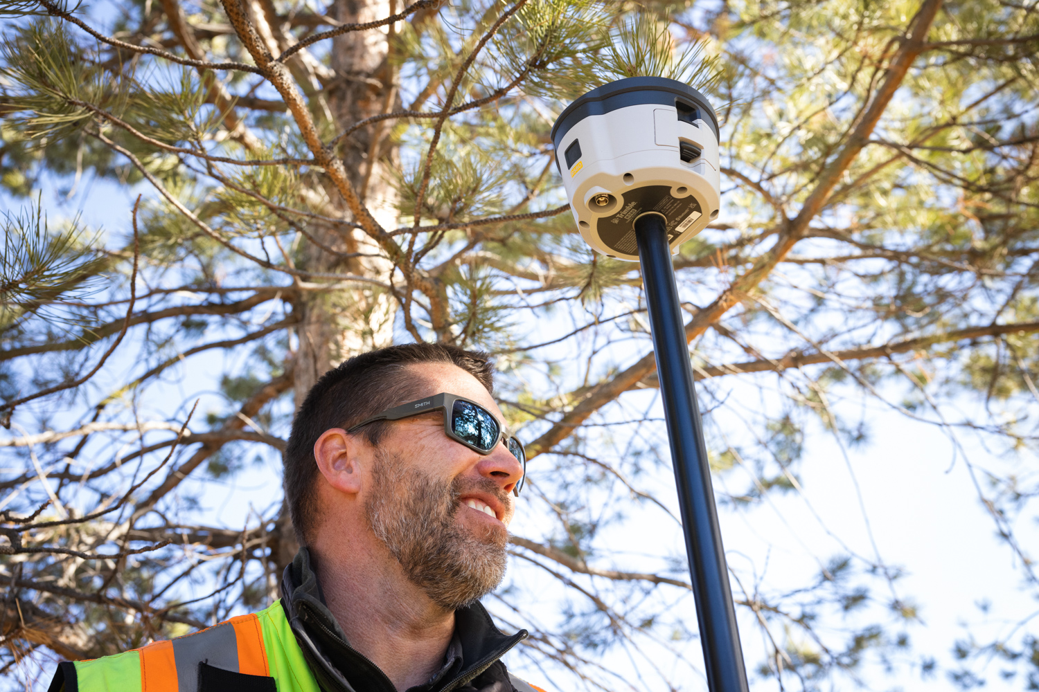
Depend on the Trimble® R580 GNSS system to keep you working with survey precision. Powered by the industry-leading Trimble ProPoint® GNSS engine, the Trimble R580 everyday integrated receiver delivers greater productivity and reliable accuracy in more places.

Trimble, Inc.
Westminster, US
Description
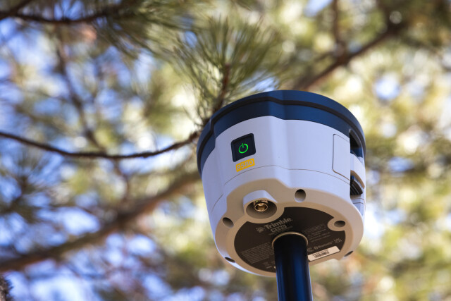
The Trimble® R580 GNSS system, is a dependable survey-grade integrated receiver that delivers productivity and reliable accuracy in more places. Boosting productivity thanks to the advanced Trimble ProPoint® technology, the R580 provides access to precise positioning for challenging GNSS environments, such as under tree canopy and near buildings. The Trimble R580 is a go-to solution for dependable survey-level accuracy in the field.
Do you have questions about this product?
- Questions about price, availability, and/or retailers
- Questions about technical specifications and usage
- Questions about suitability for your project or application
Specifications
-
General
-
Depth [m]
0
Height [m]
0.114
Housing Material
Plastic with metal endoskeleton
Total Weight [kg]
1.08
Width [m]
0.140
Year of initial introduction
2023
Type
Land
-
Performance
-
Max. simultaneous tracked channels
336
MRS functionality
Yes
No. channels
336
Reacqisition time [s]
1
RTK Network Compatibility
Yes
SBAS differential signals
WAAS, EGNOS, MSAS, MSS, GAGAN
Tracked satellite signals
L1/L2/L5 (GPS, GLONASS, Galileo, BeiDou, QZSS)
Type of measurements
Full wavelength carrier phase; C/A; P code; C code
-
Environment
-
Humidity resistance
100% condensing
Operating temperature: min. [°C]
-20
Operating temperature: max. [°C]
55
ROHS compliance
Y
Shock and vibration proof
MIL-STD-810G
Water sand and dust proof
IP65
WEEE compliance
Y
-
Communication: general
-
Communication ports
Cabled Mini-B USB, Wireless 2.4 GHz WiFi and Bluetooth
Simultaneous links
Y
PPS Out
N
Bluetooth
Y
-
Communication: Protocols
-
CMR standards for differential data
CMR+, CMRx
Configuration method
Web Interface, Field Software
L-Band Compatible
Yes
NMEA output format
24 NMEA
Other formats for differential data
GSOF, RT17, RT27
other output formats
Yes
RTCM standards for differential data
RTCM 2.1, 2.3, 3.0, 3.1, 3.2
-
Communication: links
-
CDMA phone modems
No/External
GSM; UMTS phone modems
External
Landline modems
No/External
Radio modems
Internal UHF Rx Only
-
Horizontal uncertainty
-
code: DGNSS/RTC (variable part) [ppm]
1
code: DGNSS/RTC (constant part) [m]
0.25
phase: RTK kinematic (variable part) [ppm]
1
phase: kinematic post processing (constant part) [m]
0.01
phase: RTK rapid static (constant part) [m]
0.003
phase: kinematic post processing (variable part) [ppm]
1
phase: RTK kinematic (constant part) [m]
0.01
phase: static post processing (variable part) [ppm]
1
phase: RTK rapid static (variable part) [ppm]
0.5
phase: static post processing (constant part) [m]
0.01
RTK network solution methods
Yes
-
Power
-
Certifications
FCC, C-Tick, CE Mark, UKCA Mark, Canadian ICES-003, Canadian RSS-247
Direct car connection cable available
No
External power supply
No
Internal power supply
Yes
Operating power: max. [V]
5.25
Operating power: min. [V]
4.75
Operating time with internal power supply [hr]
5
Rechargeable with (auto)battery
Yes, via external charger
Typical consumption [W]
2.75
Connectors
Mini-B USB connector
-
Recording
-
Data capacity [MB]
48
Data input
Multiple Trimble data controllers are available and BYOD
Memory medium
Internal
Type of data (on board recording)
Trimble compact format
-
More information
-
Distinguishable features
The Trimble R580 GNSS system is a dependable, everyday integrated receiver for survey, asset data capture, mobile GIS and inspection workflows. The R580 harnesses Trimble ProPoint technology so you can survey with precision in difficult places, boosting field work productivity like never before. With proven technology to guard against anti-spoofing and multipath issues, the dependable R580 provides confidence for every measurement and point you capture.
Documents
Brochure
links?dcs=Collection-133488

Videos


