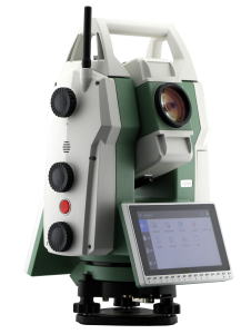
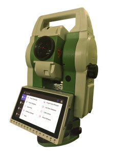
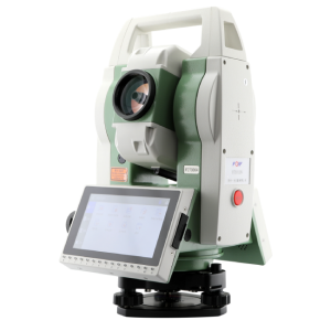
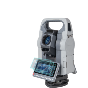
TAS-Z1 Total Station
New generation of total station
TAS-Z1 adopts a new ranging system, with a long measurement range and fast speed. Laser pointing technology on the same vertical axis provides more accurate alignment. Full number+letter keyboard for more immediate input. Dual-face keyboards with buttons illumination to minimize mistakes provide optimum viewing and convenience under any environmental conditions.
Tersus GNSS
Shanghai, CN
Description
Hardware guarantees high-precision results
150MHz modulation frequency, shorter precision measurement ruler, and higher accuracy at the same signal-to-noise ratio and phase discrimination resolution. The new optical path design fully isolates the transmitting and receiving optical signals, ensuring high accuracy.
Convenient and reliable data processing
Support EXCEL table data and DAT data import and export. Add known point files, and all projects can call known point coordinates.
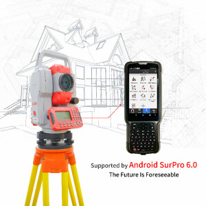
Coping with road measurements in complex situations
A brand new road measurement program that can calculate horizontal and vertical curves of any type of road, allowing for discontinuous changes in the radius of horizontal curves, including non-complete transition curves with any large deviation angle, straight line elements with straight turning points, and any broken chain piles.
Specifications
-
General
-
Area of Application
Road survey
Height [m]
0.33
Weight [kg]
5.5
Width [m]
0.19
Year of introduction
2023
Year of last update
2023
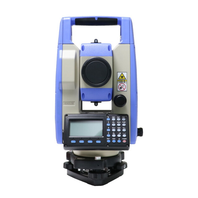
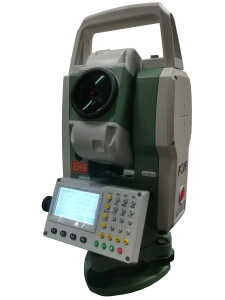
Display Panel
LCD
-
User Interface
-
Color display
N
No. faces
2
No. keys
24
Number of rows
6
Operating System
DOS
Screen type
LCD, 6 lines digital screen
Touchscreen
N
Characters per row
20
Resolution [px rows x columns]
160*96 dpi
Screen size: length of diagonal ["]
7.0
-
Distance Measurement with Prism
-
Maximum range with 1 mini prism [m]
5000
Maximum range with combined prisms [m]
5000
Maximum range with 1 standard prism [m]
5000
No. prisms for maximum range
1000
Standard deviation: variable part [ppm}
2
Standard deviation: constant part [mm]
2
Measuring Time [s]
0.3
Prism EDM Range [m]
5000
Prism EDM Accuracy [mm]
2
-
Integrated camera
-
Field of View Horizontal [deg]
1.5
Field of View Vertical [deg]
1.5
Integrated camera available [Y/N]
Y
Resolution [px rows x columns]
3"
-
Data Storage & Connectivity
-
Bluetooth {Y/N}
N
Compact Flash [Y/N]
Y
Radio [Y/N]
N
RS-232 /422 Serial [Y/N]
N
SD Card [Y/N]
N
USB [Y/N]
Y
WiFi {Y/N}
N
Internal memory [GB]
0
-
Miscellaneous
-
Guiding light
Y
Integration with GNSS receiver possible [Y/N]
N
Laser plummet
Y
-
Operation
-
IP dust/water protection class [IPxx]
IP55
Maximum working temperature [degC]
60
Minimum working temperature [degC]
-20
-
Distance Measurement without Prism
-
Maximum range on Kodak white [m]
1000
Maximum range on Kodak gray [m]
1000
Minimum size of spot at maximum range [mm2]
3600
Standard deviation: constant part [mm]
3
Standard deviation: variable part [ppm]
2
Non-Prism Range [m]
1000
Non-Prism Accuracy [mm]
3
-
Power Supply
-
Batteries hot-swappable
N
Battery
Lithium
Capacity
3100mAh
Max. operation time on one battery [hr]
8
-
Support
-
Standard warranty [years]
1
-
Angle Measurement
-
Standard deviation [arcsec]
2"
Compensation
1"
Guide Light
Y
-
More information
-
Distinguishable features
Road survey
-
Connectivity
-
USB
Yes
Bluetooth
N
RS232
No
-
Hardware
-
Auto Leveling
Dual-axis liquid photoelectric electronic compensator
LED Indicators
N
Laser Plummet
Class 3R


