
TAP - Tersus Advanced Positioning
a satellite-based precise point positioning service
TAP is a satellite-based precise point positioning service developed by Tersus GNSS, which allows users to achieve centimeter-level high-precision positioning worldwide.
Description
TAP is a satellite-based precise point positioning service developed by Tersus GNSS, which allows users to achieve centimeter-level high-precision positioning worldwide. With TAP, the GNSS rover receiver will not need to work with the local RTK base station or CORS, but directly receives corrections broadcast by the satellites, such as ephemeris error, satellite clock error, ionospheric delay, etc.. TAP meets the demand of centimeter-level high-precision positioning in areas without or with poor network coverage, such as oceans, deserts, mountains, high altitudes, etc.
Specifications
-
Options
-
INS Integration
N
Offline operability
Y
Interface
USB or Serial port
-
General
-
Compatible Receivers
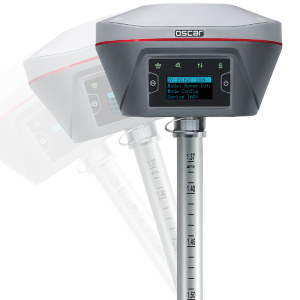
Oscar Ultimate,Oscar Basic, David30
Year of introduction
2023
Area of application
Marine
Processing type
Post-processing
-
Requirements
-
Operating System
Linux
Hardware
V1.0
-
Corrections base
-
RTK Corrections Via NTRIP Network
Y
DGNSS
Y
SBAS
Y
Signal
Satellite
Other
GPS, GLONASS,BeiDou, Galileo
-
Technical specifications
-
Coverage
Global
Horizontal accurcacy (RMSE) {cm}
5
Vertical accuracy (RMSE) {cm}
5
-
Miscellaneous
-
Subscription
Global
Subscription plans
NA
Distinguishable features
With worldwide coverage,it canbeusedaslongasthere is a goodvision No need to use the network to receive corrections High signal stability, which guarantees uninterrupted transmission for 24 hours a day The TAP NTRIP(NetworkTransport of RTCM over Internet Protocol) service is available as a back-up method over data delivery for all users It canbe widely used in autonomous driving,precision agriculture,and disaster monitoring and so on
Typical applications
oceans,deserts, mountains,highaltitudes
