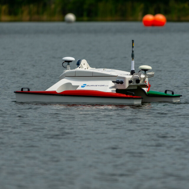
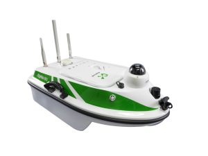
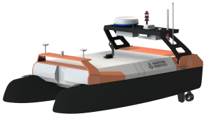
SR-Surveyor M1.8
Autonomous hydrographic Survey System
The SR-Surveyor M1.8 is a highly capable man-portable autonomous hydrographic survey vessel. It is tightly integrated with multiple high-resolution hydrographic sensors and a topographical mapping LiDAR. It’s unique sensor suite make it a versatile system for collecting a wide range of hydrographic data in inland and coastal waters. It’s small form factor, light weight, and extremely shallow draft allow it to be rapidly deployed to difficult to access areas.
SeaRobotics
Stuart, US
Description
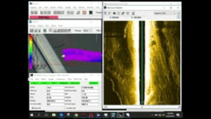
The SR-Surveyor M1.8: 7 Data Sets in a 1.8m ASV from SeaRobotics Corp on Vimeo.
This system is used for:
• Shallow water hydrographic surveys (less than 50
meters water depth)
• Benthic habitat mapping
• Nautical charting
• Military rapid environmental assessments (REA)
• Route surveys
• Dredging operations
• Marine debris search
• Port & harbor security
• Infrastructure inspection
• Scour surveys
• Bridge inspection
• Pipeline survey
• Stream gauging
• Volumetric discharge measurement
• Plume detection
• Search & rescue
Sensors on board:
The EdgeTech 2205 and AML MicroSV are part of the base
boat. An SBG INS must be selected as a required option.
The other items can be purchased as options and added
to the vehicle at any time.
• EdgeTech 2205 dual sidescan/bathy multi-phase
echosounder
• AML MicroSV sound velocity sensor
• SBG dual antenna inertial navigation system (INS)
(select Ellipse, Ekinox or Apogee)
• Sontek M9 acoustic doppler current profiler
(ADCP)
• Velodyne PUCK 16 channel mapping LiDAR
Specifications
-
More information
-
Applications
Bathymetry, rapid environmental assessment, habitat mapping, pipeline survey, bridge & dam inspection, site survey, search & rescue
Distinguishable features
Autonomous fail safes & health monitoring
-
General
-
Length [m]
1.8
Width [m]
0.91
Min. weight of USV in air [kg]
49
Max. Weight of USV in air [kg]
52.3
Portable
Y
Draft [m]
0.17
Number of thrusters
2
Thruster specifications
Electric
Chassis
Foam Filled Unsinkable
-
Communication and Control
-
Type of Communication
WiFI/ Celular
Data sent to shore
Yes & stored onboard
Auto- control
Yes
Emergency recovery procedure
Automatic
-
Navigation and Payload
-
Navigation sensors - standard
SBG INS
Payload sensors - standard
Egdetech 2205 sidescan & bathymetery, AML Micro SV
Payload sensors - optional
SBG INS, Velodyne Puck LiDAR, SonTek M9 ADCP
-
Operations
-
Min. turning radius [m]
0.8
Operational Area
Inland, coastal
Launch and Recovery System
Man proatble
Max. speed [kn]
7
Min. crew size
1
Min. required number of surface computers
1
Available size of storage room
N/A
Max. WMO seastate
2
-
Energy and Propulsion
-
Propulsion
Electric
Energy Source
LiPo
Endurance at nominal power [hr]
6 hours
Videos


