

Seapath 130
Compact GNSS aided inertial navigation system
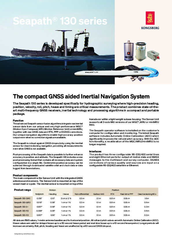
The Seapath 130 series is developed specifically for hydrographic surveying where high-precision heading, position, velocity, roll, pitch, heave and timing are critical measurements. The product combines state-of-theart multi-frequency GNSS receivers, inertial technology and processing algorithms in a compact and portable package.

Kongsberg Discovery
Horten, NO
Description
High accuracy position output
The advanced Seapath sensor fusion algorithms integrate raw inertial sensor data from our unique and very high-performance MGC® (Motion Gyro Compass), MRU (Motion Reference Unit) or miniMRU, together with raw GNSS data and RTK, PPP or DGNSS corrections. Our unique navigation algorithms enable high accuracy position output even when no correction signals are available.
Inertial sensor
The Seapath is robust against GNSS dropouts by using the inertial sensor for dead reckoning navigation, providing all measurements even when GNSS is not available.
No need for recalibration
The Seapath operator software is installed on the customer’s computer for configuration and monitoring. The latest Seapath software includes Automatic Online Calibration (AOC) which significantly improves the roll and pitch accuracy. With the AOC functionality, a recalibration of the MGC/MRU/miniMRU is no longer required.
Key features
Compact and robust integrated INS/GNSS system
0.007° to 0.015° roll & pitch accuracy dependent on IMU (Inertial Measurement Unit) model
No accuracy degradation in roll, pitch and heave measurements during turns
Precise heave at long wave periods by use of the PFreeHeave® algorithms
550-channel multi-frequency GPS/GLONASS/Galileo/BeiDou/QZSS receiver
Robust against GNSS dropouts due to inertial sensor part of product
Multiple differential correction support including SBAS
RTK correction on RTCM format supported
Seastar®, OmniSTAR® and Marinestar™ corrections supported
All data are provided with a time stamp with an accuracy of 0.001 s to the actual measurement time
Outputs on RS-232, RS-422 and Ethernet
Up to 100 Hz data output rate
Precise Time Protocol (PTP) and NTP available for time critical applications over Ethernet
Multi-frequency GNSS ionospheric compensation
Logging of raw satellite and IMU data possible
Meets IHO exclusive order requirements
Do you have questions about this product?
- Questions about price, availability, and/or retailers
- Questions about technical specifications and usage
- Questions about suitability for your project or application
Documents
Brochure
datasheet_seapath130.pdf
840.01 KB
Related products


