
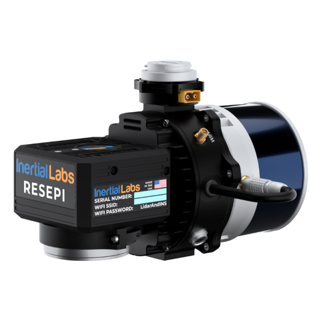
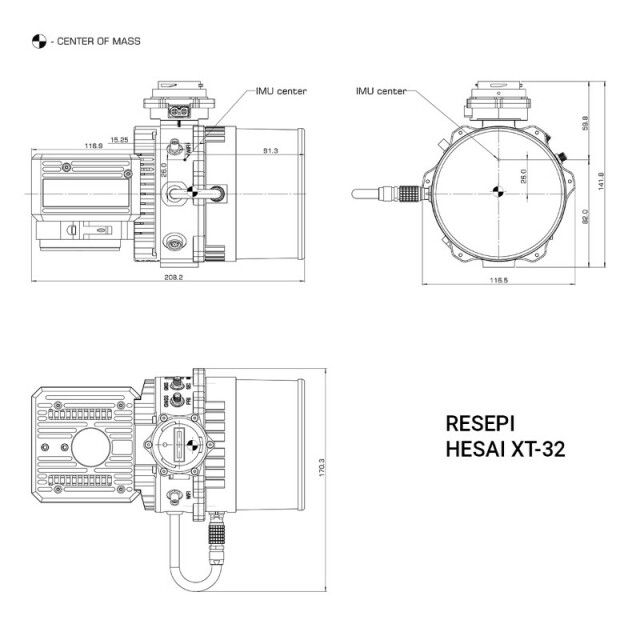


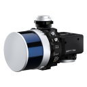
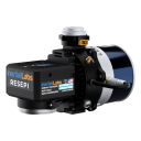
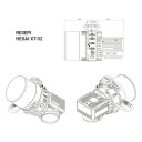


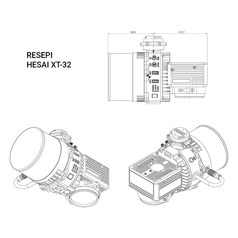


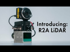
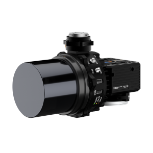
RESEPI Hesai XT-32 – LiDAR and RGB Remote Sensing Payload Instrument
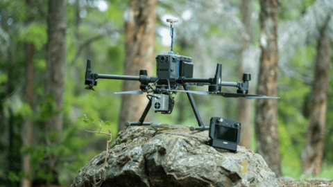
Supporting DJI Martice 210, 300 and 600 and other UAV platforms, Land Vehicles
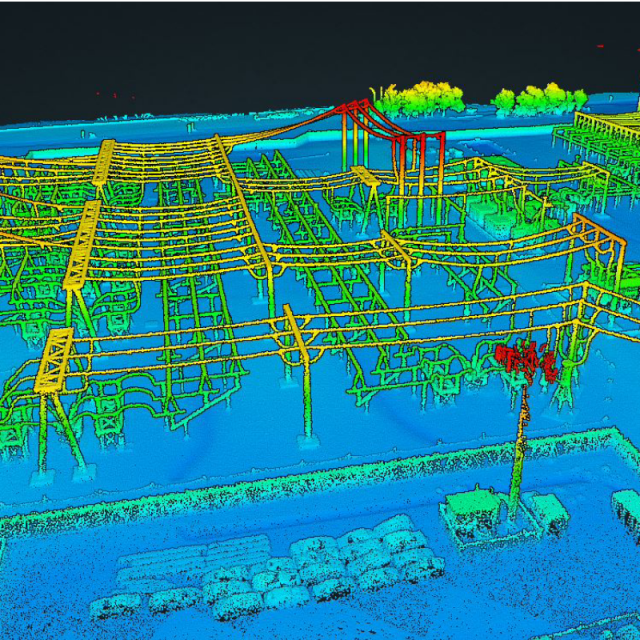
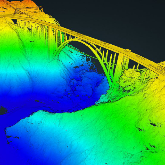
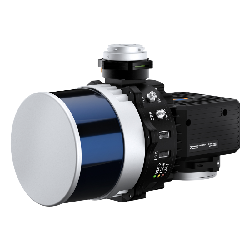
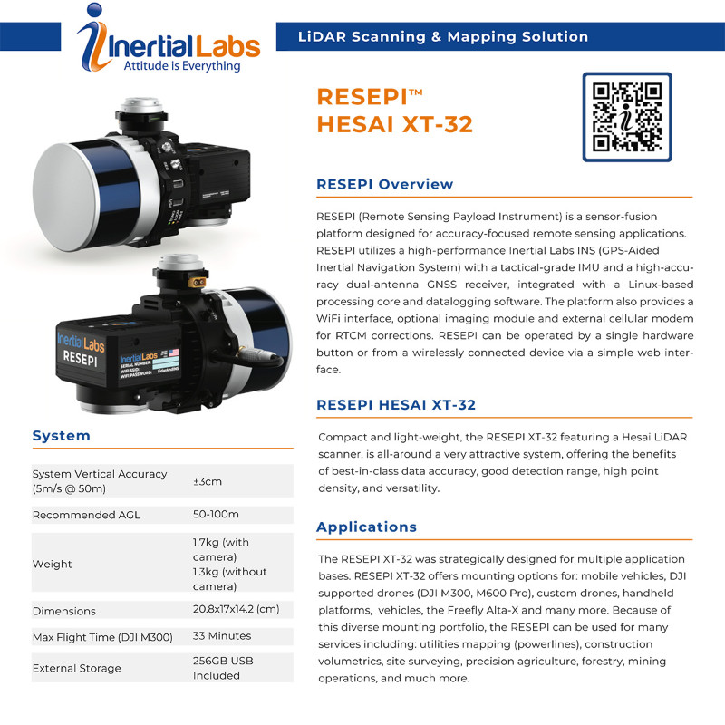
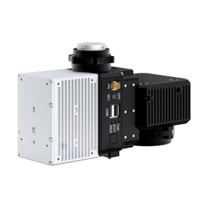
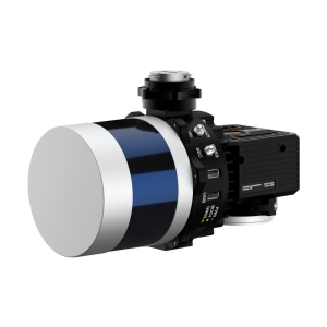
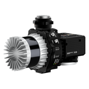
Compact and light-weight, the RESEPI XT-32 featuring a Hesai LiDAR scanner, is all-around a very attractive system, offering the benefits of best-in-class data accuracy, good detection range, high point density, and versatility.

Inertial Labs, Inc.
Paeonian Springs, US
Description
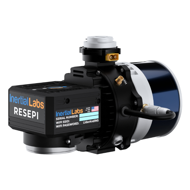
RESEPI (Remote Sensing Payload Instrument) is a sensor-fusion platform designed for accuracy-focused remote sensing applications. RESEPI utilizes a high-performance Inertial Labs INS (GPS-Aided Inertial Navigation System) with a tactical-grade IMU and a high-accuracy dual-antenna GNSS receiver, integrated with a Linux-based processing core and datalogging software. The platform also provides a WiFi interface, optional imaging module and external cellular modem for RTCM corrections. RESEPI can be operated by a single hardware button or from a wirelessly connected device via a simple web inter- face.
Applications
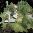
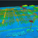
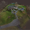
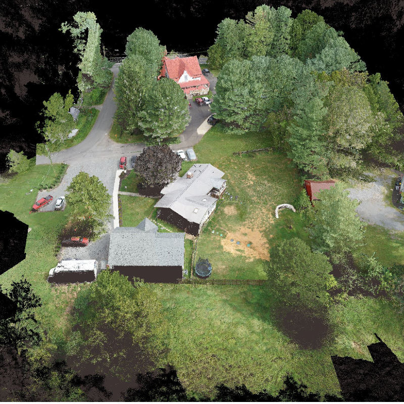
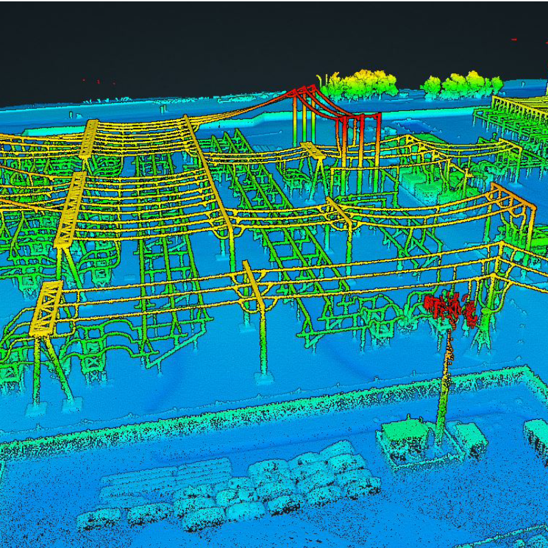
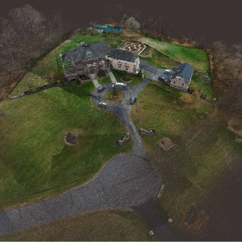
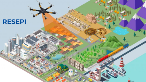
The RESEPI XT-32 was strategically designed for multiple application bases. RESEPI XT-32 offers mounting options for: mobile vehicles, DJI supported drones (DJI M300, M600 Pro), custom drones, handheld platforms, vehicles, the Freefly Alta-X and many more. Because of this diverse mounting portfolio, the RESEPI can be used for many services including: utilities mapping (powerlines), construction volumetrics, site surveying, precision agriculture, forestry, mining operations, and much more.
Do you have questions about this product?
- Questions about price, availability, and/or retailers
- Questions about technical specifications and usage
- Questions about suitability for your project or application
Specifications
-
Application
-
Main applications
UAV-based and mobile mapping, surveying, inspection
Training, maintanence and support
Included
Distinguishable features
Low-cost, multi-platform
-
Measurement Characteristics
-
Scanning method
Multiple commercially available scanners supported
-
Physical Properties
-
Height [cm]
20.8
Length [cm]
17
Width [cm]
14.2
Weight [kg]
1.3
Water and dust proof
IP67
-
Laser Pulse Characteristics
-
Laser Class
Multiple commercially available scanners supported
-
Power Supply
-
Power consumption
12W
Power requirements
9-36V
Type of battery
external
-
Positioning System
-
Number of GNSS positioning sensors
1
Type of GNSS positioning sensors
NovAtel OEM7720
Typical positioning accuracy [cm]
1
Heading, Pitch and Role internally captured
Y
Type of INS or IMU
Inertial Labs INS-D, Tactical Grade IMU
Gyroscopes Bias In-Run stability [deg p hr]
1
-
Operation Characteristics
-
Mounting
Cross-platform mounting options available, SkyPort, AltaX and other mounting systems
Requirements for compatible UAVs
DJI M210, M300, M600, FreeFly and other UAS
Camera included
Yes, Optional
Camera specifications
ADTi 24MP RGB; Lens: Sony E-Mount 16mm, 70° FOV
-
Data and Software
-
Type of storage
flash card
Max. storage space [mb]
262144
Included software
PCMasterGL, PCPainterGL, Boresighting Software, 1st year PPK Software Support License Included
-
General
-
Year of last update
2021
Year of introduction
2020
Documents
Brochure
resepi-datasheet-rev-2-3-september-2021-yourlogo-draft-3.pdf
2.93 MB

Videos


Related products
Articles

![YRBKMWXn[1].png](https://cdn.geo-matching.com/En53gY1o.png?w=300&h=300&crop=1&s=024b01a5456af84a24979824702460d7)


