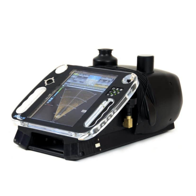
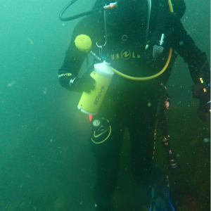
Portable Sonar and Navigation system SONADIVE
SONADIVE assists divers during recognition or object detection missions.
The embedded navigation system relies on several sensors: heading, immersion, DVL (Doppler) and a GPS for surface initialization. Divers can communicate with each other and the surface unit in real-time via the acoustic modem, sharing contacts and their symbology. A communication module allows underwater repositioning and transmission of data to the surface. Sonar and navigation data are fully recorded allowing mission replay, data analysis and export.

RTsys
Caudan, FR
Description
Advantages
- Always safe operations thanks to the lowest magnetism on the market
- Clear Target identification underwater thanks to its large screen
- Multi-missions product
- High accuracy in target localization
Features
- Integrated navigation unit (DVL)
- High-resolution acoustic camera
- Low light video camera
- Floating removable GPS antenna
- Integrated chart with georeferenced POI
Do you have questions about this product?
- Questions about price, availability, and/or retailers
- Questions about technical specifications and usage
- Questions about suitability for your project or application
Specifications
-
Sonar Details
-
Max. depth [m]
100
Min. frequency [kHz]
450
Max. frequency [kHz]
2250
-
Other specifications
-
Carrier options
