
Next Generation of Airborne Laser Scanning system X10
Multiple Views From One
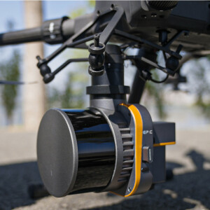
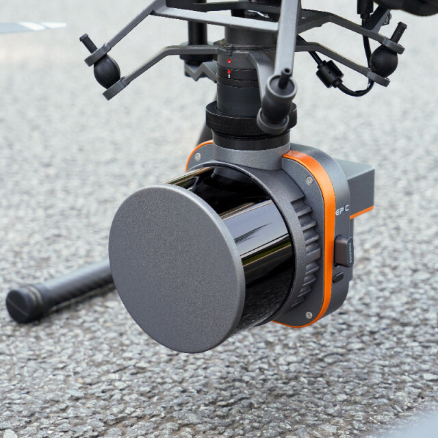
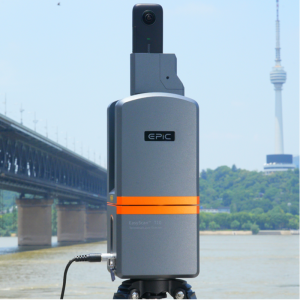
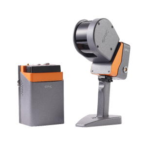
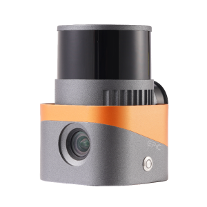
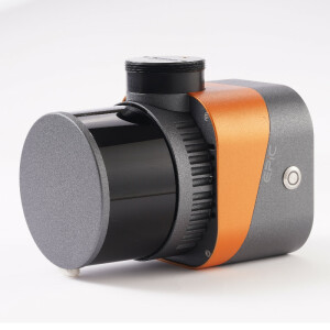
EPiC X10 integrates a variety of sensors such as LiDAR,GNSS,high-precision IMU and aerial metric camera. With the distributed structure first introduced in the industry and special accessories,it can be disassembled into 4 different independent modes of fully aerial survey (LiDAR+camera),SLAM,airborne LiDAR and airborne camera.One device, multi-purpose,can easily meet the requirements of different standards of data acquisition under different scenarios.
Description
X10 is a versatile airborne 3D laser scanning system and it features High efficiency,Not affected by light,No signal limitation and Real-time monitoring.
High efficiency
Ultra light aerial survey module, image acquisition not limited by LiDAR measurement range, filght height can be appropriately increased to improve the operation efficiency.
Not affected by light
LiDAR is not affected by environment, less side overlap, wider coverage of single flight, data can be easily collected even in the night.
No signal limitation
Switch to SLAM mobile scanning mode, no limitation of GNSS signal, indoor and ourdoor data integrated collection makes the 3D data more complete.
Real-time monitoring
Stimultaneous acquisition of point cloud and orthophoto to achieve the real-time monitoring of flight trajectory,3D point cloud and images during the whole flight of the system.
Industry Application:
Smart Grid,Topographic Survey,Emergency Rescue,Smart Mining,Water Conservancy &Hydrology,Nature Resource,Real 3D.
Do you have questions about this product?
- Questions about price, availability, and/or retailers
- Questions about technical specifications and usage
- Questions about suitability for your project or application
Specifications
-
General
-
Year of introduction
2022
Year of last update
2023
Total Weight [kg]
1.26
Power requirements
10~30V DC
Type of GNSS/INS positioning system
MEMS
Camera
26MP Built-in camera
Data storage facilities
USB-disk 256GB
Mission planning software
Easy Pilot Access
Postprocessing software
EPiCloud Center
-
Application
-
Main applications
Smart Grid, Topographic Mapping, Emergency Rescue, Smart Mining, Water Conservancy & Hydrology, Nature Resource,Real 3D
-
Measurement Characteristics
-
Scanning method
Mechanic Rotation Mirror
Max. field of view [deg]
360°
Max. number of recorded echoes per pulse
2
Full-wave form digitization
N
Pulse sampling frequency [GHz]
1
multiple pulses in air
Y
Recording of intensity of return signal [bits]
8
-
Operation Characteristics
-
Platform
RPAS (UAV/UAS)
Max. flying height [m]
150
Max. acquisition time [hr]
0.5
-
Laser Pulse Characteristics
-
Wavelength [nm]
905
Type/class laser
Class I
Eyesafe range [m]
Eyesafe laser
-
More information
-
Distinguishable features
4 operation modes in 1 device
-
Uncertainty and resolution
-
Heading pointing precision [deg]
0.008
Elevation precision at 1 km [m]
0.015
Planimetric precision at 1km [cm]
0.01
-
Application areas
-
Select an application area:
Land Surveying and Cadastre, Construction and Infrastructure, Cultural Heritage
More from Wuhan Eleph-Print Tech Co.,Ltd

