

GeoSwath USV
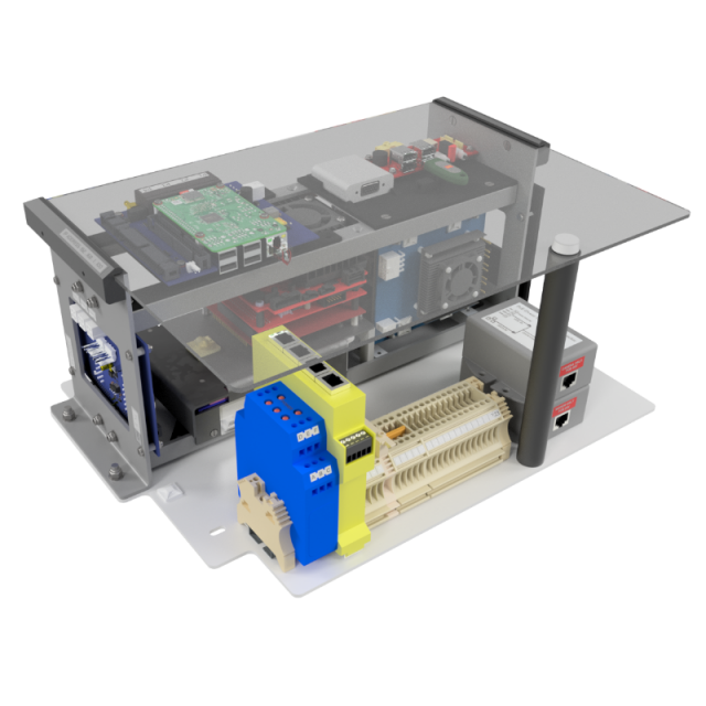
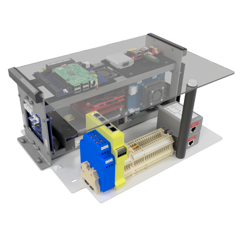
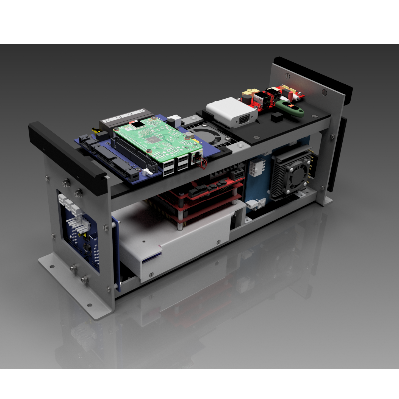
GeoSwath 4 Module for USV Installation
GeoSwath 4 offers industry-leading simultaneous swath bathymetry and Sidescan sonar mapping for shallow waters. The USV module is a highly flexible solution. It can be installed into any compatible USV, allowing for the efficient survey of inland or offshore bodies of water, including those which may be hazardous or inaccessible for conventional survey vessels.

GeoAcoustics Ltd
Great Yarmouth, GB
Description
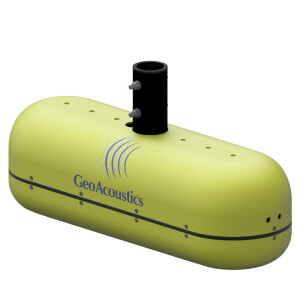
The GeoSwath 4 dual transducer head delivers data accuracies that exceed IHO hydrographic survey standards with a 240° field of view from port to starboard waterline, enabling bottom coverage of up to twelve times the water depth. The transducers have a versatile range of mounting options and are available in frequencies of 125, 250 or 500 kHz, each varying in depth and data resolution to optimise performance for the individual survey task.
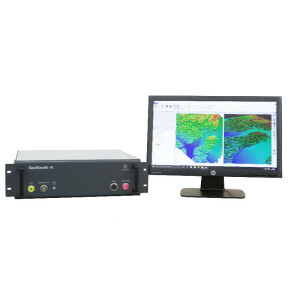
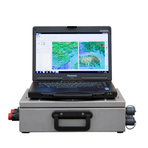
The latest GS4 software comes included and has been exclusively developed for the GeoSwath 4. The GS4 software provides a complete project-based solution. It includes the acquisition, storing and editing of sonar and ancillary data, data processing and advanced data gridding capabilities, Sidescan mosaicing and 3D data visualisation. The GeoSwath 4R can also be interfaced to third-party software for acquisition and processing.
The GeoSwath USV module has been installed on several USVs, including the Z-Boat from Teledyne Marine, the EchoBoat from Seafloor Systems, SL 40 from Ocean Alpha and the Inception from Unmanned Survey Solutions.
Key features:
- Ultra-high resolution wide swath bathymetry
- 240° field of view up to the water line
- Bottom coverage up to 12 x water depth
- Fully featured GS4 software included
- Available in 125, 250 and 500 kHz
- Simple USV installation
***News Flash***
GS4 software v1.0.25 is ready for general release soon
The update introduces a new Artificial Intelligence-powered data processing for GeoSwath users, which has already been trialed by selected end-users globally.
The system improves in-survey operational agility and decision support by providing a high-quality real-time data stream on board while cutting the time to final product in post-processing.
Other new functionality with this update includes Survey Accuracy verification, and an Auto mode for side scan data processing. A full change log is available on request.
The GS4 v1.0.25 software update is available free of charge1 via micro-SD card for customers already using GS4 v1.0.24.
Contact your local dealer or email [email protected] for more information.
1Cost of physical media, logistics and support may be applicable.
Do you have questions about this product?
- Questions about price, availability, and/or retailers
- Questions about technical specifications and usage
- Questions about suitability for your project or application
Specifications
-
Physical properties of transducer head
-
Length [m]
0.38
Width [m]
0.12
Height [m]
0.17
Min. external power [V]
18
Max. external power [V]
26
Max. power consumption [W]
65
Weight in Air
3.4 kg
Transducer Head Weight, appr. including peripherals
18.5 kg (125 kHz)
-
Speed of sound
-
Real-time correction of refraction at transducer head
Y
-
Motion compensation
-
Motion sensors compatible to the system
Any outputting TSS1 or EM3000
Required pitch uncertainty [deg]
0.3
Required roll uncertainty [deg]
0.3
-
Mounting and deployment
-
Mounting
Hull mounted & Portable
Retractable
N
-
Used Sonar Methods
-
Type of system
Bathymetric sonar
Bottom Detection Method
Interferometric
-
System Parameters
-
Min. frequency [kHz]
125
Max. frequency [kHz]
500
Number of selectable frequencies
1
Max. depth [m]
200
Depth resolution [mm]
1.5
Max. swath as a function of depth
780
Min. depth [m]
0
Ping frequency [Hz]
30
Min. beam width across track [deg]
0.5
max Swath Update Rate
30
Pulse length
User selectable
-
Bottom Coverage
-
Max. swath width [m]
780
Equi-angular/equi-distant mode
Documents
Other documents
-
GeoSwath 4 USV 2024.pdf2.14 MB

