


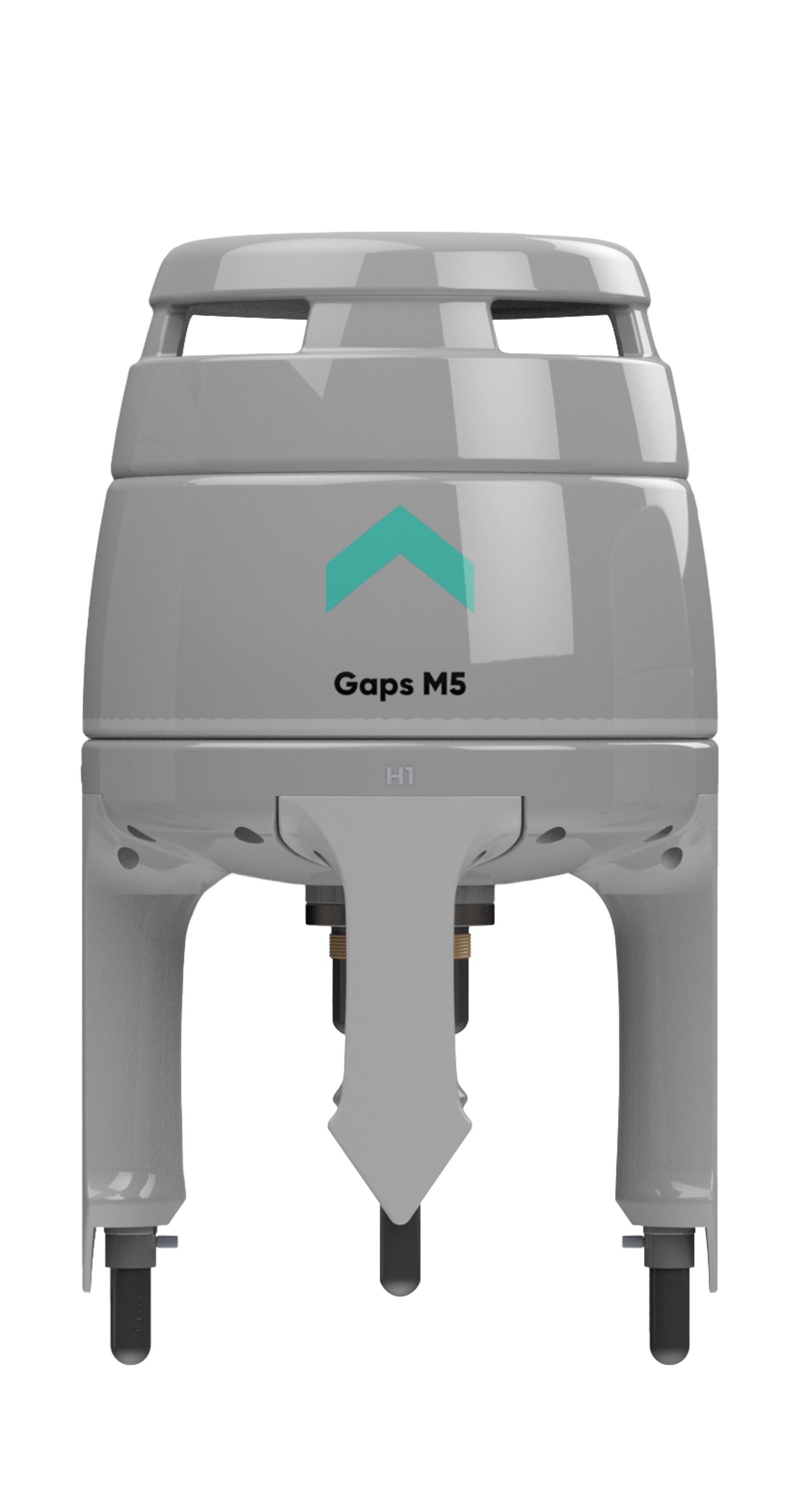
Gaps M5
Calibration-free and export-free USBL system
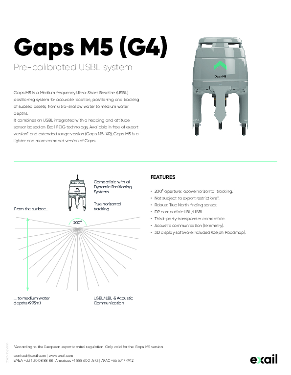
Gaps M5 is a medium frequency ultra-short baseline (USBL) positioning system for accurate location, positioning and tracking of subsea assets, from ultra-shallow water to medium water depths. It combines a USBL integrated with a heading and attitude sensor based on Exail FOG technology. Free of export restrictions, Gaps M5 is a lighter and more compact version of Gaps, the lightest high-performance USBL system on the market.

Exail
Saint Germain en Laye, FR
Description
FEATURES
- 200° aperture: above horizontal tracking.
- Not subject to export restrictions.
- Robust True North finding sensor.
- DP compatible LBL/USBL.
- Third-party transponder compatible.
- Acoustic communication (telemetry).
- 3D display software included (Delph Roadmap).
Do you have questions about this product?
- Questions about price, availability, and/or retailers
- Questions about technical specifications and usage
- Questions about suitability for your project or application
Specifications
-
Physical properties of transducer head
-
Max power consumption [W]
22
Diameter [mm]
296
Height [m]
520
Min. external power [Voltage]
24
Max. external power [Voltage]
230
-
System Parameters
-
Frequency {kHz}
MF
Spread spectrum technology
Y
Min. operation range {m}
5
Max. operation range {m}
995
Operation beam angle {deg}
220
Angle accuracy (degr) @ 20 dB
0.03
Focussed beam forming
N
Horizontal accuracy (in % of the water depth)
0.2
Number of active elements
40
Number of transponder channels
500
Multi user functionality
Y
LBL-functionality
Y
-
Motion compensation
-
Motion sensors compatible to the system:
Not needed, INS inside. Optional: Support all exail AHRS and INS products, NMEA and KM binary dataformat
-
Interfaces
-
Compatible hardware
Third-party transponders and DP Systems
Inertial interfacing
Y
Compatible software
QINSY, HIPACK, NAVIPAC, PDS
-
Speed of sound
-
Ray tracing
Y
Real-time integration of SV-profile
Y
-
Deployment
-
Inside deployment pole available
Y
Outside deployment pole available
Y
Diam gate valve {mm}
350
Recommended distance below keel {m}
1.5
-
Mounting and deployment
-
Mounting
Hull mounted & Portable
Retractable
N
-
Used Sonar Methods
-
Type of system
Omndirectional
-
More information
-
Distinguishable features
Calibration free, free-of-export version (995m), extended range version (4,000m), shallow water tracking, permanent installation, third party friendly, easy to install operate and repir for cost-efficiency
-
General
-
Date of first release
2020
Documents
Brochure
Datasheet_Gaps M5_G4.pdf
1.35 MB
Other documents
-
Brochure_Solutions for subsea positioning and navigation.pdf1.78 MB
Related products


