


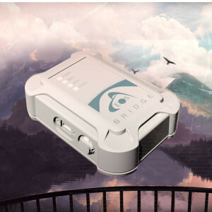
Eos Locate for ArcGIS Field Maps
Underground utility mapping solution for ArcGIS users
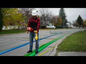
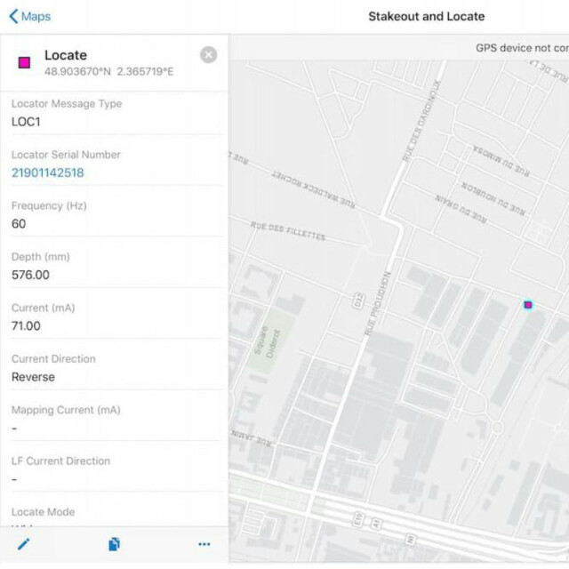
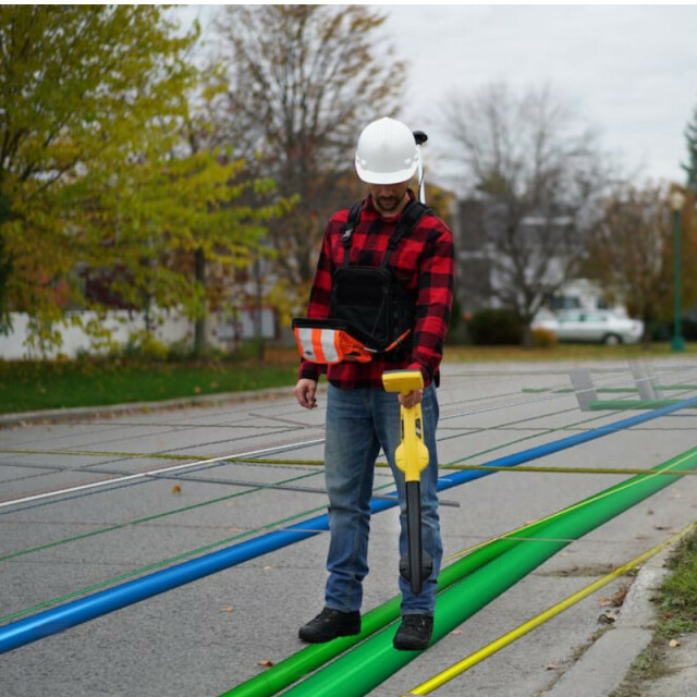
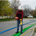
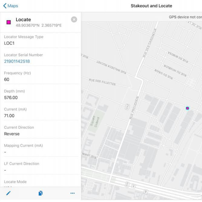
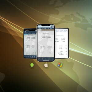
Eos Locate™ for ArcGIS is the world’s first real-time, high-accuracy, underground-mapping solution for utilities using Esri software. With Eos Locate™ utilities can map their buried infrastructure with centimetre-level accuracy in real-time, directly into their Esri software environment. All a field worker needs is an Arrow GNSS receiver, either ArcGIS Collector or ArcGIS Field Maps on iOS, and a compatible locator device.
Eos Positioning Systems
Terrebonne, CA
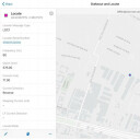
Description
Key Features
Better Safety
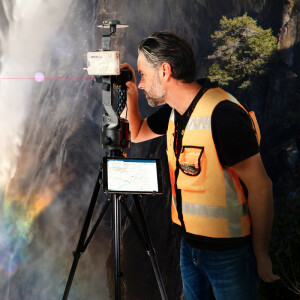
Ditch blind digging. Prevent liabilities to your constituents, employees, and third parties by keeping accurate records of underground pipes, cables, and wires in ArcGIS Online.
More Efficiencies
Roll just one truck, but get the value of rolling two. Consolidate your underground locate trips with your GPS data collection. All your GNSS and locate data is sent to ArcGIS Online in the push of one button!
Prepare for 3D
Pave the way for the future of work — by collecting what’s under the pavement. 3D asset management and augmented reality will require an integrated depth of cover and precise elevations.
Core innovations of Eos Locate™ for Collector:
- Map buried assets with submeter or centimeter accuracy.
- Single-user setup allows for simultaneous locate and GPS-mapping workflows.
- Exclusively compatible with Esri Collector, Arrow GNSS receivers, and leading utility locator devices.
- Simple solution design takes advantage of the intuitive iOS platform.
Do you have questions about this product?
- Questions about price, availability, and/or retailers
- Questions about technical specifications and usage
- Questions about suitability for your project or application
Specifications
-
General
-
Type
Year of initial introduction
2019
-
Performance
-
Max. simultaneous tracked channels
394
Tracked satellite signals
GPS: L1CA, L1P, L1C, L2P, L2C, L5. GLONASS: G1, G2, P1, P2. Galileo: E1BC, E5a, E5b. BeiDou: B1, B2, B3 (without L5). QZSS: L1CA, L2C, L5, L1C.
SBAS differential signals
WAAS/EGNOS/MSAS/GAGAN
Type of measurements
Code and Carries phase
Reacqisition time [s]
1
RTK Network Compatibility
Yes
-
Environment
-
Operating temperature: min. [°C]
-40
Operating temperature: max. [°C]
85
Humidity resistance
95% non-condensing
Water sand and dust proof
Waterproof, IP-67
ROHS compliance
Y
-
Communication: Protocols
-
RTCM standards for differential data
RTCM 2.x, 3.x, SC-104
CMR standards for differential data
CMR, CMR+
Other formats for differential data
proprietary binary
NMEA output format
NMEA-0183
L-Band Compatible
Yes
Configuration method
Compatible with Apple, Android and WIndows devices.
-
Horizontal uncertainty
-
phase: RTK rapid static (constant part) [m]
0.01
phase: RTK rapid static (variable part) [ppm]
1
RTK network solution methods
SafeRTK® is a trademarked feature of the Arrow Gold. When your receiver loses RTK connection, for whatever reason, SafeRTK® takes over. Within just a few seconds, SafeRTK® is enabled, allowing you to maintain an RTK-level accuracy (i.e., cm) for up to 20 minutes while waiting for a reconnection. So you can save time and keep moving. There has never been a smoother RTK experience.
-
Power
-
Operating power: min. [V]
2.5
Operating power: max. [V]
16
Internal power supply
Batterie Li-Ion
Operating time with internal power supply [hr]
8.5
Certifications
FCC, CE, RoHS and Lead-free
Rechargeable with (auto)battery
Yes
Direct car connection cable available
Vehicle charger available
-
Recording
-
Type of data (on board recording)
NMEA 0183, RTCM SC-104, Binary
-
More information
-
Distinguishable features
The Arrow Gold GNSS RTK is the first high-accuracy iOS, Android, and Windows Bluetooth GNSS receiver to implement all four constellations (GPS, Glonass, Galileo, BeiDou), three frequencies (L1, L2, L5), and satellite-assisted RTK.
Documents
Brochure
Eos-Locate-Brochure-2021.pdf

Videos
