IP-S3 HD1
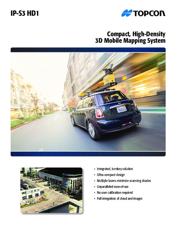
The IP-S3 Mobile Mapping System Offers High Density, High Precision, Point Clouds Combined With High-Resolution Panoramas From a System That Is Smaller, Lighter and Easier to Handle.
IP-S3’s positioning system is an integration of an inertial measurement unit, GNSS receiver and a vehicle odometer. It provides precise positioning and attitude in a dynamic environment.

Topcon
Capelle aan den IJssel, NL
Description
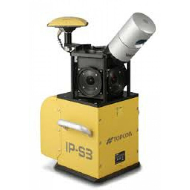
The IP-S3 mobile mapping system offers high density, high precision, point clouds combined with high resolution panoramas from a system that is smaller, lighter and easier to handle. IP-S3’s positioning system is an integration of an Inertial Measurement Unit (IMU), GNSS receiver (GPS and GLONASS) and a vehicle odometer. It provides precise positioning and attitude in a dynamic environment.
Do you have questions about this product?
- Questions about price, availability, and/or retailers
- Questions about technical specifications and usage
- Questions about suitability for your project or application
Specifications
-
General
-
Year of initial introduction
2014
Application
Outdoor
-
Positioning
-
GNSS receiver: Brand and model
Topcon
Number of antennas
1
Number of wheel sensors
1
-
Lidar Sensor
-
Number of laser scanners
1
Max Range [m]
100
Max. vertical field of view [deg]
30
Scans per second
700000
-
Operation
-
Max. speed [km/hr]
100
Main applications
Topcon mobile mapping systems are the perfect solution when a massive amount of asset data needs to be collected in a short amount of time. By mounting a mapping system with various integrated sensors (GNSS, laser scanner, camera, IMU, wheel encoders) to a vehicle, users get all field data quickly. Just drive at normal speeds and get locations and visual detail of all roadside features. There is no need to take time to revisit the field for missing points. Easy to use office software can then be used for viewing, processing, projecting and exporting data for GIS or CAD software.
Distinguishing features
IP-S3’s six-lens digital camera system provides 360 degree high resolution spherical images that allow for easy feature recognition.Mobile Master Office software handles all post processing trajectories and geo-referencing scans and images.Integrated turnkey solutionUltra compact designMultiple lasers minimize scanning shadesUnparalleled ease of useFactory calibratedFull integration of cloud and images
Training provided
Y
-
Camera System
-
Number of cameras
6
Spectral Bands [PAN, RGB, NIR, CIR]
RGB
CCD size [.. x .. pixels]
8000 x 4000
-
Dimensions & Environment
-
Size with case
260 x 160 x 121
Weight [kg]
18
Min. Operation temp. [°C]
0
Max. Operation temp. [°C]
45
-
Included Processing Software
-
Photogrammetry Software
MAGNET Collage
Laser Point Clouds Software
MAGNET Collage
Project Management Software
MAGNET Collage
Other Software
MAGNET Collage Web


