
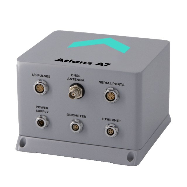
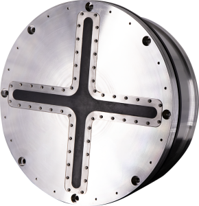
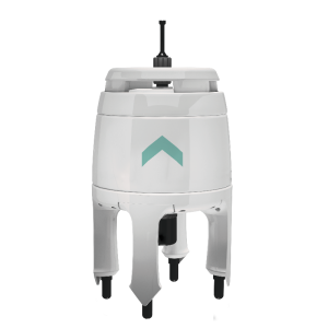
Atlans A7
Navigation grade INS for land and air georeferencing applications
Atlans A7 is a high performance all-in-one position & orientation system for both land and air applications. It benefits from smart coupling techniques between Exail Inertial Navigation Systems (INS) based on FOG (Fiber-Optic Gyroscope) and Septentrio GNSS receiver embedded. Atlans A7 is a robust and cost effective north-finding inertial navigation solution that provides continuous data even in the most challenging applications.

Exail
Saint Germain en Laye, FR
Description
Atlans A7 is a high performance all-in-one position & orientation system for both land and air applications. It benefits from smart coupling techniques between Exail Inertial Navigation Systems (INS) based on FOG (Fiber-Optic Gyroscope) and Septentrio GNSS receiver embedded. Atlans A7 is a robust and cost effective north-finding inertial navigation solution that provides continuous data even in the most challenging applications. It has been specifically designed for quick and simple installation, as well as “set and forget” operations.
Features & Benefits
- Simplified integration with its all-in-one housing and single GNSS antenna setup
- Predefined vehicle modes: plane, car, train
- North-finding even in GNSS denied environment
- Dynamic alignment with GNSS
- INS/GNSS smart coupling
- Compatible with Exail Delph INS ^pst-processing software
- ROS driver available
- 24/7 worldwide technical assistance
- Free of ITAR Component
Applications
- Asset management
- Land mobile mapping
- Aerial mobile mapping
- Pavement condition survey
- Tunnel mapping
- Railway survey
- Vehicle control and guidance
- Autonomous vehicles
- Ground Truth
- Automotive
- Precision pointing
Do you have questions about this product?
- Questions about price, availability, and/or retailers
- Questions about technical specifications and usage
- Questions about suitability for your project or application
Specifications
-
Other specifications
-
Export restrictions
Dual use
Graphical user interface
Y
Typical application
high precision survey, land & air
Distinguishable features
heading accuracy -position accuracy in GNSS challenging areas - gyrocompassing - compact system and 1 antenna
-
Environmental
-
Min. operating temperature [°C]
-20
Max. operating temperature [°C]
55
Operating shock tolerance [g]
15
Max. rotation speed [deg/s]
750
-
Software
-
Name
internal Kalman filter
Filtering
Y
Integrity monitoring of position input
Y
Max. number of position input signals
1
Maximum latency of position input [ms]
3000
Uncertainty indicators given in output
yes
Uncertainty of time stamp for output [ms]
0.1
-
GNSS aided uncertainty
-
Heading [deg]
0.015
Pitch [deg]
0.008
Roll [deg]
0.008
Increase in position uncertainty w.r.t. stand-alone GPS [m]
0
-
General
-
Type of application
Air, Land
Year of initial development
2020
Weight [kg]
2.9
Mean time between failures [hr]
150000
Type of gyro
FOG (Fiber-Optic Gyroscope)
Moving parts
N
Height [mm]
113
Width [mm]
160
Length [mm]
160
Power consumption [W]
22
-
GNSS Positioning Sensor
-
Tracked satellite signals
GPS (L1, L2, L3, L5), GLONASS (L1, L2, L3), GALILEO (E1, E5a, E5b, AltBOC, E6), BEIDOU (B1, B2, B3), SBAS (EGNOS, WAAS, GAGAN, MSAS, SDCM) (L1, L5), IRNSS (L5), QZSS (L1, L2, L3, L5, L6)
SBAS differential signals
Yes
RTK Network Compatibility
Yes
Number of integrated GNSS receivers and antenna ports
1
No. channels p receiver
544
Update rate [ Hz ]
100
-
Unaided uncertainty
-
Decrease in position accuracy [m/hr]
1.8
-
Data formats
-
NMEA formats
Yes
Other
ASCII; BINARY
-
GNSS positional accuracy
-
Horizontal Position Accuracy (SBAS) [ RMS in cm ]
600
Horizontal Position Accuracy (RTK) [ RMS in cm ]
0.605
Horizontal Position Accuracy [ RMS in cm ]
120
Documents
Brochure
atlans-a7-ds.pdf
235.62 KB
Videos
