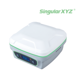


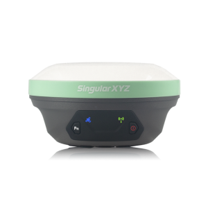
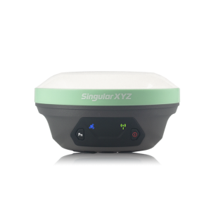
M1 Monitoring GNSS Receiver
Reliable For Your Monitoring Tasks
The M1 can reach a reliable and stable millimetre-level positioning for precise monitoring. Moreover, the altitude sensor with the MEMS data provides one more guarantee for monitoring results.

SingularXYZ Intelligent Technology Ltd.
Shanghai, CN
Description
Millimetre Accuracy
Embedded with a high precision GNSS module, the M1 can reach a reliable millimetre-level positioning accuracy for precise monitoring. Moreover, the altitude sensor with the MEMS data provides one more guarantee for monitoring results.
Compact Design
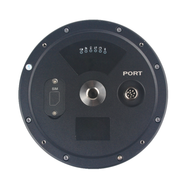
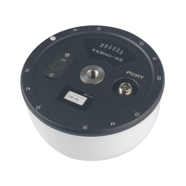
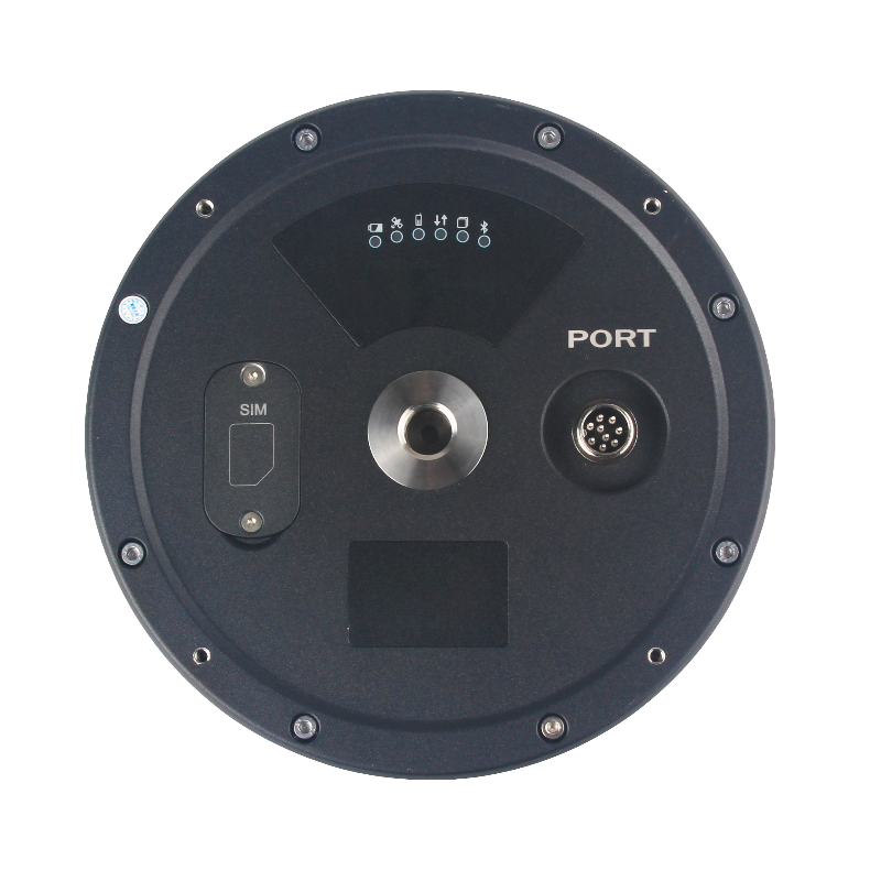
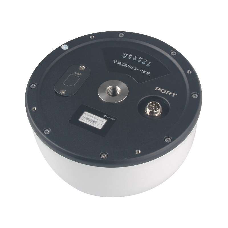
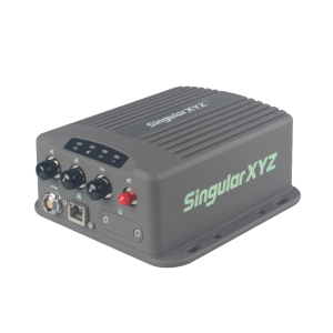
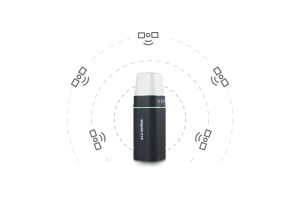
Integrated GNSS engine, GNSS antenna, altitude sensor, 8GB storage, Bluetooth and dual 4G modules in one device, the M1 is extremely compact designed.
Wide Applications
The M1 is a reliable choice for various monitoring solutions, such as deformation monitoring, dam monitoring, mining monitoring, bridge monitoring, slide monitoring, high building monitoring etc.
Environmental Adaptability
With a 9750mAh internal battery and built-in solar controller, the M1 has a stable power supply even in the field. Featured with IP67 waterproof and dustproof levels, the M1 can adapt to harsh working environments in the field.
Monitoring your Data
With 8GB internal memory, the M1 can backup the monitoring data or loop record monitoring data. The dual 4G modules design realizes a seamless transmission of monitoring data in different network environments.
Do you have questions about this product?
- Questions about price, availability, and/or retailers
- Questions about technical specifications and usage
- Questions about suitability for your project or application
Specifications
-
General
-
Type
Land
Year of initial introduction
2022
Height [m]
0.1295
Depth [m]
0.1967
Width [m]
0.1967
Total Weight [kg]
1.65
-
Performance
-
Tracked satellite signals
BDS: B1/B2 GPS: L1/L2 GLONASS: L1/L2 Galileo: E1/E5b QZSS: L1/L2
Type of measurements
RTK, PPK, static
Reacqisition time [s]
< 1
RTK Network Compatibility
RTCM 2.x, 3.x, CMR, CMR+
-
Environment
-
Operating temperature: min. [°C]
-45
Operating temperature: max. [°C]
75
Humidity resistance
100% no condensation
Water sand and dust proof
IP67
Shock and vibration proof
Survive from a 2m-drop
-
Communication: Protocols
-
RTCM standards for differential data
RTCM 2.x, 3.x
CMR standards for differential data
Y
NMEA output format
NMEA-0183 messages
-
Horizontal uncertainty
-
phase: RTK kinematic (constant part) [m]
± 10mm Horizontally, ± 15mm Vertically
phase: RTK kinematic (variable part) [ppm]
1
phase: static post processing (constant part) [m]
± 2.5mm Horizontally, ± 5mm Vertically
phase: static post processing (variable part) [ppm]
1
RTK network solution methods
VRS
-
Power
-
Operating power: min. [V]
9
Operating power: max. [V]
26
Typical consumption [W]
1.5
Internal power supply
9750mAh
External power supply
9~26V DC, support automatically start, built-in photoelectric isolation, reverse connection protection
Rechargeable with (auto)battery
Y
Connectors
Serial: RS232, RS485 (baud rate 4800~921600); USB (optional): USB2.0; Network: TCP, NTRIP, MQTT
-
Recording
-
Data capacity [MB]
8192
-
More information
-
Distinguishable features
TCP, NTRIP, MQTT
Documents
Brochure
aa6526e0180e3ad9.pdf


