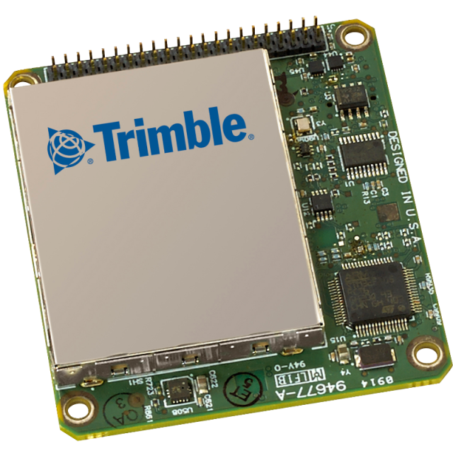
BD940-INS Receiver Module
Triple-frequency receiver with integrated inertial navigation system and MSS Band Demodulator
Taking advantage of Trimble’s expertize in both GNSS and Inertial technology the Trimble® BD940-INS module has been designed for applications requiring continuous centimeter accuracy in a compact package. By integrating inertial sensors on the same module, robust high accuracy positions are produced in all environments. The GNSS components are fully shielded. This design ensures the high-quality signals are protected from the sources of EMI on the host platform.
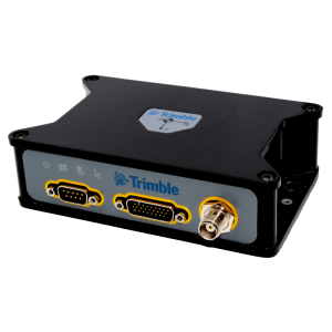
Trimble OEM GNSS
Westminster, US
Description
The Trimble BD940-INS supports both triple-frequency for the GPS and GLONASS constellations plus dual-frequency from BeiDou and Galileo. As the number of satellites in the constellations grows the BD940-INS is ready to take advantage of the additional signals. This
delivers the quickest and most reliable RTK initializations for 1–2 centimeter positioning. For applications that do not require centimeter accuracy the BD940-INS integrated GNSS Inertial engine delivers high accuracy GNSS, DGNSS positions in the most challenging environments, such as urban canyons. Different configurations of the module are available. These include everything from a DGPS L1 unit all the way to a four constellation, triple-frequency RTK unit. Choose the receiver that suits your application and price point. All features are password-upgradeable, allowing functionality to be upgraded as your requirements change. With the option of utilizing OmniSTAR or RTX services, the BD940-INS delivers varying levels of performance down to centimeter-level without the use of a base station.
Specifications
-
More information
-
Distinguishable features
Triple-frequency receiver with integrated inertial navigation system for precise position and orientation
-
Power
-
Operating power: min. [V]
5.5
Operating power: max. [V]
30
Typical consumption [W]
2
Connectors
44-pin header, MMCX receptacle
-
Performance
-
No. channels
336
Tracked satellite signals
GPS: L1 C/A, L2E, L2C, L5; BeiDou: B1, B2; GLONASS: L1 C/A, L2 C/A, L3 CDMA; Galileo: E1, E5A, E5B, E5AltBOC; IRNSS: L5; QZSS: L1 C/A, L1 SAIF,L1C, L2C, L5, LEX; SBAS: L1 C/A, L5; MSS L-Band
Reacqisition time [s]
<2
RTK Network Compatibility
Yes
Max. simultaneous tracked channels
336
SBAS differential signals
WAAS, EGNOS, MSAS, GAGAN, SDCM
-
General
-
Type
Aerial, Land, Marine
Height [m]
0.015
Depth [m]
0.067
Width [m]
0.06
Total Weight [kg]
0.06
Year of initial introduction
2017
-
Horizontal uncertainty
-
code: DGNSS/RTC (constant part) [m]
0.25
phase: RTK rapid static (constant part) [m]
0.008
phase: RTK rapid static (variable part) [ppm]
1
Initialization time on the fly [s]
<8
code: DGNSS/RTC (variable part) [ppm]
1
-
Communication: Protocols
-
RTCM standards for differential data
RTCM 2.1, 2.2, 2.3, 3.0, 3.1
CMR standards for differential data
CMR, CMR+
Other formats for differential data
sCMRx
NMEA output format
ASCII: NMEA-0183 GSV, AVR, RMC, HDT, VGK, VHD, ROT, GGK, GGA, GSA, ZDA, VTG, GST, PJT, PJK, BPQ, GLL, GRS, GBS
other output formats
Binary: Trimble GSOF, NMEA2000
L-Band Compatible
Yes
-
Communication: general
-
Communication ports
1 x USB, 1 x Ethernet, 2 x RS232
PPS Out
Y
Bluetooth
N
-
Environment
-
Operating temperature: min. [°C]
-40
Operating temperature: max. [°C]
75
Humidity resistance
5% to 95% non-condensing
ROHS compliance
Y
WEEE compliance
Y
Related products


