3D ImageVector - GNSS & IMU Camera Add-on
L1,L2 GNSS & IMU Camera Add-on with Centimetre Accuracy (RTK/PPK)
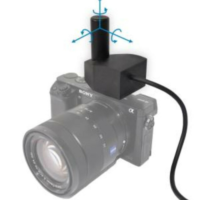
The technology contains a multichannel L1,L2 and L5 GNSS receiver and an IMU built into a tiny camera add-on, which can be plugged on the flash-shoe of your camera.
REDcatch GmbH
Fulpmes, AT
Description
The technology contains a multichannel L1,L2 and L5 GNSS receiver and an IMU built into a tiny camera add-on, which can be plugged on the flash-shoe of your camera.
Use the recorded information for close range photogrammetry applications, to perform ”direct georeferencing” for surveying tasks at centimetre level accuracy. Most noteworthy is the fact that for may applications, ground control points (GCPs) are no longer required, which saves you time and money on your projects.
The 3D ImageVector is used in the following sectors: surveying, infrastructure monitoring, natural hazards, geology, architecture, archaeology, etc.
Specifications
-
Power
-
Internal power supply
yes
External power supply
no
Operating time with internal power supply [hr]
8
Rechargeable with (auto)battery
Yes
-
Performance
-
Tracked satellite signals
GPS, GLONASS
SBAS differential signals
WAAS, EGNOS
-
General
-
Year of initial introduction
2019
Height [m]
0.06
Depth [m]
0.06
Width [m]
0.05
Total Weight [kg]
0.2
Type
Land
-
Recording
-
Memory medium
SD Card
Type of data (on board recording)
NMEA / txt
-
Environment
-
Operating temperature: max. [°C]
50
