UAVs Supercam for Forest Areas Protection
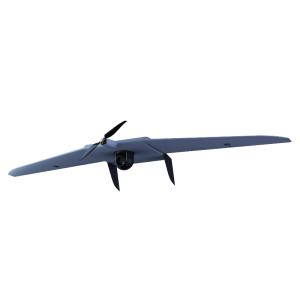
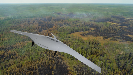
Vast forest areas of Russia require permanent measures for their protection, which cannot be carried out without aviation, including unmanned aircraft. In order to increase the situational awareness and improve control over forests, the complex with UAV Supercam S350 was delivered to the Sakhalin base of aviation and ground-based forest protection.
Unmanned Aerial Vehciles (UAVS for Forestry
Unmanned aerial vehicles are able to solve the following tasks for forest protection: patrolling local forest fund areas to detect forest fires; counteraction to illegal economic activities in forests; information support of ground firefighting teams.
Complexes with UAVs Supercam have the ability to plan the flight taking into account the peculiarities of the terrain and its correction, to bind of images to geographic coordinates, as well as to load the maps from map servers. If the communication with the ground control station is lost , the UAV automatically returns to the specified point. And with the appearance of new tasks for the complex, it is possible to increase its functionality.
UAV Camera for Forest Protection
A camera with a resolution of at least 24 Mp and a lens of at least 20 mm and a controlled video camera with a resolution of at least 720 × 576 pixels (PAL) with at least 28 optical resolution are installed on Supercam S350 as a payload. The payload of the UAV is set to provide an overview of the flying terrain with partial visibility of the horizon. Noticing the smoke over the forest, the operator switches the UAV in manual or semi-automatic flight mode, changes the flight route and directs the UAV to the smoke point.
The specified module designed by Unmanned Systems Group enables holding the target chosen by the operator and tracking the object automatically basing on the video image coming from the payload (for example, a gyrostabilized video camera). Digital stabilization of the image is also realized in this system.
Specialists of Sakhalin base were trained in the theoretical foundations of UAV control, its operation, use of specialized software for decryption of data. Then they passed the examinations and obtained certificates of training.
Future Projects: Fire Monitioring with Unmanned Aerial Vehicles
Unmanned aerial systems are considered as an element of a single information system, formed by aviation and ground-based equipment in real time. The use of drones by institutions carrying out fire monitoring is being extended. In July, complexes with UAVs Supercam were purchased by Avialesookhrana that carries out forest fire monitoring on the territory of the Moscow Region.


![3月21日-封面[1].jpg](https://cdn.geo-matching.com/voeE1ywo.jpg?w=320&s=6b3b1a0215d770f8797653e9202a8f52)


