Terra Lidar One Allows for Accurate Automated Centimetre-Level Mapping and Surveying
The Terra Lidar One with Applanix Direct Georeferencing is an easy-to-use, low-cost, and high-accuracy drone-based mapping solution that addresses the challenges of an ageing workforce coupled with the need to survey a deteriorating global infrastructure.
The Terra Lidar One drone solution produces automated centimetre-level accurate mapping and surveying products!
The Terra Lidar One with Applanix Direct Georeferencing is an easy-to-use, low-cost, and high-accuracy drone-based mapping solution that addresses the challenges of an ageing workforce coupled with the need to survey a deteriorating global infrastructure.
Solution:
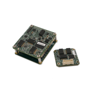
- Trimble APX-15 UAV with POSPac UAV Cloud Software is a single board GNSS-Inertial Direct Georeferencing solution for UAVs with POSPac UAV Cloud post-processing ‘as-a-service
- Terra Drone, Terra Lidar One, is one of the biggest drone service providers.
Overview
Terra Drone is one of the world’s largest providers of industrial drone solutions for aerial survey, infrastructure inspection, and drone data processing and analysis. Terra Drone provides drone solutions in many industries and has conducted more than 1,500 drone surveys. One client is Ugo Sokki Co., a company that uses information and communications technology in rivers and roads governed by Japan’s Ministry of Land, Infrastructure, Transport and Tourism.
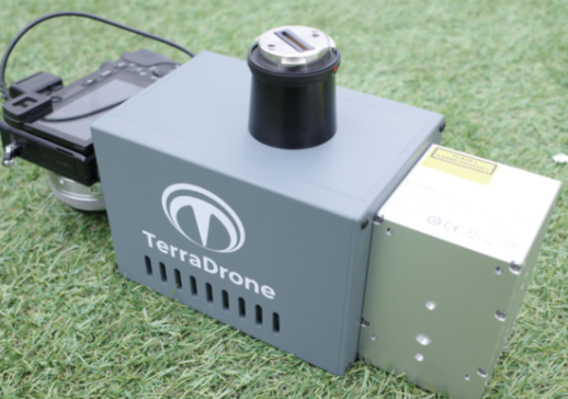
TerraDrone Terra LiDAR One
The Challenge
The use of drone technology for surveying and mapping has grown tremendously in recent years due to savings in cost and time and by offering a simpler, more convenient solution.
Due to an ageing workforce, Japan’s construction and mapping industries have faced a decline in the working population while facing a higher demand for services to address deteriorating infrastructure. Now more than ever, it is essential to have:
- Easy-to-operate, low-cost, and high-accuracy mapping solutions that require both fewer operators and person-hours to perform
- Solutions that remove personnel from dangerous duties, such as accessing hard-to-reach structures and areas
- Solutions with complete and automated workflows that deliver accurate data quickly and cost-effectively with minimal interaction
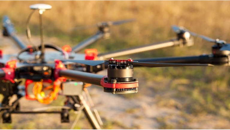
Lidar Sensor in the Terra Lidar One
Solution
A survey drone can quickly and easily produce high-resolution survey data (i.e. orthomosaic imagery, Lidar point clouds) and detailed 3D models of areas where low-quality, outdated, or no data are currently available. High-accuracy maps and models are produced quickly and easily, even in complex or difficult-to-access environments. Costs are significantly reduced versus traditional methods of collecting data from the ground or crewed aeroplanes.
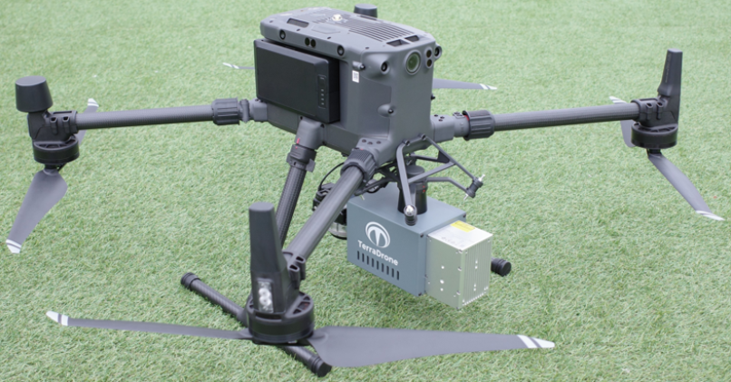
TerraDrone Terra LiDAR One
A drone developed a payload for an uncrewed aerial vehicle (UAV) with a laser scanner and camera to generate the final map products seamlessly new, highly accurate drone solution, the Terra Lidar One. The Terra Lidar One solution includes the payload, UAV, and Cloud-based processing software to seamlessly generate the final mto generate the final map products seamlesslyap products. To ensure accuracy and efficiency, Terra Drone knew it needed a DG solution with hardware small and light enough for a UAV, yet still highly accurate and reliable with automated processing.
With this in mind, Terra Drone turned to Applanix’s DG for UAV solutions. Using the Trimble APX-15 UAV with Applanix POSPac UAV Cloud, Terra Drone developed a lightweight Lidar and camera payload. It provides an accurate, georeferenced map of the surveyed area which means that every bit of sensor data is geographically located at the centimetre level.
The Trimble APX-15 UAV is a single-board GNSS-inertial solution designed to be flown by UAVs. It is small, lightweight, and low-power. The APX-15 UAV’s data is processed using the Applanix POSPac UAV Cloud post-processing software to automatically generate the final, highest accuracy trajectory (position and orientation) in the cloud. It also uses the POSPac Lidar QC Tools module to automatically boresight and adjust the trajectory using the Lidar data.
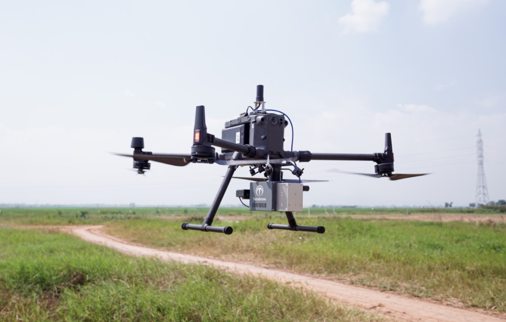
The result is the Terra Lidar One, a drone solution for high-accuracy mapping that can be flown in all environments, including dense vegetation and difficult-to-reach areas.
Terra Lidar One
Do you have questions about this case study?
Get in touch with Trimble Applanix, and they would be happy to answer any questions you have about pricing, suitability, availability, specs, etc.

Related products


![3月21日-封面[1].jpg](https://cdn.geo-matching.com/voeE1ywo.jpg?w=320&s=6b3b1a0215d770f8797653e9202a8f52)


