
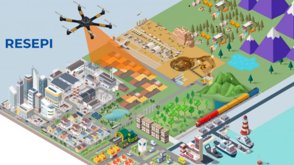
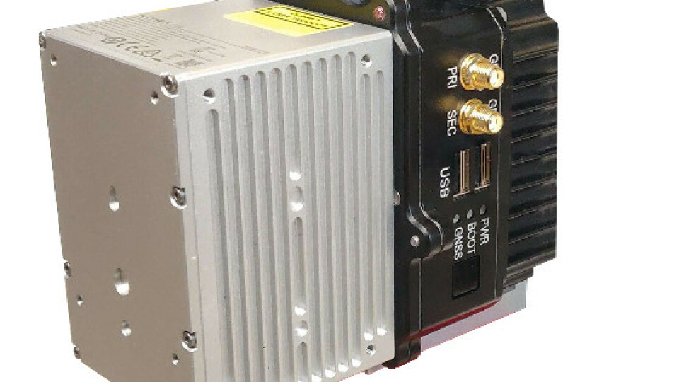
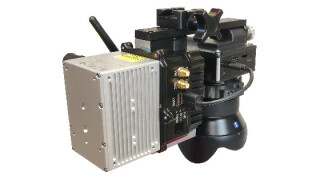
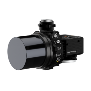
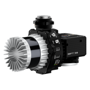
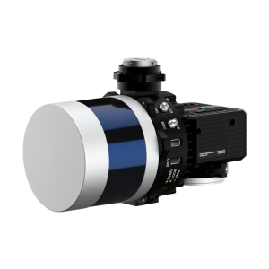
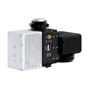
RESEPI Complete Lidar & RGB Payload Solution
Engineered for partners and resellers in the remote sensing industry, the Remote Sensing Payload Instrument, or RESEPI®, is a combined Dual Antenna GNSS-Aided Inertial Navigation System, datalogger, Lidar, camera and communications system that allows for the real-time and post-processed generation of point cloud solutions. The processing platform contains a Wi-Fi interface, embedded cellular modem to support RTCM corrections, data logging software and gigabit Ethernet. RESEPI® can be used with commercially available Lidars like Velodyne, Quanergy, Ouster, RIEGL, Livox, and Hesai. The device was built with the purpose of white-labelling.
Remote Sensing with Lidar
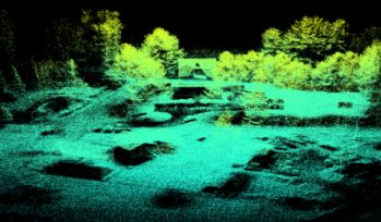
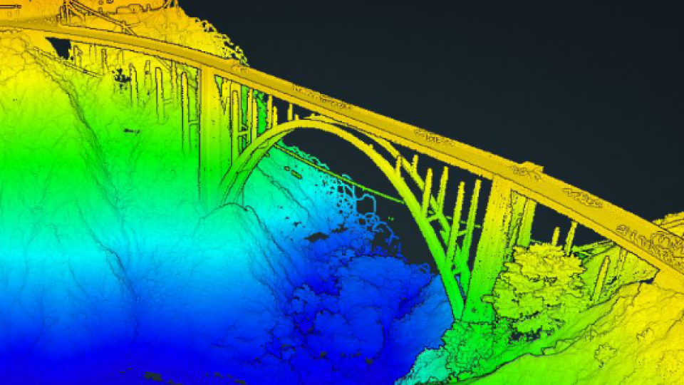
Sometimes called a 3D laser scanner, Lidar is a surveying method that measures the distance to a target by illuminating the target with pulsed laser light and measuring the reflected pulses with a sensor. It has terrestrial, airborne, and mobile applications. Some models of 3D Lidar can generate up to 700,000 data points per second, There are plenty of exceptional producers on the market, for example, Quanergy® and Velodyne®.
Scanning and Mapping
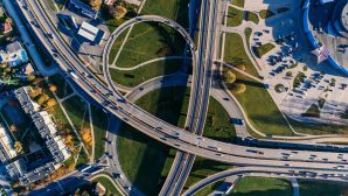
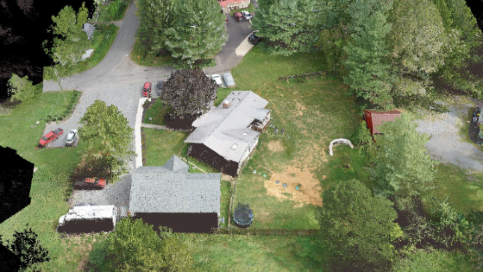
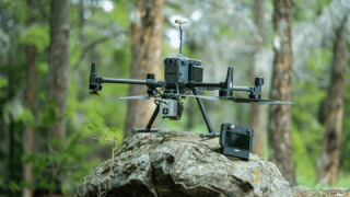
Perhaps area mapping is still the biggest domain for remote sensing. Making sense of the physical world by analyzing maps and 3D models allows businesses to make faster and more informed decisions that increase efficiency, profit and more importantly, improve safety. A few of the most often used bases it can be done on are a land vehicle or Unmanned Aerial Vehicles (UAV).
Precision Agriculture with Lidar
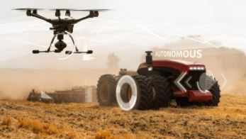
Lidar technology is instrumental in developing 3D models of farmland, which can be used to aid crop planning and can produce accurate maps of natural resources. In addition, it can be used in crop yield forecasting, field management, land segmentation, and determination of soil type.
Simultaneous Localization and Mapping (SLAM) Algorithm Development

RESEPI has the ability to generate a point cloud in real-time. This feature, along with aiding imagery from other optical sources such as RGB and thermal cameras, can lay the foundation for SLAM algorithm development.
Utility Inspection
Drones equipped with Lidar and Photogrammetry technology are a much cheaper and safer option when compared to other aerial scanning methods or manual inspection. With innovative Lidar and Photogrammetry algorithms, users can reconstruct utilities and identify potential hazards and damages.
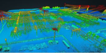
Construction Site Monitoring
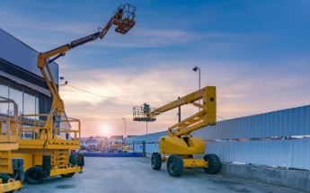
Drones equipped with RGB cameras and Lidar technology enable construction companies to regularly monitor project progress. In addition, Lidar point cloud colour schemes are a useful tool for the visualization of elevation, which makes 3D analysis of the ground and structures much easier.
Do you have questions about this case study?
Get in touch with Inertial Labs, Inc., and they would be happy to answer any questions you have about pricing, suitability, availability, specs, etc.


![3月21日-封面[1].jpg](https://cdn.geo-matching.com/voeE1ywo.jpg?w=320&s=6b3b1a0215d770f8797653e9202a8f52)


