Mining Exploration and Remote Sensing Imagery
Remote sensing imagery can be used in all phases of the mining life cycle, within prospecting, exploration, mineral extraction as well as mine closure and reclamation. Although ground based surveying continues to be used in mining operations, the increased availability of imagery from spaceborne satellites as well airborne platforms such as Unmanned Aerial Vehicles (UAVs) has resulted in a significant increase in the use of remote sensing imagery.
How remote sensing software is used for Mining Applications
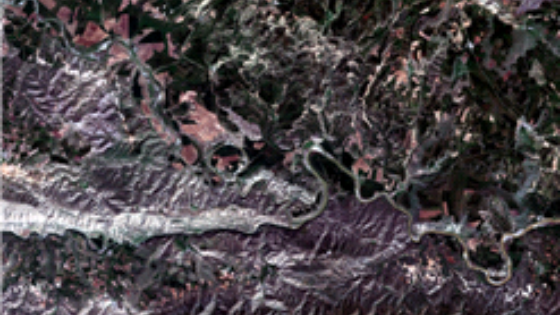
Many organizations make use of the Geomatica software suite to derive information to be used for mining applications. Prospection (the search for mineral resources and deposits) can make use of medium resolution imagery from sensors such as Landsat-8 or Sentinel-1/2 to perform geological and hydrogeological structure interpretation - derived geological maps can be used to assess the location of potential mineral deposits.

Exploration

Volumetrics

Interferometry

Monitoring and Visualization
In-Situ Validation
During the mineral extraction phase (the development and mining of resources), repeat pass SAR imagery can be used to detect subtle ground movements, which is critical to protecting infrastructure as well as people working within these mining operations. Furthermore, using multispectraland time series imagery, land use changes and environmental impacts can be examined and remediation measures can be implemented.
In the exploration phase (once a site has been identified as having potential reserves), higher resolution imagery can be used to assess the existing infrastructure in the location, identify the potential drilling locations, as well as assess the topography within the region to determine mining methods and what mining technology to apply.
Finally, in the mine closure / reclamation phase (restoring the land to minimize long term environmentalimpacts), once again long term monitoring of vegetation health, as well as land movement (subsidence, uplift) can be accomplished using remote sensing imagery and Geomatica.
Do you have questions about this case study?
Get in touch with PCI Geomatics, and they would be happy to answer any questions you have about pricing, suitability, availability, specs, etc.
Related products


![3月21日-封面[1].jpg](https://cdn.geo-matching.com/voeE1ywo.jpg?w=320&s=6b3b1a0215d770f8797653e9202a8f52)


