Dronezone srl. cut mapping time by 50% through combining an OxTS xNAV v3 INS and a 3D-LiDAR - read how they did it here
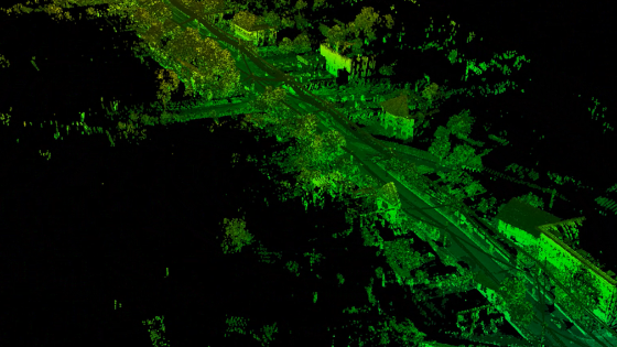
OxTS customer, Dronezone srl. were able to reduce mapping time by over 50% by integrating an OxTS xNAV v3 INS with a 3D-LiDAR.
Dronezone srl had a customer project to map 45km of road. Through simple and flexible INS and LiDAR integration they were able to cut down the time taken to survey the road by over 50%.
This reduction in 'time to survey' allowed Dronezone to focus on new customer projects and provided them with a vastly improved project ROI.
You can read the full case study here - OxTS Dronezone Case Study
Do you have questions about this case study?
Get in touch with Oxford Technical Solutions - OxTS, and they would be happy to answer any questions you have about pricing, suitability, availability, specs, etc.
Related articles


![3月21日-封面[1].jpg](https://cdn.geo-matching.com/voeE1ywo.jpg?w=320&s=6b3b1a0215d770f8797653e9202a8f52)


