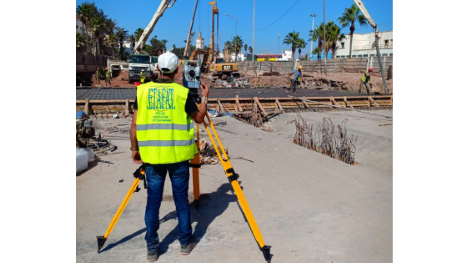
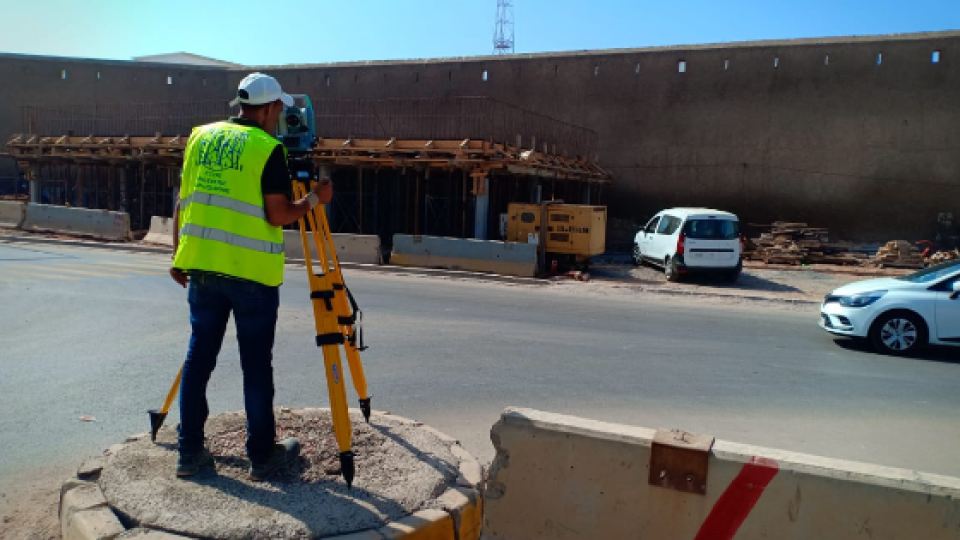
Casablanca's medina Builidings monitore during Tunnel construction
Casablanca, Morrocco; February 2020, Vibrations during the construction of a new 1,890-meter tunnel adjacent to Casablanca’s Old Medina, the 250-year-old section of the famed Moroccan city, challenged the stability of its historically important buildings.
Casablanca, Morrocco; February 2020, Vibrations during the construction of a new 1,890-meter tunnel adjacent to Casablanca’s Old Medina, the 250-year-old section of the famed Moroccan city, challenged the stability of its historically important buildings.
To monitor in real time the effects on the Medina’s aging buildings and to confrm that the construction work meets all engineering standards and guidelines, ETAFAT, a geospatial information acquisition and processing company, used the Nikon XF Total Station to perform more than 100 daily inspections. The ETAFAT team relied on optical targets placed on building facades whose coordinates were determined by forced centering to complete the inspections. According to ETAFAT engineers, the Nikon XF 1" with its fast autofocus function, saved considerable feld time. The Nikon XF enabled very fast collection of highly accurate observations throughout the monitoring and control of the planimetric and altimetric locations of the structure. The monitoring of the buildings during the various phases of the tunnel’s construction generated a large amount of data essential for understanding the consequences of the work and defning any necessary corrective measures.
In addition to the important task of monitoring the integrity of the buildings, the Nikon FX 1”, with its advanced options and Survey Pro software, enabled survey teams to quickly yet accurately perform a variety of other essential feld tasks. These tasks include digital terrain modeling (DTM), cubature calculations, COGO topometric calculations, and layout control with customized report generation. The use of Survey Pro software also had the added advantage of permitting ETAFAT engineers to fully integrate their total station work with their feet of Spectra Geospatial SP60 GNSS receivers. The new Les Almohades tunnel, beneath the Boulevard des Almohades, runs parallel and adjacent to the old Medina. Together with its 380 meters of access roads, the twin-tube tunnel, which carries trafc in two unidirectional lanes in each tube, was constructed to reduce trafc congestion.
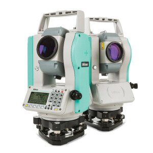
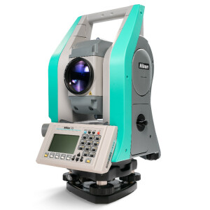
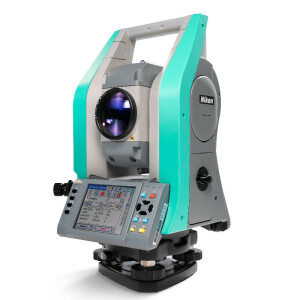
About the Nikon XF 1” Total Station
The Nikon XF 1” is a mechanical total station that stands up to the toughest worksite conditions. It is ideal for quickly capturing accurate measurements, and it offers crisp, clear optics for sighting in both bright and low-light conditions. Its dual-color touchscreen displays run Survey Pro, Survey Basic and Layout Pro. It is also equipped to take advantage of the optional Trimble Protected L2P device for asset security to locate lost, stolen or missing equipment.
About ETAFAT
Headquartered in Casablanca, Morocco, ETAFAT is a continent-wide leader in the acquisition and processing of geo-spatial information, specializing in innovative technologies in geomatics. More information www.etafat.ma
About Nikon-Trimble
Designed to meet the needs of surveyors around the world, Nikon delivers maximum precision, reliability and affordability. Located in Japan, Nikon-Trimble Co., Ltd. is a joint venture between Nikon Corporation and Trimble to address the global surveying and construction markets. In Japan, the company focuses on the design and manufacture of surveying instruments, including mechanical total stations and related products. Outside Japan, Trimble and its subsidiaries are the exclusive distributors of Nikon survey and construction products. Spectra Geospatial surveying equipment is an economical choice that utilizes technologies for optimal efciency. With convenience and reliability as the foundation of the Spectra Geospatial brand, it is an ideal choice for value. The Spectra Geospatial brand is backed with the strong technical support that users have come to expect from a quality name in surveying and construction
Do you have questions about this case study?
Get in touch with Spectra Geospatial, and they would be happy to answer any questions you have about pricing, suitability, availability, specs, etc.


![3月21日-封面[1].jpg](https://cdn.geo-matching.com/voeE1ywo.jpg?w=320&s=6b3b1a0215d770f8797653e9202a8f52)


