
Bathymetric and FLS Sonar Shipwreck Survey in Budapest
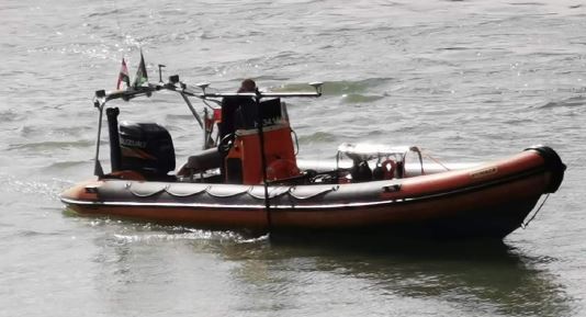
In November 2019, a NORBIT team completed a bathymetric and FLS sonar survey around the barge wreck. Using a USV mounted Multibeam Echosounder and Imaging Sonar, the survey was executed.
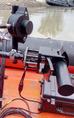
• System used: NORBIT iWBMS and WBMS FLS
• Systems were mounted parallel on one pole
• Platform: RHIB vessel
• RTK used during the survey via cell phone
Ferenc József bridge was blown up by retreating German troops in 1945. The central section of the bridge which had been blown up was rebuild in and reopened in August 1946, with the new name Liberty bridge. Barges were used to bring in logs for the construction. A barge sank during the construction period and was left on the riverbed.
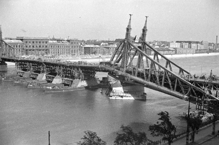
Liberty (former Ferenc József) Bridge during reconstruction Image credit: welovebudapest.hu
The dismantling of the sunken barge was planned as early as 1948, however, the authorities never considered the issue to be important, especially since no one had ever been able to prove that the cargo of the barge sitting outside the main river fairway, was dangerous, hence the wreck was left alone.
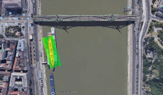
Liberty (former Ferenc József) Bridge with the sunken barge
In 2004 a diver claims that a barge is underwater at Belgrade Quay, with up to seven hundred tons of ammunition aboard.
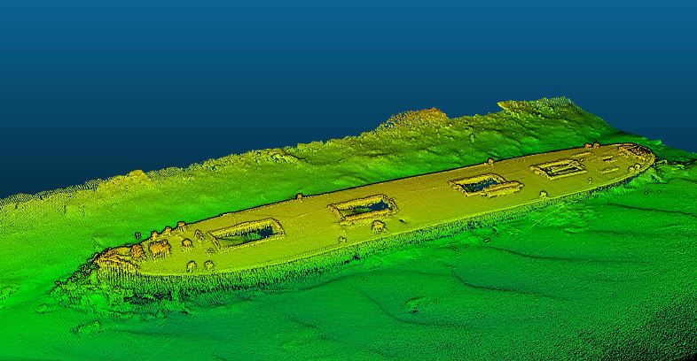
iWBMS multibeam bathymetry sonar data, 400kHz
The Hungarian Defense Forces, with fifty people, including twenty divers, and two de-mining boats, took part in an action organized by the Defense Forces, to investigate the barge. Divers found mud in the middle of the barge and thought it might contain bombs or ammunition. The underwater investigation also included photos and video footage of the Army divers, who also exposed a large wooden pole from the ship. From what the divers saw, it was easy to imagine that the first diver might have looked at logs and debris, which could have resembled ammunition in the muddy water.
Logs inside the hull are visible on the bathymetric image
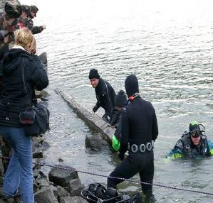
Cargo material and divers during recovery Image credit: index.hu
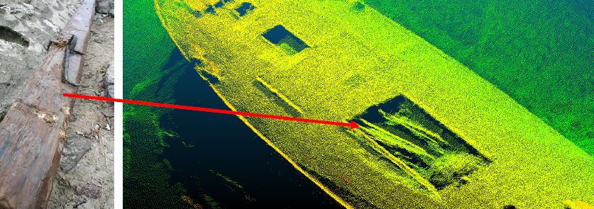
Logs visible in bathy data
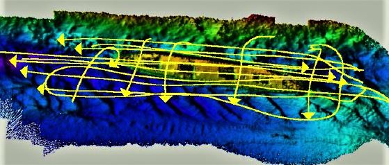
The survey was conducted along parallel and perpendicular lines
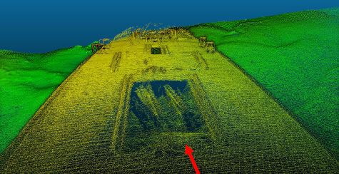
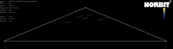
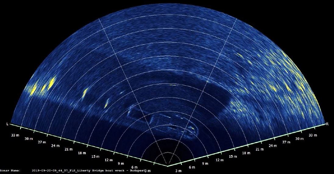
GUI – bottom detections on cargo door openings
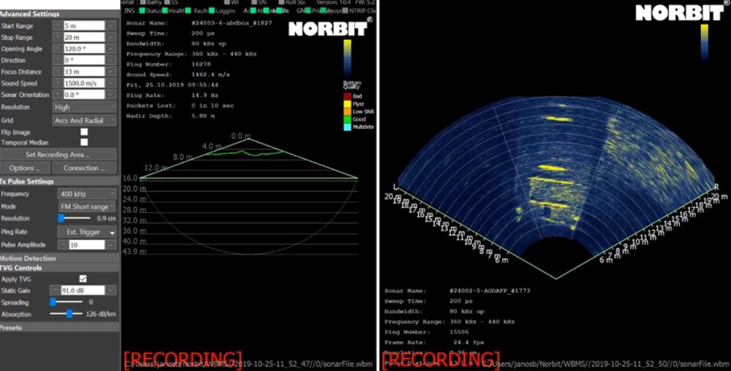
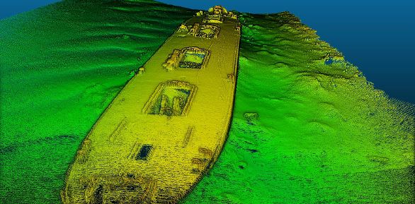
NORBIT GUI in parallel usage of Bathy and FLS sonar
Do you have questions about this case study?
Get in touch with NORBIT Subsea, and they would be happy to answer any questions you have about pricing, suitability, availability, specs, etc.


![3月21日-封面[1].jpg](https://cdn.geo-matching.com/voeE1ywo.jpg?w=320&s=6b3b1a0215d770f8797653e9202a8f52)


