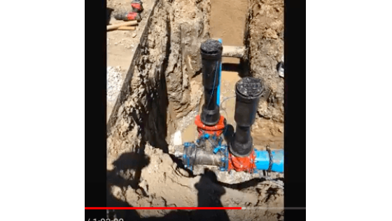
As-Builting
Indiana AmWater Streamlines Operations, Improves Data Accuracy with Eos Arrow and Collector for ArcGIS.
Indiana American Water (Indiana AmWater) streamlines their operations workflows and improves data accuracy with Eos Arrow and mobile GIS. They have now realized faster workflows, more accurate data, and happier staff across their organization.
In this webinar Indiana American Water will share their GIS story. How GIS went from a technology that many staff didn’t understand and didn’t want to use to a resource that they are asking for.
Join us to hear how Randy Winston, Senior GIS Technician, is using Collector for ArcGIS and the Arrow 200 to help staff across the state of Indiana understand how useful GIS can be.
Find out how the perception of GIS has been greatly improved and lead to:
• Faster workflows
• More accurate data
• Happier staff
You can also read the full success story with more information about Indiana AmWater’s project here.
Do you have questions about this case study?
Get in touch with Eos Positioning Systems, and they would be happy to answer any questions you have about pricing, suitability, availability, specs, etc.
Related products


![3月21日-封面[1].jpg](https://cdn.geo-matching.com/voeE1ywo.jpg?w=320&s=6b3b1a0215d770f8797653e9202a8f52)


