![Press_Release_June2024_Visual_Media_Partners (2).jpg](https://cdn.geo-matching.com/Vo1zlxwR.jpg?w=480&s=e3aafd5557d7264fcb6a1b2e441b6393)
![simactive-header-companyprofile.jpg](https://cdn.geo-matching.com/9p66rWpb.jpg)
Showing 1-9 of 9 results
![Press_Release_June2024_Visual_Media_Partners (2).jpg](https://cdn.geo-matching.com/Vo1zlxwR.jpg?w=480&s=e3aafd5557d7264fcb6a1b2e441b6393)
![Press_Release_May2024_Visual_Media_Partners.jpg](https://cdn.geo-matching.com/wRWmJK3p.jpg?w=480&s=93e040f0a09b015da34160e955c41d89)
SimActive Software Used for Mapping the Himalayas
![Press_Release_April2024_Visual_Media_Partners.jpg](https://cdn.geo-matching.com/vRMOD9Np.jpg?w=480&s=11ea3352dc61f6eff25583783c4e79dc)
SimActive Integrated with Multi-Camera Systems for Precision Photogrammetry
![Press_Release_January2024_Visual_Media_Partners.jpg](https://cdn.geo-matching.com/voeEmMlo.jpg?w=480&s=c7fcf830702bc6ebe4469cc697cb9ff5)
SimActive Announces Enhanced Cloud Capabilities
![applying-color-to-lidar-data-using-simactive-software-point-cloud-1.png](https://cdn.geo-matching.com/vRMv5knY.png?w=480&s=345ebd48afc61c5815f5e06ab7a808a6)
Applying color to Lidar data Using SimActive photogrammetry software
![tsmc-header-xl.jpg](https://cdn.geo-matching.com/Vo1kvwn1.jpg?w=480&s=95d8850cbdc4091aa60bff507c85fdc8)
Pandemic Makes Remote Construction Site Monitoring the New Normal
![pc-sample-3.jpg](https://cdn.geo-matching.com/1o4ykVRG.jpg?w=480&s=c282bead01745a68bc99ebccecc270eb)
Dual collection with lidar and imagery: extending the value of your deliverables in one flight
![simactive-for-mining-drones-volume-calculation.jpg](https://cdn.geo-matching.com/7o2jAgo5.jpg?w=480&s=24643457bdb07109d37c4180567ff8c5)
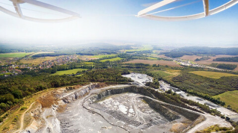
SimActive for Mining: Drones & Volume Calculation
![simactive-lidar-software-for-precision-agriculture-in-brazil.jpg](https://cdn.geo-matching.com/kplLM3pr.jpg?w=480&s=0812124a195646ade6ef1ccf2ec19781)