About Klau Geomatics
Klau Geomatics is an innovative technology company in the geospatial sector, with its origin in geodetic mapping, exploration surveying and R&D. We specialise in the manufacture of direct geo-referencing systems and integrated LiDAR solutions, used for aerial mapping and mobile mapping. We have created unique solutions in GNSS and IMU processing, and geospatial data delivery. Our company serves the needs of customers around the globe, by delivering a range of advanced and accurate products that can efficiently streamline client processes and enterprise operations. Our team of technical and software engineers, work to develop ground-breaking systems that can sustain in commercial industry.
Explore our range of products and services:
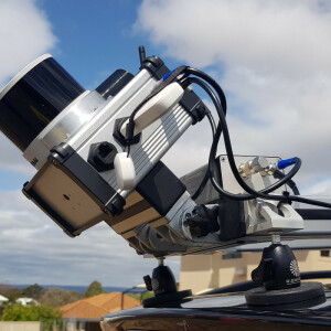
Brumby LiDAR -
For aerial mapping, geophysics and mobile mapping, an integrated system of LiDAR scanners integrated with the KlauPPK/PPP system is a synergy of hardware, software and methodology to enable easy accurate data capture and streamlined output production.
4D Mapper -
Break down the geospatial data delivery bottleneck, and leverage the value of your data by streaming it to your clients. 4D Mapper is the only platform of it's kind, that automatically ingests virtually any data type; imagery, digital terrain, GIS data, WMS, pointclouds, inspection data... and enables immediate viewing, measurement and collaboration via just a URL. No software. Just drag and drop your data and you're underway.
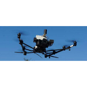
MakeItAccurate -
MakeItAccurate takes data from your drone or survey equipment and makes it accurate. No longer worry about base stations, RTK links, CORS data or any other external inputs - just the data from your drone or survey equipment. Now, enterprise drone operations can apply one simple workflow across their entire global operations to achieve consistent high accuracy, no matter where they are. One simple solution, with unprecedented accuracy – anywhere, any time.
Featured products
Main office
-
Level 7, 34 Charles St
Parramatta 2539
Australia -
+61 401 588 005
- https://geomatics.com.au/