![hqdefault (826).jpg](https://cdn.geo-matching.com/9p65Nqnb.jpg?w=300&s=a85447e7c85ccb0d938fc8716e07f4c1)
![eiva-horizon.jpg](https://cdn.geo-matching.com/dpq5mXpq.jpg)
![eiva-logo-cmyk-no-tagline.jpg](https://cdn.geo-matching.com/yRQVBOnJ.jpg)
Showing 1-9 of 16 results
![hqdefault (826).jpg](https://cdn.geo-matching.com/9p65Nqnb.jpg?w=300&s=a85447e7c85ccb0d938fc8716e07f4c1)
![hqdefault (827).jpg](https://cdn.geo-matching.com/1pAP6lnP.jpg?w=300&s=efe8a9b869869abe6338fc8bec905144)
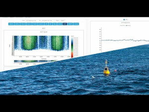
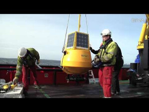
Remote monitoring of data collection buoy: Dive into EIVA's web portal ToughBoy Onshore
![hqdefault (1137).jpg](https://cdn.geo-matching.com/jpGrkEnm.jpg?w=300&s=4d9a820875eec3d2fa484030b7a14110)
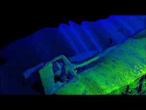
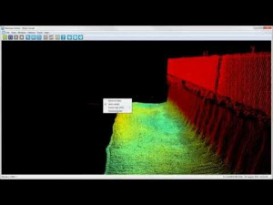
3D modelling of sunken U-boat - NaviSuite
![hqdefault (1138).jpg](https://cdn.geo-matching.com/ZpzkWaoK.jpg?w=300&s=16d318bc5b79826dafa9cfc75aa9f065)
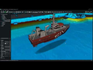
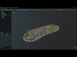
EIVA NAVISUITE – Link 3D models to live objects
![hqdefault (1672).jpg](https://cdn.geo-matching.com/vRM523RY.jpg?w=300&s=d35a9c9661e35fa9e75b4f816c409a1a)
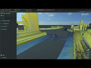
NaviSuite Cloud Viewer – Visualisation tools in a web browser
![hqdefault (1673).jpg](https://cdn.geo-matching.com/En56gdp5.jpg?w=300&s=b2bab5e4bfed1cec886471b107bbed6d)
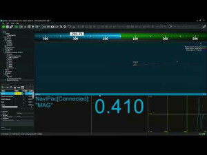
EIVA NaviSuite - Multibeam and hydrographic surveys - User-defined data view in NaviPac
![hqdefault (1674).jpg](https://cdn.geo-matching.com/XRwzL4o5.jpg?w=300&s=9b466272d2a6c3e1d02a9cac181e94be)
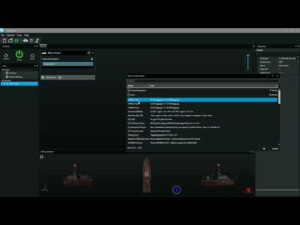
EIVA NaviSuite - Multibeam and hydrographic surveys - Easy configuration in NaviPac
![hqdefault (1675).jpg](https://cdn.geo-matching.com/kpl3lAnr.jpg?w=300&s=e23f8063872a12045a842123f682b67a)
Live laser acquisition and DTM - NaviSuite Kuda
![hqdefault (705).jpg](https://cdn.geo-matching.com/jpGr0Gnm.jpg?w=300&s=bafc681a0ee24270725ef7e7e1a64ba1)