
Description
Specifications
-
Other
-
Training provided
Y
Main users
Data Managers, Data Analysts, Survey Managers, Surveyors
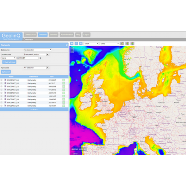
Main applications
Spatial Data Hub, Spatial Data Portal, Backbone for spatial data analyses, Creating Single Point of Truth, Create dynamic OGC compliant web services based on available data
Distinguishable features
Unique configurable data modelling including runtime changes, interchangable data sources, many data sources availabe, All functionality web based availble, High performance, no storage limitaties, Point, Raster and Vector data, Link, harvest,query and share data, Enterprise authorization,
-
General
-
Year of introduction
2015
Year of last update
2018
Open source
N
License configuration
User based licensing or SAAS solution based on storage, CPU and RAM configuration
-
Required Computer System
-
Operating system(s)
Unix, Linux, Microsoft Windows, FreeBSD etc
Min. CPU
2 CPU's
Preferred CPU
Scalable
Min. RAM memory [Gb]
4
64-bit version available
Y
Distributed processing capacity
Y
GPU based calculations
N
Data storage capacity [Terabyte]
1000
-
Geo-data Types and Formats
-
2D vector data
Y
3D vector data
Y
Pixels
Y
Raster
Y
Voxels
N
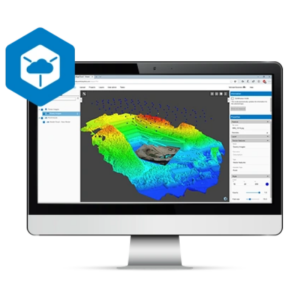
Point clouds
Y
Input formats
Geotiff, ASCII, Shape, LAS, GML, other on request
Output formats
Geotiff, ASCII, Shape, LAS, other on request
-
Distribution
-
Vertical Scalability
Y
Horizontal Scalability
Y
Replication
Y
Sharding
Y
-
Database
-
SQL
Y
NoSQL
N
Spatial Database
Y
Column-family database
N
Graph database
N
XML document database
N
-
Retrieval of Geo-resources over the Web
-
OGC Compliant
Y
WMS
Y
WFS
Y
Proprietary solutions
N
Platform-dependent solutions
N
-
Data Handling
-
Support of Topographical Relationships
N
Support of Attribute Relationships
Y
Support of Metadata
Y
XML
Y
GML
Y
Query Language(s)
SQL
User programmable operations and extensions
Java API, REST

