USV Bathymetric Survey of a Quarry Lake for Adventure Activity Company
Adrenalin Quarry, a leading adventure activity company, operating in the heart of Cornwall, UK required a bathymetric survey to make a preliminary depth and hazard assessment for their next planned white knuckle attraction. Providing an accurate bathymetric chart with contour lines depicting minimum depth requirement has helped the customer to complete their due diligence, risk and safety assessments for the new feature. The Inception MK I helped deliver a complete,efficient and cost effective survey solution.
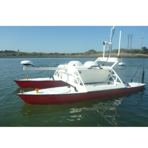
The Unmanned Survey Solutions (USS) Inception MK I class Unmanned Surface Vessel (USV) has been developed to address a gap in the shallow water sector. This hydrographic survey vessel is composed of tough aluminium hulls, weed cutting propellers and provides bathymetric surveys in areas where access for a traditional survey vessel is not possible such as quarry lakes, lagoons, mining ponds and other shallow water zones.
Bathymetric Survey with the USS Inception Inspection MK I Class USV
The customer wished to investigate the feasibility of a new adrenaline fuelled attraction and needed to know overall depth and any potential submerged hazards in the vicinity of the proposed site. With the quarry lake having no slipway or launch facilities, access for traditional survey vessels was impossible. The area of the site was ~2,900m2 and the customerrequired a sufficiently accurate bathymetric chart with contours depicting areas shallower than 7 metres for assessment and appraisal.

The Solution
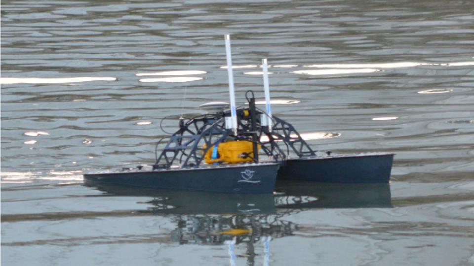
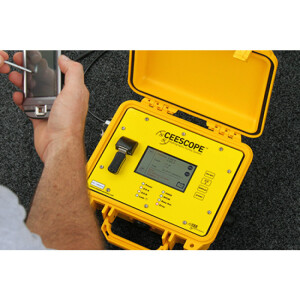
The USS Inception class USV can be easily transported by car or van and its quick mobilisation and deployment procedure means that online survey activities can commence within the first hour of arrival at site. Once deployed, it is remotely piloted from shore with the aid of an additional HYPACK navigation display. The solution for this application consisted of a CEE HydroSystems CEESCOPE-USV system, a combined SBES, GNSS, Telemetry system and HYPACK survey software package.
Bathymetric Survey Overview
Access to the site was restricted so manned boats could not be launched or recovered. The Inception solution therefore enabled an effective unmanned vessel survey operation. At a survey speed of ~2.5 knots, sufficient coverage of the designated site was quickly attained. Contours and TIN models were created near real time, allowing for initial charts and onsite QC. The Inception proved to be a great solution for the customer’s requirements

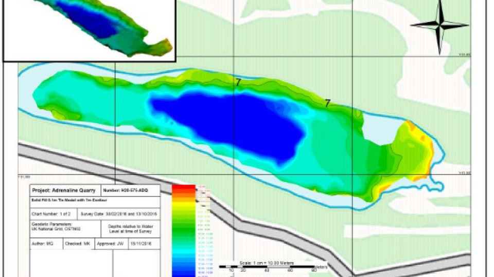
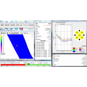
Figure 1. Sample bathymetric charts and 3D imagery produced from the data collected with the Inception USV survey solution.
Do you have questions about this case study?
Get in touch with Unmanned Survey Solutions, and they would be happy to answer any questions you have about pricing, suitability, availability, specs, etc.


![3月21日-封面[1].jpg](https://cdn.geo-matching.com/voeE1ywo.jpg?w=320&s=6b3b1a0215d770f8797653e9202a8f52)


