Handheld Laser Scanner Enables Quick and Accurate Estimation and Modeling of Waste Quantities
The government of Egypt (GoE) are leading several initiatives to reuse and recycle the ever-increasing quantities of construction and demolition waste (CDW) around the country. These initiatives include a national strategy and action plan to effectively manage around 40 million tons of CDW generated annually. They target to recycle 50% of CDW materials by 2030.
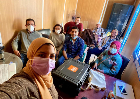
One of the major challenges facing Municipalities in Egypt is calculating the amount of CDW accumulated, due to illegal dumping of waste being commonplace in cities. Commissioned by the Ministry of Environment and the GIZ institution, HBRC (Housing and Building National Research Centre) have been tasked with finding effective methods for quantifying and characterising the amount of CDW in four Egyptian Governorates (Gharbia, Kafr-El-Sheikh, Assuit and Qena).
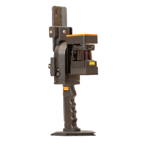
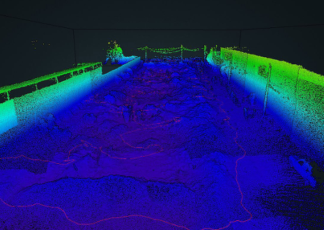
This project paves the way to developing an optimal construction and demolition waste management strategy in Egypt. The research team used GeoSLAMs ZEB Revo RT SLAM laser scanner to map the construction waste piles. The scan data is a sound method for quantifying waste volumes over a period of time, due to the ease of capture and accurate data.
The traditional surveying of CDW accumulations was not practical as CDW locations are difficult to walk through and experience rapid changes to the waste quantities. - Amr Hesham, Construction and Project Management Engineer
Scanning with the ZEB Revo RT
The ZEB Revo RT is ideal for rapid data capture in real-time, making it the perfect tool for this job. By walking through the construction and demolition waste sites, the team are mapping as they go, shortening the amount of time spent in a hazardous environment, reducing health and safety risks. The simplicity of the solution means that anybody can capture the data, with minimal training, making the scans repeatable as often as needed. Covering an area of 84,823 m2, the research team conducted 12 scans, dividing the route into zones and each scan lasted an average of 17 minutes. Once the scanning was complete, they opened the data in GeoSLAM Hub where the point cloud can be viewed and prepared for GeoSLAM Volumes.
Using GeoSLAM Volumes, the researchers could accurately calculate the quantity of construction and demolition waste. The findings were reported back in a presentation during the third International Conference on Smart Cities. This way of calculating volumes is fast, efficient, cost-effective, safer than other methods and repeatable, making the SLAM scanner the right tool for the job. The research effort opens the door to the utilisation of 3D modelling of construction waste management sites.
The application of laser technology would enable the quick and accurate estimation and modeling of waste quantities. - Amr Hesham, Construction and Project Management Engineer

Related products


![3月21日-封面[1].jpg](https://cdn.geo-matching.com/voeE1ywo.jpg?w=320&s=6b3b1a0215d770f8797653e9202a8f52)


