

Dolomite Extraction Planning with Photogrammetric Software
Dolomite, also known as “dolostone” and “dolomite rock,” is a sedimentary rock composed primarily of the mineral dolomite. Dolomite is found in sedimentary basins worldwide.
One of the biggest dolomite and granite crushed stone producers in Lithuania „Klovainių Skalda“, turned to Pixpro team looking for innovative solutions and more advanced methods of activity planning and timely information.
The dolomite mining process consists of these accurately planned stages:
- vegetation layer removal;
- soil layer removal;
- dolomite layer blasting and crushing;
- transportation.

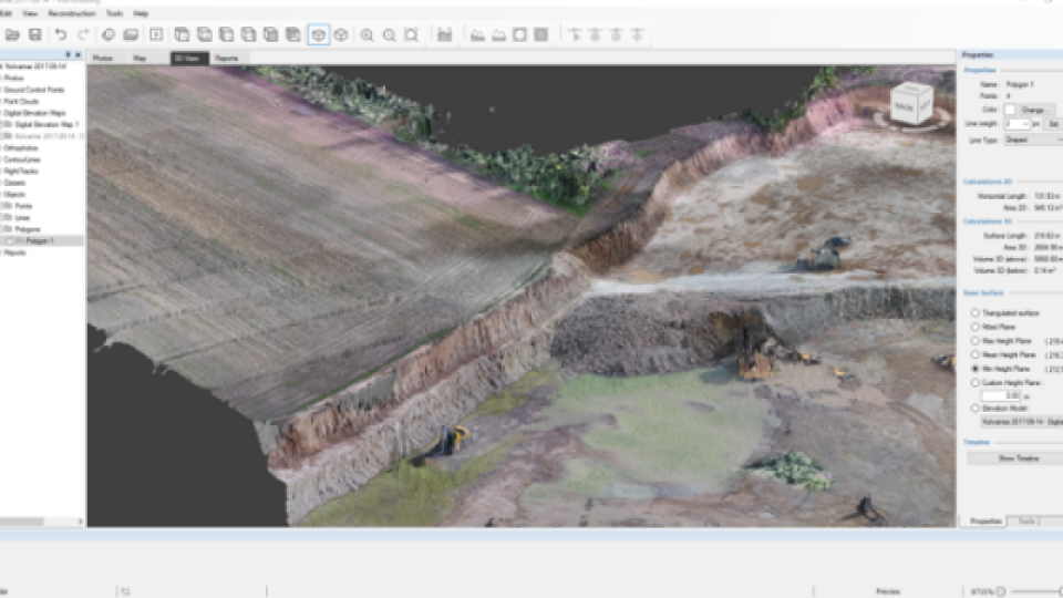
To reconstruct the 3D model of the quarry with photogrammetric software, we used 110 photos collected with the DJI Inspire 2 drone. Capturing was done with 90 degree camera angle, altitute of 50 meters, single grid overlap 80/80.
The desired outcome simulation
First we need to simulate the desired situation. To excavate the dolomite we need to estimate the 3 layers: vegetation, soil and dolomite. When the photo gathering took place, vegetation layer was already removed, so it will not be considered in the use case. For the rest of the stages the desired outcome will be simulated by cutting off the marked area using „flattening by minimizing“ feature.

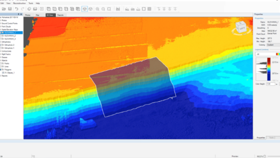
The „object comparison in the time lapse“ feature is the most convenient way to evaluate the volume. Therefore we need to create 3 identical DEM‘s and simulate the desired outcome.

To fix the reference for measurement comparison it is very convenient to use the polygon and mark the desired area for excavation.

On the second DEM the amount of soil that needs to be dug is marked by according the location of the primer and then cut out by using the flattening by minimizing feature.
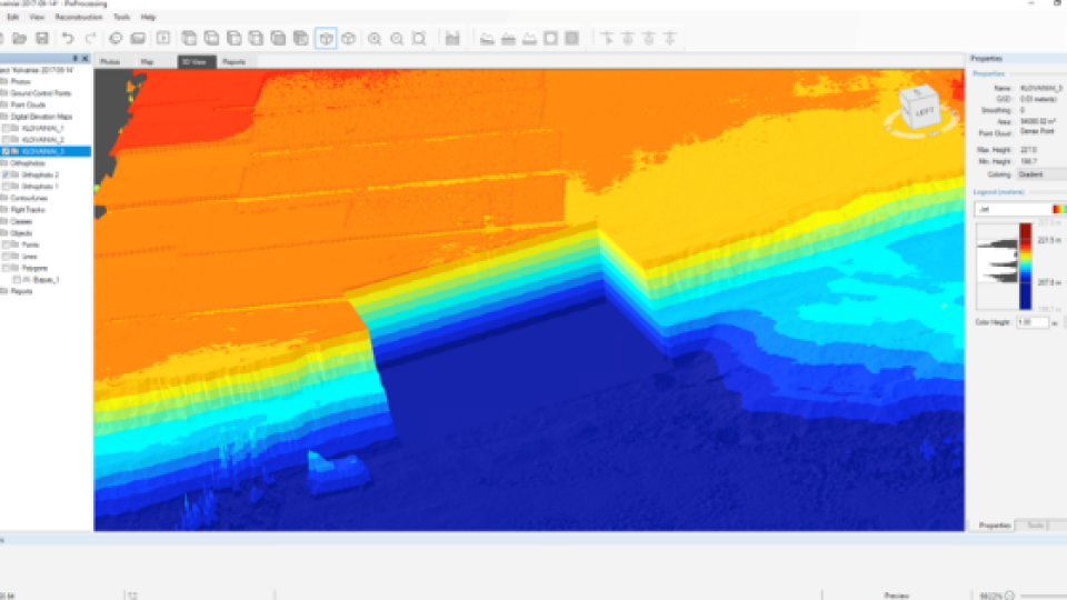
The 3rd DEM needs to reflect the excavation of a dolomite layer. Using the same procedure and the flattening by minimizing feature the final outcome is simulated.

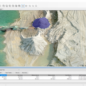
The Volume Calculation
In order to calculate the excavated volume, it is necessary to compare all the 3 DEMs. The initially marked polygon feature will be used as the referencing point to get the most accurate data.

The difference between the 1st and the 2nd DEM shows the volume of the ground to be cut. This is a very useful data for calculating, the need for equipment for material reallocation, workload planning or even for money flow planning.
The outcome of the object comparison shows that there is 2644 m3 on the ground and above – 3315 m3

However, it must be noted that the thickness of the dolomite raw layer differs from the dolomite rubble volume after explosion. To estimate the material to be excavated after explosion it is necessary to consider the new density of the material.
Conclusion
Using photogrammetry software that reconstructs 3D objects from aerial images, one can get not only an overview of the actual situation, but also to perform various simulations, plan work, increase safety, and anticipate the use of vehicles.
Using this new approach saves time and simplifies the process:
– flying a drone takes up to 20 minutes
– process the data takes up to 4 hours
– to get the analytical data takes several minutes.
Flying a drone does not face any limits. It can fly large as well as small objects, as well as prevent the workers from risky situations.
Data processing is simple, accurate and can be run as often as required.
Do you have questions about this case study?
Get in touch with Pixpro Ltd, and they would be happy to answer any questions you have about pricing, suitability, availability, specs, etc.

Related products


![3月21日-封面[1].jpg](https://cdn.geo-matching.com/voeE1ywo.jpg?w=320&s=6b3b1a0215d770f8797653e9202a8f52)


