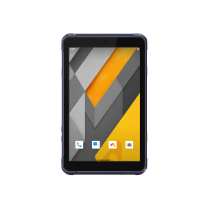
CHCNAV Unveils LT800: a Rugged Android Tablet for Professional Field Data Collection
CHC Navigation (CHCNAV), a global leader in geospatial solutions, today launched the LT800, a professional 8.1-inch Android tablet designed for mobile fieldwork. With its rugged design, reliable GNSS positioning, and extensive connectivity, the LT800 is a versatile field data collector for the most demanding utility, agriculture, environmental, and asset management applications.
"When it comes to enterprise-grade rugged tablets for data collection and mapping, the LT800 sets a new standard," said Ms. Sans Ma, Product Manager at CHCNAV. "With its rugged IP67-rated design, integrated GNSS technology, and seamless 4G connectivity, the LT800 tablet enables field workers to maximize productivity and data quality regardless of outdoor conditions."

CERTIFIED ENTERPRISE-READY
With both Google Mobile Service (GMS) and Android Enterprise Recommended (AER) certifications, the LT800 ensures compatibility and seamless performance with today's most popular data collection applications. The LT800's certifications provide the highest levels of security and ease of use, making it ideal for easy integration into any existing IT ecosystem.
ALL-DAY PRODUCTIVITY
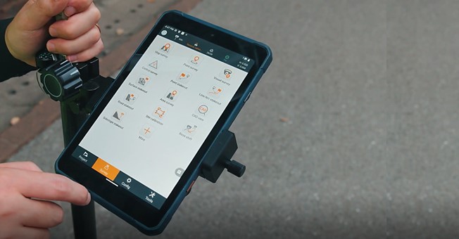
9000 mAh Li-ion battery provides up to 10 hours of use for extended data collection sessions. The 2.0 GHz octa-core processor displays maps and data without lag. The LT800's capacitive multi-touch screen allows data capture with a stylus, gloves, or wet hands to accommodate all working conditions.
.jpg")
RELIABLE POSITIONING
The LT800 leverages a high-performance 45-channel GPS, GLONASS, Galileo, and BeiDou module to deliver meter-level positioning accuracy even in challenging environments.
RUGGED FOR DEMANDING CONDITIONS
With an IP67 rating, the LT800 can withstand harsh environments and adverse weather conditions. Its 500-nit anti-glare Gorilla glass touchscreen is optimized for superior outdoor use, even in direct sunlight.
The LT800 is a durable tablet specifically created to enhance the efficiency and productivity of mobile workers in applications that demand consistent performance and meter-level GNSS positioning, such as mapping, surveying, and monitoring.
About CHC Navigation
CHC Navigation (CHCNAV) creates innovative mapping, navigation, and positioning solutions to make customers' work more efficient. CHCNAV products and solutions cover multiple industries such as geospatial, construction, agriculture, and marine. With a presence across the globe, distributors in more than 120 countries, and more than 1,700 employees, CHC Navigation is recognized as one of the fastest-growing companies in geomatics technologies today.
For more information about CHC Navigation [Huace:300627.SZ], please visit: https://www.chcnav.com/about-us/overview
Do you have questions about this news item?
Get in touch with CHC Navigation | CHCNAV, and they would be happy to answer any questions you have about pricing, suitability, availability, specs, etc.

Related products


![YRBKMWXn[1].png](https://cdn.geo-matching.com/En53gY1o.png?w=320&s=7a38f8b5a386c40e410a744082db4a37)

