CivDot
The Right Tool for the Right Job ‘More Precise and Higher Outputs'
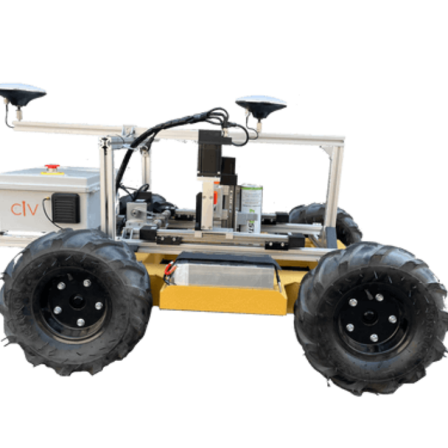
Thanks to our autonomous surveying systems, construction professionals gain higher outputs and greater precision than with traditional survey methods. CivDot is reliable, fast, and smart; creating a seamless experience for layout on any project.
Description
Anyone can operate CivDot
No prior surveying experience or special license is required to operate CivDot. CivPlan, our intuitive software, is super simple for data prep and field operations.
Reduce the number of Reworks
CivDots layout coordinates with ⅓” accuracy (8mm) and measures the ground elevation within 1” (25mm). Automated reports include the ground elevation of each coordinate laid out by CivDot.
Inputs
Upload your blueprint in standard CSV or DXF format to CivPlan, and CivDot is ready to work. If you’re a Trimble user, we have a plug-in for Trimble Business Center for seamless integration.
Outputs
CivDots spray paint coordinates with dots or dashed lines. Follow behind with flags or nails with whiskers when necessary, and CivPlan will indicate which colour marker to install at each point. At the end of the mission, you will receive a detailed report with the marked coordinates and the ground elevation measurements.
CivDot+
- Up to 2,000 coordinates/day with ⅓” accuracy.
- Robust and rugged system with 6-8” of ground clearance.
- Great for high-precision layouts such as piling, drilling and road makings.
CivDot
- Up to 3,000 coordinates/day with 4” accuracy.
- Ability to handle rough terrains with various tire options.
- Great for rough layouts for staging piles, topos, grade checking and Earthworks.
