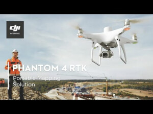
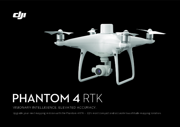
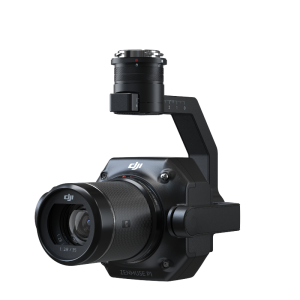
PHANTOM 4 RTK
Visionary Intelligence. Elevated Accuracy.
DJI has rethought its drone technology from the ground up, revolutionizing its systems to achieve a new standard for drone accuracy, offering Phantom 4 RTK customers centimetre-accurate data while requiring fewer ground control points. Upgrade your next mapping mission with the Phantom 4 RTK, the most compact and accurate low altitude mapping solution.

DJI ENTERPRISE
Shenzhen, CN
Description
DJI AirWorks
Through the annual AirWorks conference, DJI drives the commercial drone industry forward as AirWorks is a hub for innovation and growth, enabling participants in this ecosystem to exchange ideas, gain more control of drone technology, and steer the future development of the industry.
Join hundreds of commercial drone professionals and technology experts at the in-person DJI AirWorks conference in Las Vegas from October 10-12, where you can be a part of the leading discussion on the future of drone technology, share your growth stories, and exemplify the impact of drone technology on your business.
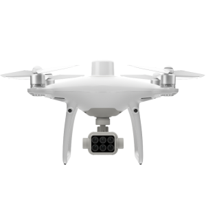
Centimeter-Level Positioning System
A new RTK module is integrated directly into the Phantom 4 RTK, providing real-time, centimeter-level positioning data for improved absolute accuracy on image metadata. In addition to optimized flight safety and precise data collection, the Phantom 4 RTK stores satellite observation data to be used for Post Processed Kinematics (PPK), which can be conducted using DJI Cloud PPK Service*. Fit the Phantom 4 RTK to any workflow, with the ability to connect this positioning system to the D-RTK 2 High Precision GNSS Mobile Station, or NTRIP (Network Transport of RTCM via Internet Protocol) using a 4G dongle or WiFi hotspot.
*DJI Cloud PPK Service is currently not available in the US, Canada, Hong Kong SAR, or Macau SAR. Support is coming soon. For more information on the Service and a free trial, please contact your local dealer.
Gather Accurate Data with TimeSync
To take full advantage of the Phantom 4 RTK’s positioning modules, the new TimeSync system was created to continually align the flight controller, camera and RTK module. Additionally, TimeSync ensures each photo uses the most accurate metadata and fixes the positioning data to the optical centre of the lens – optimizing the results from photogrammetric methods and letting the image achieve centimetre-level positioning data.
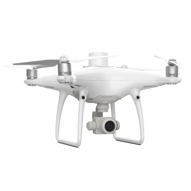
Precise Imaging System
Capture the best image data with a 1-inch, 20-megapixel CMOS sensor. Mechanical shutter makes mapping missions or regular data capture seamless as the Phantom 4 RTK can move while taking pictures without the risk of rolling shutter blur. Due to the high resolution, the Phantom 4 RTK can achieve a ground sample distance (GSD) of 2.74 cm at 100 meters flight altitude.To ensure each Phantom 4 RTK offers unparalleled accuracy, every single camera lens goes through a rigorous calibration process, with parameters saved into each image’s metadata, letting post-processing software adjust uniquely for every user.
Built for Surveyors
Offering a range of control schemes and complementary technologies, the DJI Phantom 4 RTK is developed to provide survey-grade results with greater efficiency than ever before.
Purpose-Built Application
A new DJI GS RTK app and Remote Controller with a built-in screen gives users a streamlined control scheme for surveying missions and other data acquisition scenarios. The GS RTK app allows pilots to intelligently control their Phantom 4 RTK, with multiple planning modes, including Photogrammetry (2D and 3D), Waypoint Flight, Terrain Awareness, Block Segmentation*, and more. Users can also import KML/KMZ files to optimize the workflow for their missions. With the built-in screen, pilots can clearly view and plan their missions on an ultra-bright, 5.5-inch HD display.
*In some countries, local regulations do not permit Multi-Aircraft Control when executing Block Segmentation missions or require special approval. Please consult and follow the applicable rules wherever you operate.
Access a Variety of 3rd Party Applications
Pilots with experience using 3rd party apps on DJI drones can access the world's leading drone app ecosystem for their Phantom 4 RTK with the SDK Remote Controller. Users can plug in a compatible Android or iOS device and install any compatible DJI Mobile SDK-enabled app to harness the full power of their Phantom 4 RTK.
OcuSync Transmission System
Enjoy stable and reliable HD image and video transmission at distances of up to 7 km, great for mapping larger sites*.
*Unobstructed, free of interference, when FCC compliant. The maximum flight range specification is a proxy for radio link strength and resilience. Always fly your drone within a visual line of sight unless otherwise permitted.
Seamless Compatibility with D-RTK 2 Mobile Station
Support your Phantom 4 RTK missions with the D-RTK 2 Mobile Station – providing real-time differential data to the drone and forming an accurate surveying solution, or acquire accurate location coordinates when used as an RTK rover. The Mobile Station’s rugged design and OcuSync transmission system ensure you can gain centimetre-level accurate data with your Phantom 4 RTK in any condition.
Start Mapping Today
With a built-in flight planning app (GS RTK) and an easy method to collect RTK data (RTK Network or D-RTK 2 Mobile Station), pilots have a full solution for any surveying, mapping or inspection workflow – right out of the box.
Do you have questions about this product?
- Questions about price, availability, and/or retailers
- Questions about technical specifications and usage
- Questions about suitability for your project or application
Specifications
-
Environment
-
Min. operation temperature [°C]
0°
Max. operation temperature [°C]
40
-
Battery and Power
-
capacity
5870 mAh
energy
89.2 Wh
Battery type
LiPo 4S
operating temperature
14° to 104℉(-10° to 40℃)
-
Imaging/scanning devices
-
Onboard imaging/scanning devices
RGB Camera
Build-in Stablilsation
Y
Exchangeable
N
Sensor tilting to allow oblique views
Y
Type of Camera
1" CMOS; Effective pixels: 20 M
-
Platform
-
Brand
DJI
Max. stay in the air [min]
30 minutes
Max. height above sea level [m]
6000
Maximum rate of ascent
6 m/s
Maxirum rate of descent
3 m/s
Weight (with cooling fan)
1391 g
Max. speed [km/h]
58
-
Operation Characteristics and Safety
-
Automatic launch and landing
Y
Collision avoidance systems (CAS)
Y
-
Dimensions
-
Weight of battery [kg]
0.468
Number of rotors
4
Transport on human back
Y
-
Navigation Sensors
-
Type of GNSS receiver and captured signals
GPS+BeiDou+Galileo(Asia); GPS+GLONASS+Galileo(other regions)
Correction services [PPK, RTK]
PPK, RTK
Positioning Accuracy
Vertical 1.5 cm + 1 ppm(RMS); Horizontal 1 cm + 1 ppm(RMS)
-
General
-
Year of last update
2020
Typical applications
Land Surveying, Urban Planning, AEC, Natural Resource Management
Product Name
Phantom 4 RTK
-
Included software and automatically generated
-
Type of software included
Flight planning
Automatically Generated Products
Flight planning software
GS RTK
Photogrammetric software
DJI TERRA
Documents
Brochure
a5-p4rtk-8p-en-format.pdf
7.62 MB
Videos


