


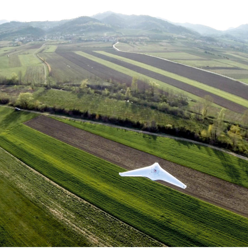
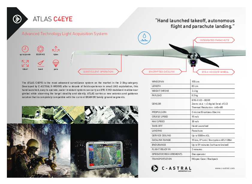
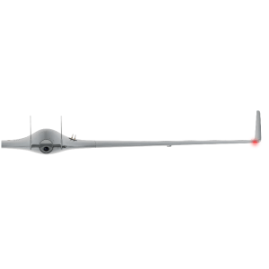
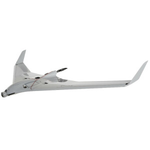
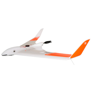
Atlas ppX
Advanced Technology Light Acquisition System
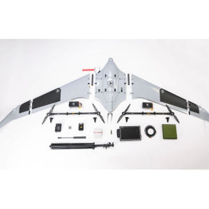
The ATLAS ppX is currently the most compact member of the C-ASTRAL UAS family weighing only 2.3 kg. Developed through a decade of exploitation experience by C-ASTRAL X-WORKS, this hand-launched system has a tactical heritage and can carry multiple modular sensors for precise PPK supported photogrammetry, multispectral and thermal remote sensing.
C-ASTRAL
Ajdovščina, SI
Description
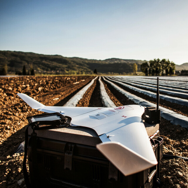
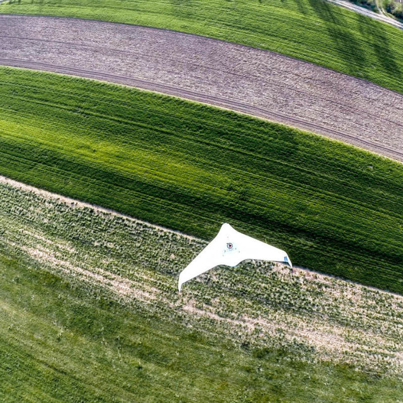
The ATLAS ppX (GNSS Post Processing) UAS is ideally suited for surveying and remote sensing applications that need a quick and industry leading high precision set of results down to sub-centimeter level also in the absence of a grid of ground control points.
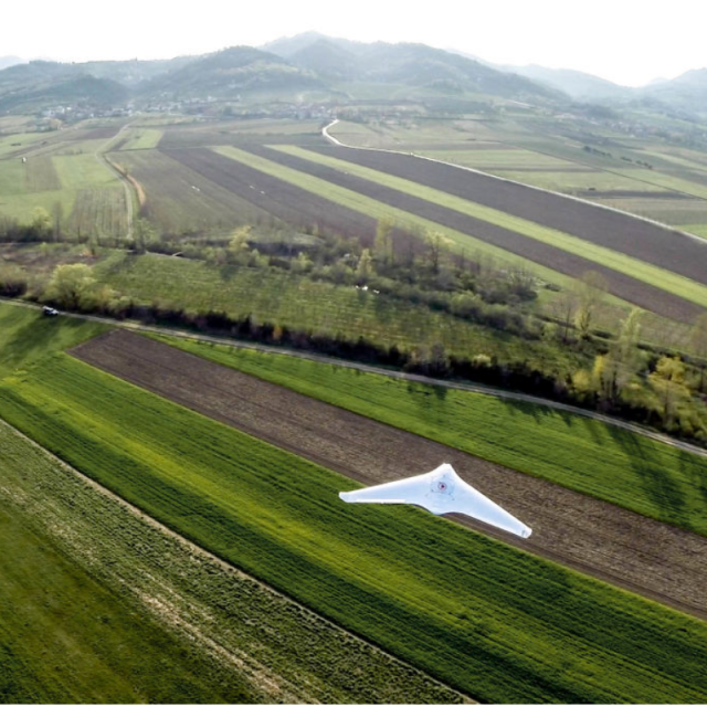
The ATLAS ppX excels with a modular architecture that enables quick reconfigurations and multiple functionalities in a light, compact easily transportable package that brings it to the front of the class of very small fixed wing systems. There is no other small, hand-launched/bungee launched system on the market with the ATLAS endurance, sensor modularity, UTM integration capabilities, safety features, aircraft grade fail safes and a heritage, that includes day to day operations in the world's most extreme environments, from the Arctic to the deserts and the jungles of South/Central America, Africa and Southeast Asia.
With the ATLAS, high resolution/extreme ground sampling distance remote sensing ANYWHERE is becoming a reality.
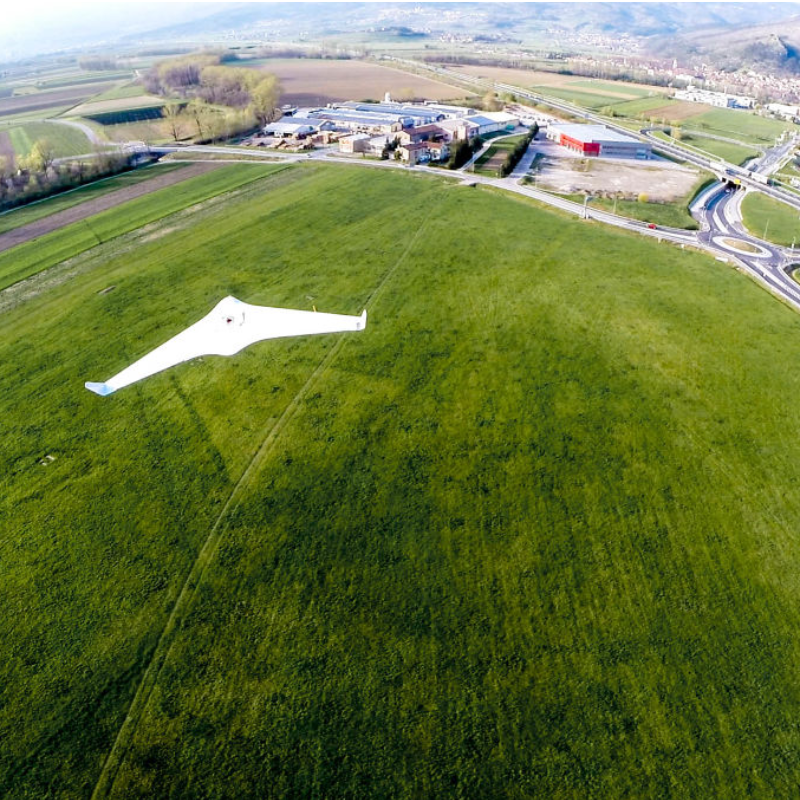
The ATLAS ppX workflow is completely comparable to the larger BRAMOR system, but the portability of the system enables its quick deployment almost anywhere on the planet.
Rugged, water-resistant, aerospace grade, safe and easy to operate.
The ATLAS ppX - ENDURING PRECISION!
Find more, arrange a demo, or just start flying, because you will, by contacting the C-ASTRAL sales team or our distributors.
COMPATIBLE WITH IMAGE PROCESSING SOFTWARE:
![]()
![]()
![]()
And others: EnsoMOSAIC, Menci
* Flight endurance measured at ICAO standard atmosphere conditions (15 °C / 1013,25 hPa / winds calm), depends on UAS configuration/system weight.
** Product images are for illustrative purposes and may differ from the actual product.
Do you have questions about this product?
- Questions about price, availability, and/or retailers
- Questions about technical specifications and usage
- Questions about suitability for your project or application
Specifications
-
Environment
-
Min. operation temperature [°C]
-25
Max. operation temperature [°C]
50
Max. wind speed [m/sec]
12
Max. humidity [%]
95
-
Imaging/scanning devices
-
Onboard imaging/scanning devices
Additional sensors
Type of Camera
20.1 Megapixel RGB Sensor with 20mm lens
Build-in Stablilsation
N
Exchangeable
Y
Sensor tilting to allow oblique views
N
Additional Sensors and additional information
IR, NDVI, Multispectral
-
Platform
-
Platform
Aircraft
Brand
C-Astral
Max. payload [kg]
0.3
Max. stay in the air [min]
59
Max. speed [km/h]
108
Max. height above sea level [m]
5000
Propulsion
Brushless Electric
Weight (with cooling fan)
2.7 kg
Maximum rate of ascent
8 m/s
Maxirum rate of descent
3 m/s
Maximum roll angle
57°
Maximum climbing speed
8 m/s
Maximum descending speed
3 m/s
-
Accessories
-
Transportation accessories
rugged flight case transportation box or water-resistant rugged mil-spec backpack made from CORDURA fabric
Included batteries and charger
Y
More included products and spare parts
Battery charger, Battery charging cables, Computer charging cable, Parachutes, Checklist, Protective filter, Tools
-
Operation Characteristics and Safety
-
Min. ø of launch/landing site [m]
20
Launching method
Hand launched
Training provided
Y
Automatic launch and landing
Y
Autonomous emergency landing
Y
Collision avoidance systems (CAS)
N
-
Dimensions
-
ø / wingspan [cm]
155
Height [cm]
16
Length [cm]
82
Weight [kg]
2.3
Weight of battery [kg]
0.7
Number of rotors
1
Transport on human back
Y
Width [cm]
155
-
Base Station
-
Ground computer included
Y
Type of Ground computer
Getac F110
Sensor control
Y
Real time image and video download link
Y
-
Navigation Sensors
-
Type of GNSS receiver and captured signals
L1&L2 GNSS Receiver
Correction services [PPK, RTK]
SBAS, PPK
Other sensors and additional information
GPS, Glonass (+optional: Beidou, Galileo)
Velocity Measurement Accuracy
0.1 m/s
Orientation Accuracy
8°
Positioning Accuracy
0.02 m
Type of IMU
Standard or Very Accurate External
-
General
-
Year of last update
2018
Typical applications
DSM, Pointcloud, Orthophoto, Volume calculation
Product Name
Atlas
Models in series
C4EYE, ppX
Product manual
Y
-
Included software and automatically generated
-
Type of software included
Block adjustment, Camera self-calibration, Flight planning, Photogrammetric software, Point cloud processing software
Automatically Generated Products
3D City Models, Point Clouds, 3D Landscape Models, DEMs, Orthomosaics
Flight planning software
C3P
Photogrammetric software
Pix4D, Agisoft PhotoScan, 3Dsurvey, Correlator3D, Ensomosaic, PIEneering, Menci Software, Orbit
Point cloud processing software
Pix4D, Agisoft PhotoScan, 3Dsurvey, Correlator3D, Ensomosaic, PIEneering, Menci Software, Orbit
Additional information on software or automatically generated products
High spatial resolution, High geometric accuracy
Documents
Brochure
atlas-brochure.pdf
3.31 MB
