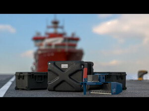


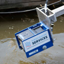

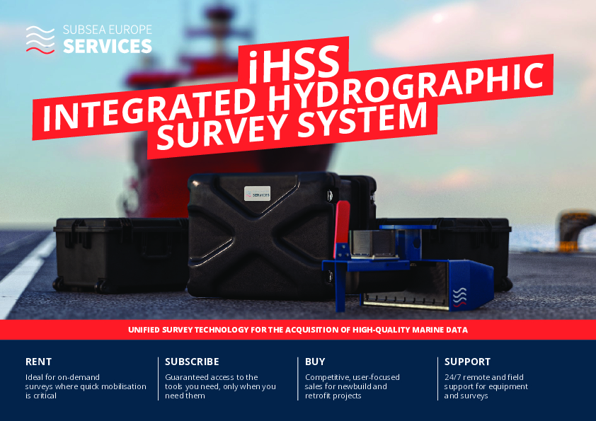
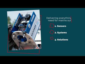
Integrated Hydrographic Survey System (iHSS)
Survey-ready, pre-configured multibeam system with everything needed for the easy acqusistion of high-quality marine data in deep and shallow waters.
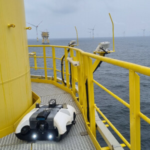
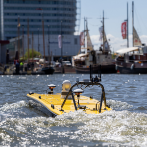
The integrated Hydrographic Survey System (iHSS) unifies high-performance multibeam echosounders, inertial navigation systems (INS), sound velocity sensors, powerful workstations running industry-standard software and flexible mounting solutions. With components selected to match any customer specification, the iHSS and its lightweight companion iHSS-Compact offer complete flexibility and reliability for offshore, coastal, ports & harbours and inland waterway hydrographic surveys.

Subsea Europe Services GmbH
Halstenbek, DE
Description
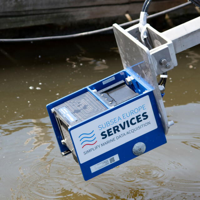
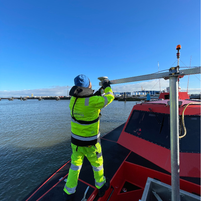
Both iHSS and iHSS-Compact are designed to simplify marine data acquisition so that users of any experience can select the right configuration for the job, quickly install and calibrate the system on almost any type of manned or unmanned survey vessel available, and collect outstanding hydrographic data under even the harshest conditions.
Integration is key to the industry-leading ease-of-use, flexibility and performance of the iHSS and iHSS-Compact. We have combined all the systems needed into an all-in-one solution, so you only have to work with one provider - Subsea Europe Services - to get the tools and data you need with fast delivery across Europe and expert support.
We have selected only the highest quality components, ensuring the reliability and precision our clients demand to colect data up to and exceeding S-44 Special Order standards. The iHSS and iHSS-Compact can be easily defined by size and depth-rating of the miltibeam system used.
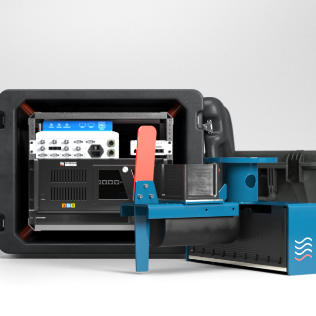
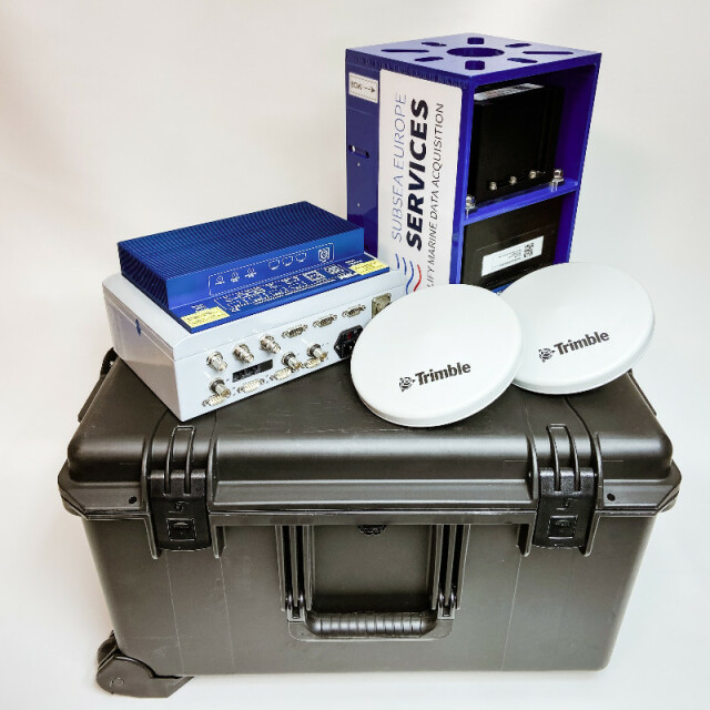
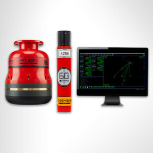
Scope of supply for the integrated Hydrographic Survey System (iHSS):
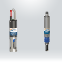
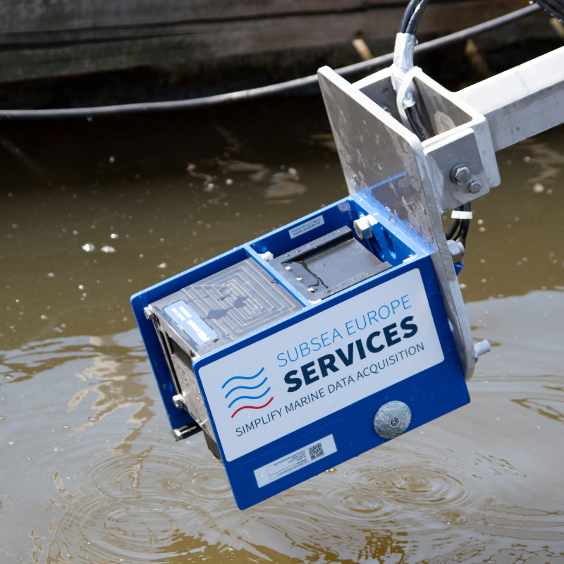
- 1 x Multibeam Echosounder Type “R2Sonic Sonic 2024” complete with:
- 4.000 m immersion depth rating
- Antifouling coating
- Ultra High Resolution (UHR, 700 kHz)
- TruePix™ Backscatter
- Raw Water Column Data
- Pipeline-/Cable-Mode and Multispectral
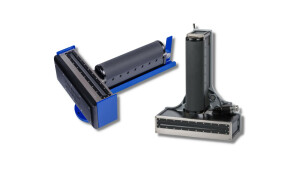
- 1 x Combined Mounting Bracket (Multibeam & MRU)
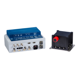
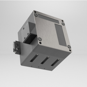
- 1 x Integrated Inertial Navigation System Type “R2Sonic I2NS Type II” featuring:
- 0.02° roll/pitch accuracy with RTK
- support for Fugro Marinestar GPS and GNSS subscription service
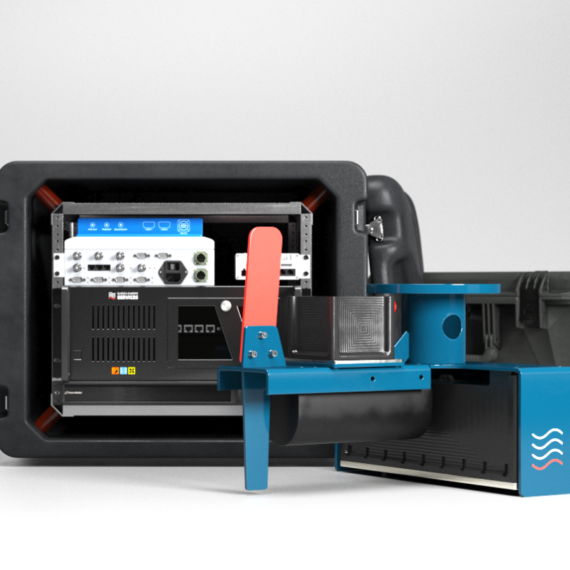
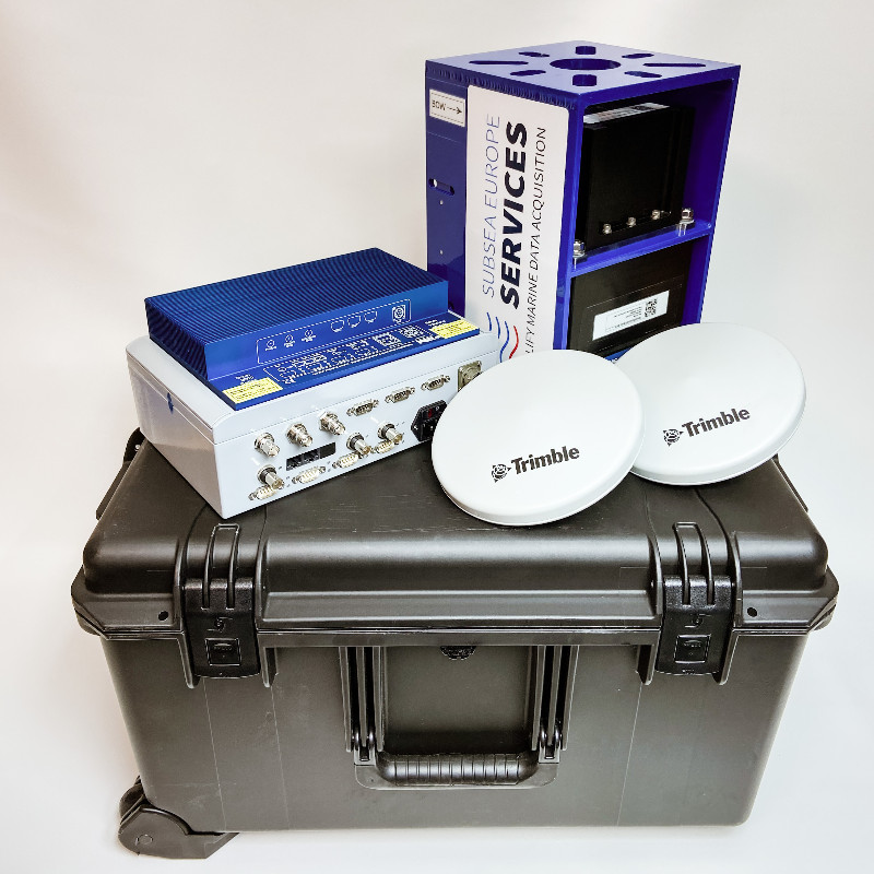
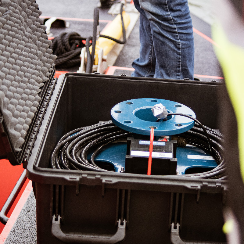
- 1 x Survey and Post-Processing Notebook with complete BeamworX Suite
- 2 x LED Monitor - 28’’
- 1 x AML Micro•X SV integrated surface sound velocity probe
- 1 x AML Base•X₂ SVP shallow water sound velocity profiler (100 m or 500 m)
- 1 x Deck cable 15 m, for Multibeam, MRU and Micro•X SV (optional 25 m and 50 m)
- 2 x Antenna cable, 8 m (optional 25 m and 50 m)
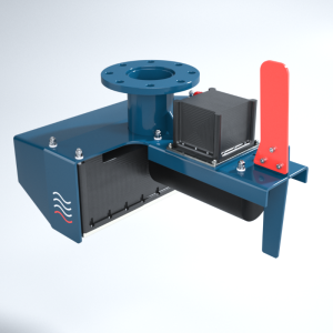
Scope of supply for the integrated Hydrographic Survey System-Compact (iHSS-COmpact):
1 x Multibeam Echosounder Type “R2Sonic Sonic 2020” complete with:
- 100 m immersion depth rating
- Ultra High Density (UHD) up to 1.024 independent soundings per ping
- Ultra-High Resolution (UHR) 700 kHz Output
- TruePix / MultiSpectral Backscatter Output
1 x Sonic 2020 Integrated Mounting Frame & Hardware Kit (Multibeam & MRU)
1 x Integrated Inertial Navigation System Type “R2Sonic I2NS Type II” featuring:
- Roll / Pitch Accuracy: 0.02° with RTK
- Heading Accuracy: 0.03° with 2 m antenna baseline
- Heave Accuracy 5 cm or 5%, 2 cm or 2% with TrueHeave™
- Optional Fugro Marinestar GNSS G2/G4+ subscription service at additional cost per day
1 x Powerful Survey and Post-Processing Notebook with complete BeamworX Suite
1 x AML Micro•X SV integrated surface sound velocity probe
1 x AML Base•X₂ SVP shallow water sound velocity profiler (100 m or 500 m)
1 x Deck cable, 15 m, for Multibeam, MRU and Micro•X SV (optional 25 m and 50 m)
2 x Antenna cable, 15 m (optional 25 m and 50 m)
Upgrade to Integrated Inertial Navigation System Type “R2Sonic I2NS Type I” at an additional cost per day.
Do you have questions about this product?
- Questions about price, availability, and/or retailers
- Questions about technical specifications and usage
- Questions about suitability for your project or application
Specifications
-
Application area
-
Select your application area
Habitat Mapping, Hydrography, Infrastructure, Offshore Renewables, Oil & Gas
-
Region
-
Select your region
Europe
-
Category
-
Select your category
Hydrographic Acquisition Software, INS - Inertial Navigation Systems, Multibeam Echosounders, Sound Velocity Sensors and Profilers
Documents
Brochure
ihss-brochure-subsea-europe-services-2.pdf
1.79 MB
Other documents
-
Subsea Europe Services - Case Study - Nicola Engineering2.74 MB

