Mapflow
Mapflow Platform
Leverage digital mapping and analysis using our geospatial image AI-processing platform which provides ready-to-use ML models and instant access to major global satellite imagery providers.
Geoalert
Toshkent, UZ
Description
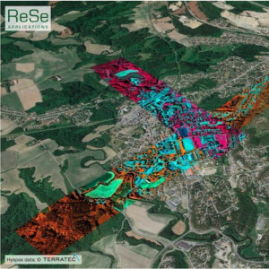
Detect and analyze real-world objects in Earth Observation imagery in large scale
We integrate with leading data providers to supply you with accurate and up-to-date satellitte imagery.
-
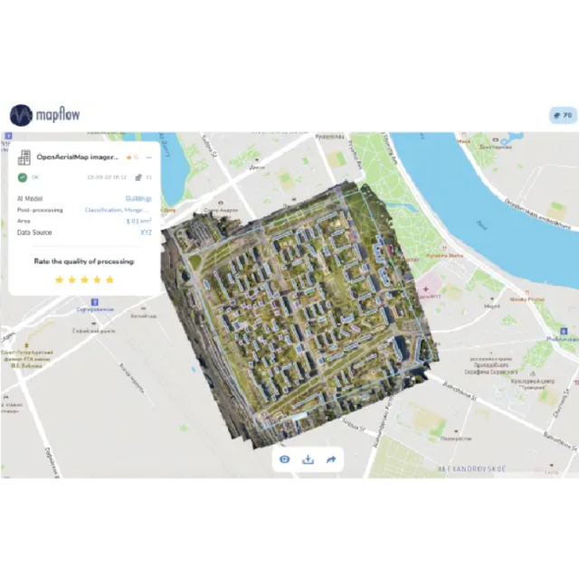
Buildings
Extract building footprints enriched with semantics such as the building type, height and population
-
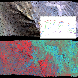
Forest monitoring
Vegetation mapping and classification by height for forestry and utilities monitoring applications
-
Construction detection
Locate construction sites and classify development by state. Monitor dynamics from a specific site to a whole city area
-
Road extraction
Extract and classify roads to analyze and produce navigation maps
-
Agricultural fields
Extraction and delineation of agriculture fields using free Sentinel and high-resolution satellite imagery
-
Segment anything
Segment anything with powerful pretrained model, train your custom model and run it with Mapflow
Specifications
-
Application
-
Main users
Cartographers
Main applications
Mapping
Distinguishable features
API
-
General
-
Year of introduction
2019
Year of last update
2022
-
Object-based classification
-
Line extraction
Roads, footprints, fields borders
Multiresolution image segmentation
Y
-
Classification in general
-
Training sample selection
Y
-
Pixel-based classification
-
Unsupervised classification
Y
Supervised classification
Y
