
Description
Specifications
-
Application
-
Main users
REDD modelers; Earth systems modelers; remote sensing experts; ecologists; and environmental modelers
Main applications
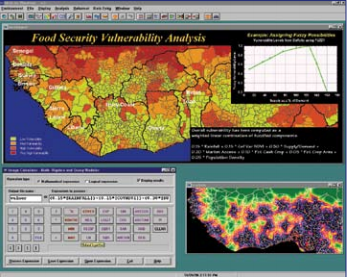
REDD carbon offset; time series analysis; ecological modeling; landuse change
Distinguishable features
integration of sofisticated raster analysis with robust remote sensing capabilities
-
General
-
Year of introduction
1987
Year of last update
2009
Supported hardware
GPS units
User definable operations and extensions
scripts; macros; graphical programming
-
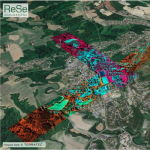
Object-based classification
-
Line extraction
N
Region growing segmentation
Y
Multiresolution image segmentation
N
Multiscale approach
Y
Generalisation
N
-
Editing
-
Manual removal and addition of points; lines; polygons
Y
Addition of text and symbols
Y
Overlay with map data
Y
-
Classification in general
-
Max. number of bands
64
Ancillary data integration
a priori probability
Sub-pixel classification
linear spectral unmixing
Training sample selection
Y
Accuracy assessment
Y
-
Radiometric and image processing
-
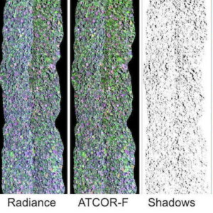
Radiometric corrections
destripe; dn to radiance; atmospheric
Spatial convolutions
smoothing; pansharpening; user definable filters
Image transforms
Y
Morphological operations
N
Filtering of radar imagery
Y
-
Pixel-based classification
-
Unsupervised classification
Y
Supervised classification
Y
Vegetation index
Y
Principal component analysis
Y
-
Geometric processing
-
Transformations
Y
Cartographic projections
Y
Ortho-image generation using DEM
N

