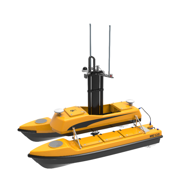
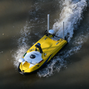
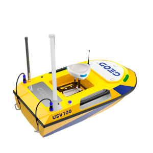
USV300 / ME 120
Autonomous bathymetry survey solution
Compatible with a wide variety of sensors, the USV300 aquatic drone is an ultra-modular surface drone for carrying out hydrographic and bathymetric surveys. Its robustness and stability facilitate interventions in many applications (bathymetric and oceanographic surveys, coastal and port surveillance, etc.).

CADDEN
Nantes, FR
Description
USV300 / ME 120
Designed for water environmental survey in inland waters such as lakes, rivers, reservoir, ponds, dams, harbors and coastal environment.
✔ A complete bathymetric survey solution
✔ Simple to operate and extremely accurate
✔ Planning of autonomous missions or use in manual mode
✔ Anti-collision system, Easy to set up and fast transport
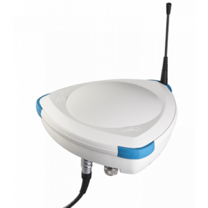
✔ Ultra-modular drone compatible with a wide variety of sensors
Typical Application
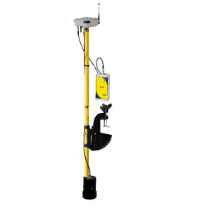
- River discharge measurement with ADCP
- Bathymetry with compact size multi beam echo sounder
- Water quality monitoring with multi parameters probe
- 3D Laser Scanner
- Integrated winch
Do you have questions about this product?
- Questions about price, availability, and/or retailers
- Questions about technical specifications and usage
- Questions about suitability for your project or application
Specifications
-
General
-
Length [m]
2.5
Width [m]
1.4
Height [m]
0.7
Max. Weight of USV in air [kg]
150
Portable
Y
Draft [m]
0.4
-
Communication and Control
-
Type of Communication
GSM, Long-range UHF (403-473MHz), Wireless LAN (2.4GHz)
Auto- control
Yes
-
Operations
-
Max. speed [kn]
10
Max. Remote Operating Range {m}
2000
-
Energy and Propulsion
-
Propulsion
Electric propeller