


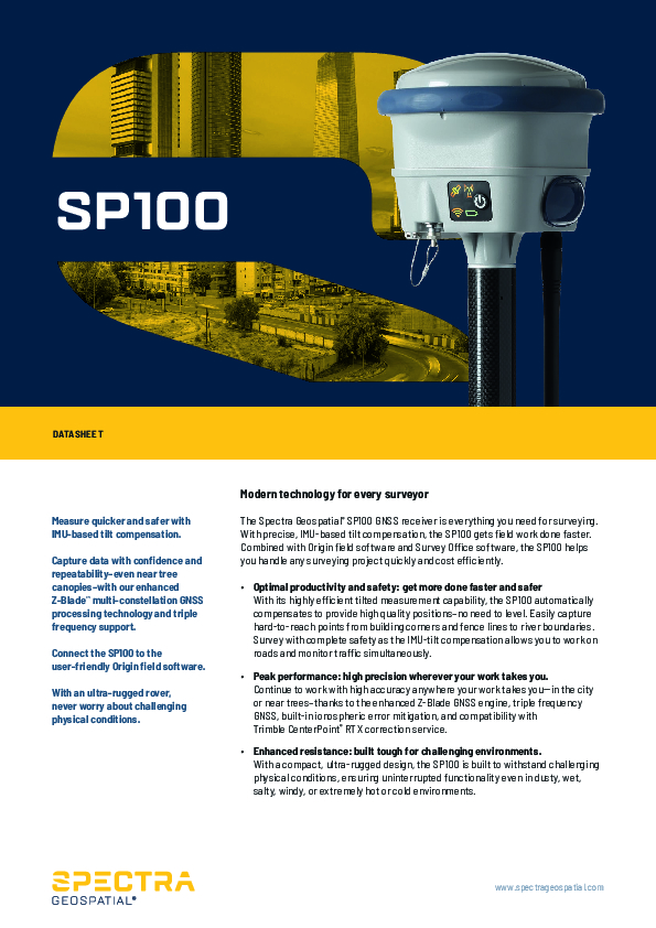
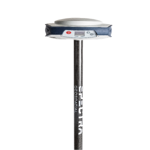
SP100 GNSS Receiver
Modern Technology for Every Surveyor
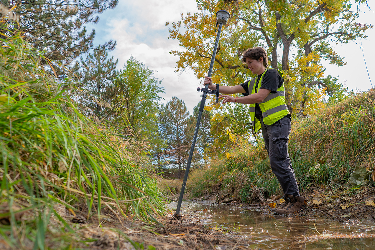
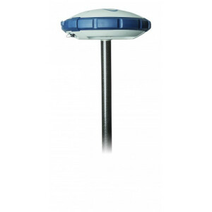
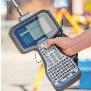
The Spectra Geospatial® SP100 GNSS receiver is everything you need for surveying. With precise, IMU-based tilt compensation, the SP100 gets field work done faster. Combined with Origin field software and Survey Office software, the SP100 helps you handle any surveying project quickly and cost efficiently.

Spectra Geospatial
Carquefou (Nantes),, FR
Description
The Spectra Geospatial® SP100 GNSS receiver is everything you need for surveying. With precise, IMU-based tilt compensation, the SP100 gets field work done faster. Combined with Origin field software and Survey Office software, the SP100 helps you handle any surveying project quickly and cost efficiently.
Optimal productivity and safety: get more done faster and safer With its highly efficient tilted measurement capability, the SP100 automatically compensates to provide high quality positions—no need to level. Easily capture hard-to-reach points from building corners and fence lines to river boundaries. Survey with complete safety as the IMU-tilt compensation allows you to work on roads and monitor traffic simultaneously.
Peak performance: high precision wherever your work takes you Continue to work with high accuracy anywhere your work takes you--in the city or near trees—thanks to the enhanced Z-BladeTM GNSS engine, triple frequency GNSS, built-in ionospheric error mitigation, and compatibility with Trimble CenterPoint® RTX correction service
Enhanced resistance: built tough for challenging environments With a compact, ultra-rugged design, the SP100 is built to withstand challenging physical conditions, ensuring uninterrupted functionality even in dusty, wet, salty, windy, or extremely hot or cold environments
Do you have questions about this product?
- Questions about price, availability, and/or retailers
- Questions about technical specifications and usage
- Questions about suitability for your project or application
Specifications
-
General
-
Depth [m]
0
Height [m]
0.130
Housing Material
Marine Aluminium
Total Weight [kg]
1.55
Width [m]
013.9
Year of initial introduction
2024
-
Performance
-
Max. simultaneous tracked channels
672
MRS functionality
yes
No. channels
672
Reacqisition time [s]
1
RTK Network Compatibility
yes
SBAS differential signals
WAAS, EGNOS, MSAS, GAGAN
Tracked satellite signals
GPS (L1C, L1C/A, L2C, L2E, L5), GLONASS (L1C/A, L1P, L2C/A, L2P, L3), BeiDou (B1, B1C, B2, B2A, B2B, B3), Galileo (E1, E5A, E5B, E5 AltBOC, E6), QZSS (L1C/A, L1S, L1C, L2C, L5, L6), NavIC (L5), SBAS (L1C/A, L5)
Type of measurements
Full wavelength carrier phase; C/A; P; C
-
Environment
-
Humidity resistance
100% condensing
Operating temperature: min. [°C]
-40
Operating temperature: max. [°C]
65
ROHS compliance
Y
Shock and vibration proof
Mil-Std-810G, FIG 514.6E-1 Cat 24, Mil-Std-202G, FIG 214-1
Water sand and dust proof
IP 68
WEEE compliance
Y
-
Communication: general
-
Communication ports
Serial, USB, TCP/IP, IBSS/NTRIP, Bluetooth,wifi
Simultaneous links
Y
PPS Out
N
Bluetooth
Y
-
Communication: Protocols
-
CMR standards for differential data
CMR+; CMRx
Configuration method
Web interface, Handheld Controller, PC software
L-Band Compatible
Yes
NMEA output format
24 NMEA messages
other output formats
R17/RT27
RTCM standards for differential data
2.1; 2.3; 3.0; 3.1; 3.2
-
Communication: links
-
CDMA phone modems
External
GSM; UMTS phone modems
External
Landline modems
External
Radio modems
Internal
-
Horizontal uncertainty
-
code: DGNSS/RTC (variable part) [ppm]
1
code: DGNSS/RTC (constant part) [m]
0.25
Initialization time on the fly [s]
2
phase: RTK kinematic (variable part) [ppm]
1
phase: kinematic post processing (constant part) [m]
0.008
phase: RTK rapid static (constant part) [m]
0.008
phase: kinematic post processing (variable part) [ppm]
1
phase: RTK kinematic (constant part) [m]
0.008
phase: static post processing (variable part) [ppm]
0.5
phase: RTK rapid static (variable part) [ppm]
1
phase: static post processing (constant part) [m]
0.003
Range on the fly [km]
30
RTK network solution methods
VRS
Horizontal uncertainty [m]
0.008 m + 0.5 ppm
-
Power
-
Certifications
WEE, RoHS, FCC, CE, IC, RCM, MIC, BT SIG
External power supply
Yes
Internal power supply
Yes
Operating power: max. [V]
28
Operating power: min. [V]
6.5
Rechargeable with (auto)battery
via external charger
Typical consumption [W]
3.2
-
Recording
-
Data capacity [MB]
9000
Data input
multiple data controllers are available
Memory medium
internal
Type of data (on board recording)
Trimble compact format
Documents
Brochure
SG_SP100 GNSS Receiver_Datasheet_English UK_LR.pdf
676.85 KB
Videos

