


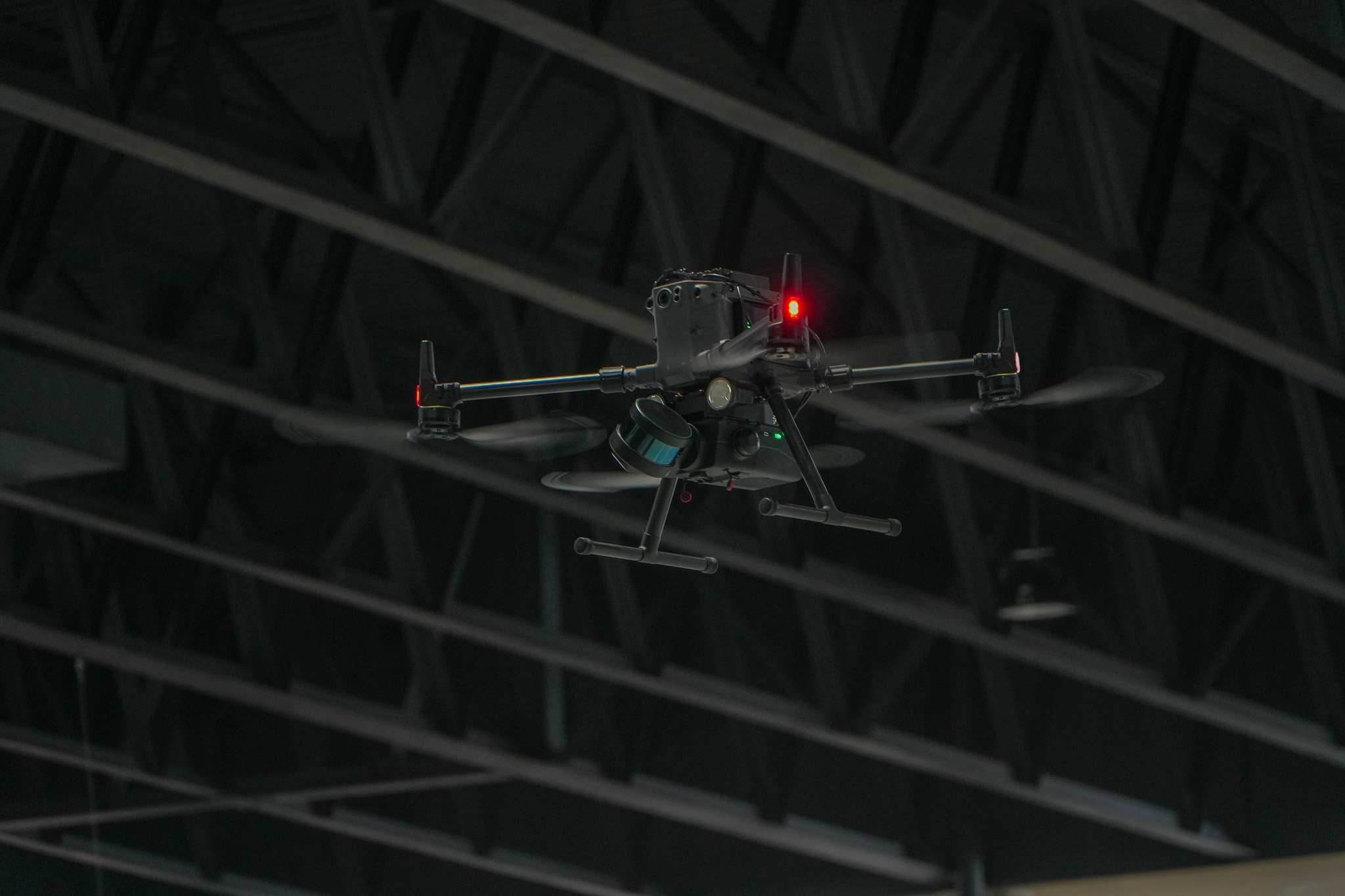

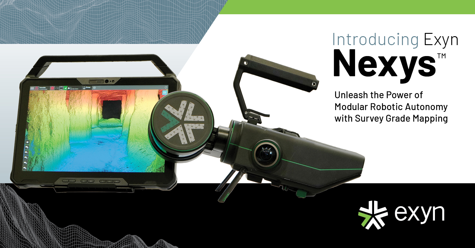
Nexys
A completely modular 3D mapping solution designed to reduce time to capture, increase safety, and drive efficiency for challenging, complex, or dangerous environments.
Proprietary autonomy algorithms, coupled with SLAM-based LiDAR scanning technology deliver survey-grade results without a pilot - even in GPS-denied, hazardous, and unilluminated environments. Start with mapping only, then upgrade to full autonomy when you need it.

Description
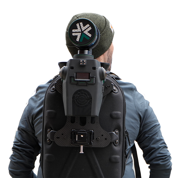
Rugged and Configurable
Nexys can be quickly and easily switched between a variety of configurations - handheld, backpack, aerial robot, terrestrial robot, vehicle, pole, custom configurations. Built to IP67 standards, users have the flexibility and cost efficiency to use one device in any mapping environment.
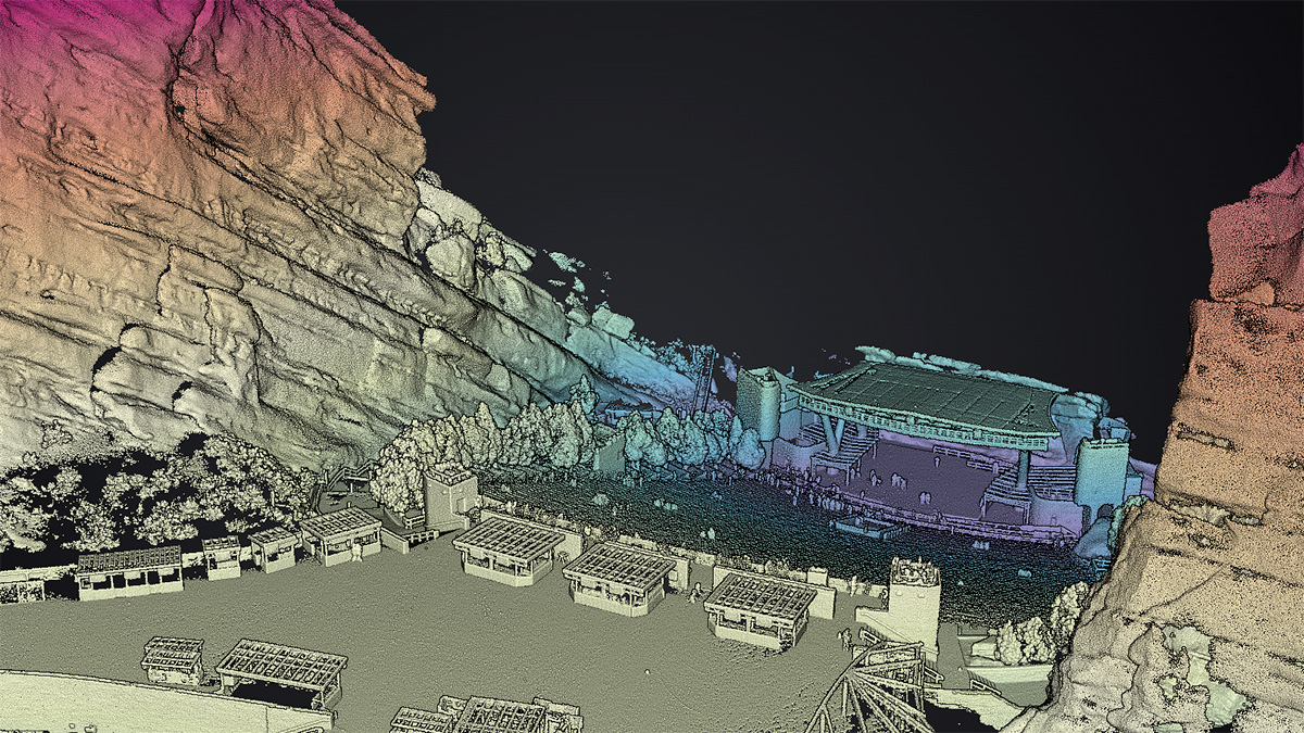
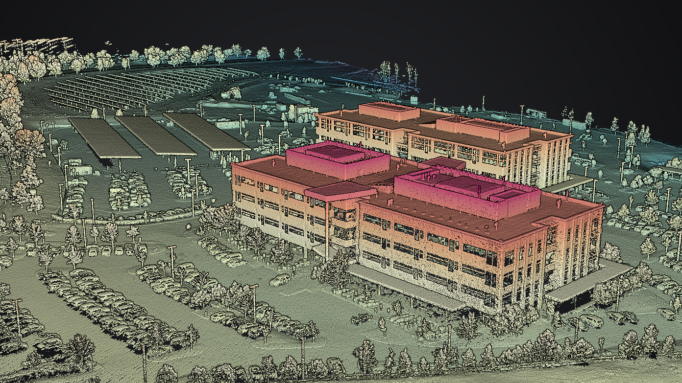
Fast Capture, Survey Grade Accuracy
Nexys’ SLAM-based spatial mapping delivers consistent and repeatable survey grade accuracy of up to 5mm @ 1 sigma at up to 1.9 million scan points per second while continuously updating the map as new data is received.
See Your Scans in Detail
Capture and post processing is done in the field, allowing for real-time visualization of your captured data with full detail and colorization to ensure the scan area is correct and complete before you leave the site.
Nexys Feature Set
EXYNVIEW SOFTWARE
Controls capture and post processing in the same system, allowing for fast on premise processing for more streamlined workflows. Creates clean, georeferenced point clouds automatically with additional processing and filtering, and data interoperability into third party software applications.
BUILT TO IP67 STANDARDS
The highest protection against water and solid ingresses, such as windblown dirt and other airborne solid materials, as well as water hoses, jet sprays, and momentary water immersion. Guaranteed to function in indoor, outdoor, wet, and demanding industrial and commercial settings.
REAL-TIME 360º COLORIZATION
Hemispherical cameras cover 100% of the field of view of the LIDAR making it easier to generate fully colorized clouds without any additional hardware or cost. Derive additional insights from point clouds with accurate colorization visualization at no additional cost.
Small, Light & Powerful Ruggedized Tablet
The Nexys comes paired with a ruggedized Dell Latitude tablet for easy mission planning for autonomous aerial exploration missions, or for monitoring the real-time status of a mobile mapping 3D capture - making mobile surveying simple, efficient, and accurate.
Do you have questions about this product?
- Questions about price, availability, and/or retailers
- Questions about technical specifications and usage
- Questions about suitability for your project or application
Documents
