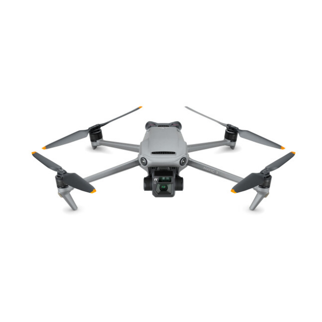
DJI Mavic 3
The DJI Mavic 3 Enterprise is a new generation of portable drone for land surveying.

AlphaGeo
Faringdon, GB
Description
High-class sensor engineered for precision drone surveying
Optimised for Surveying: Large pixel size
Wide Camera: 4/3 CMOS camera; 20MP; Mechanical shutter
Tele Camera: 12MP; 56x hybrid zoom
Lightweight, compact, and portable: 915g airframe
Ultra-long battery life: 45 minutes maximum flying time (up to 42 minutes with RTK Module)
Enhanced Flight Safety: Omnidirectional obstacle sensing and advanced Return to Home
Exclusive Controller: New DJI RC Pro Enterprise smart controller with high-bright screen.
Accessories (available separately): RTK Module for centimetre-level precision; Loudspeaker; D-RTK 2 Mobile Station high-precision GNSS receiver.
Full Software Suite: DJI Pilot 2; DJI FlightHub 2; DJI Terra.
Do you have questions about this product?
- Questions about price, availability, and/or retailers
- Questions about technical specifications and usage
- Questions about suitability for your project or application
