GraviProbe 2.0
Sediment profiler
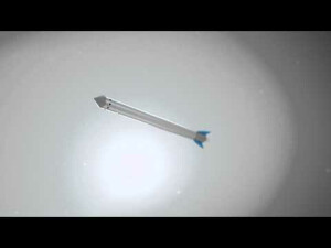
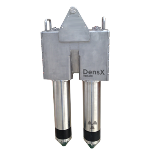
The GraviProbe is a free-fall impact instrument and sediment profiler, analyzing the underwater sediment layers during the intrusion. Under its own weight, it accelerates and penetrates fluid and consolidated mud layers. The geotechnical and density conditions of the soil layers are determining the probe’s dynamical behaviour.

dotOcean
Brugge, BE
Description
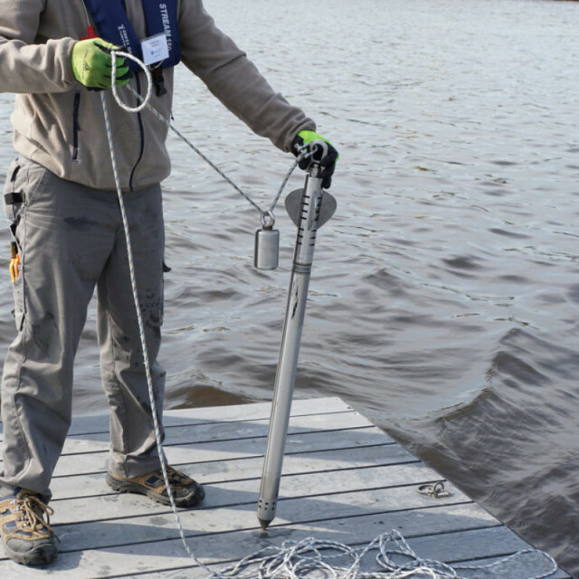
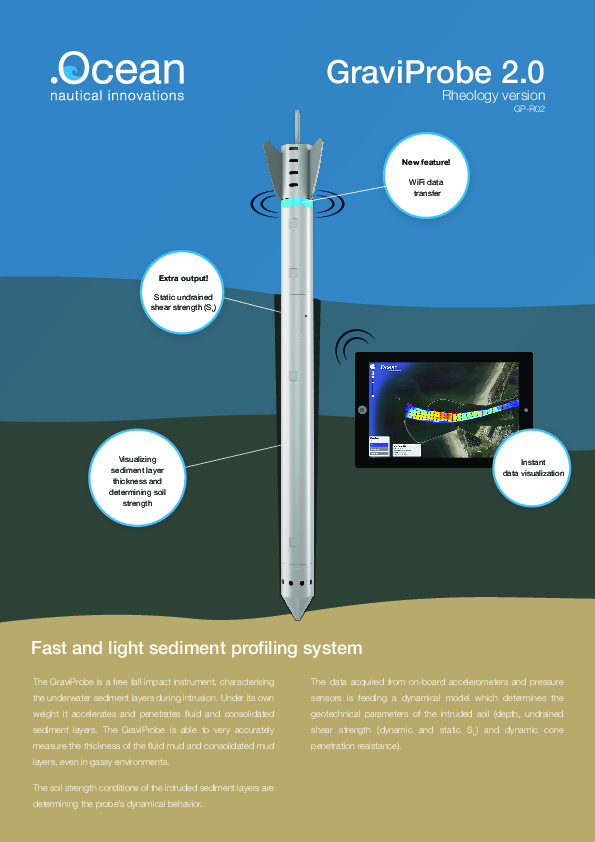
The GraviProbe is a free fall impact instrument and sediment profiler, analyzing the underwater sediment layers during intrusion. Under its own weight it accelerates and penetrates fluid and consolidated mud layers. The geotechnical and density conditions of the soil layers are determining the probe’s dynamical behavior. The data acquired from on-board accelerometers, inclinometers and pressure sensors is feeding a dynamical model which determines the geotechnical parameters of the intruded medium (depth, undrained shear strength and dynamic cone penetration resistance). As a result the GraviProbe is able to very accurately distinguish the depth of the fluid mud and consolidated mud layers, even in gassy environments. The high sensor data acquisition rates of up to 2kHz in combination with a low drag housing results in the highest quality profiles at drop rates over 7 m/s. Due to its light weight the probe can be operated manually from a small vessel, platform or quay and is limiting the operational costs. The GraviProbe Rheology provides tip resistance and shear strength. The GraviProbe Soil is similar to the GraviProbe Rheology but has a conus extension to penetrate hard an stiff sediment layers.
Do you have questions about this product?
- Questions about price, availability, and/or retailers
- Questions about technical specifications and usage
- Questions about suitability for your project or application
Specifications
-
Mode of operation
-
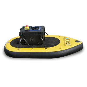
Platform type
Side Mounted
Operating System
Other
Min. depth of operation [m]
4
Max. depth of operation [m]
150
Power output [W]
0
Max. resolution [m]
0.01
Max. penetration [m]
6
Max. pulse rate [Hz]
0
Max. pulse length [s]
0
Dynamic range [dB]
0
Pitch corrected
Y
Roll corrected
Y
Heave corrected
Y
Signal composition
Frequency
-
General
-
Product type
Free Fall Penetrometer
Year of initial development
2010
Application
High Resolution
Max power consumption [W]
2
Power type
DC
Transducer weight [kg]
0
Transducer length [m]
1
Transducer width [m]
0.1
Transducer height [m]
0.1
Weight of logging unit [kg]
8
Length of logging unit [m]
0.9
Width of logging unit [m]
0.05
Height of logging unit [m]
0.05
Portability of logger
Portable
Components to be used in combination with product
GPS
-
Integration in work process
-
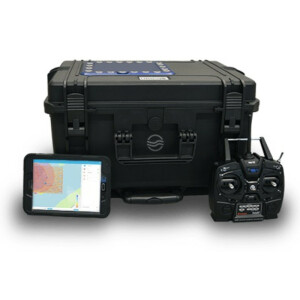
Remote operation
Y
External heave input
N
External roll input
N
External pitch input
N
External positioning input
Y
Marking of events
Y
Real time coupling to survey software
Y
Coupling to post-processing software
Y
-
Data Processing
-
Data displayed
Acceleration (m/s²), velocity (m/s), dynamic undrained shear strength (Pa), static undrained shear strength (Pa), dynamic cone penetration resistance (Pa)
Main use
Classification of mud and soil layers, determination of nautical depth, high accurate layer thickness measurement, calculating dredging volumes, characterizing echo sound and acoustic data, complementary soil analysis during CPT and core sampling
Data output
Processed by GraviProbe software or uploaded in other survey software.
Formats
Any
Data output for seafloor classification
Y
Internal logging
Hard drive
Post-processing
GraviProbe software or dotOcean Atlantis (web-based platform) or other programs
Connections
Documents
Brochure
migrationt5adps.pdf
2.25 MB
Other documents
-
GraviProbe - Time series monitoring of full scale agitation dredging experiments in the port of Rotterdam.639.23 KB
-
GraviProbe - Innovative free fall sediment profiler for preparing and evaluating dredging works and determining the nautical depth.1.39 MB
